
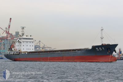
TONG MAO 9
Cargo
Current Trip
| Time Travelled | 21 h, 13 mins |
|---|---|
| Remaining Time | 1 day |
| Distance Travelled | 161.52 nm |
| Remaining Distance | 323.15 nm |
| AVG Speed | 9.1 Knots |
| MAX Speed | 10 Knots |
| AVG Wind | 11.4 knots |
| MAX Wind | 14.9 knots |
| MIN Temp | 24.5°C / 76.1°F |
| MAX Temp | 26°C / 78.8°F |
| Draught | 4.2 m |
| Position Received | 8 h, 41 m ago |
Current Position
| Longitude | 118.10167° |
|---|---|
| Latitude | 23.36500° |
| Status | Under way using engine |
| Speed | 8 Knots |
| Course | 253° |
| Area | South China Sea |
| Station | T-AIS |
| Position Received | 8 h, 41 m ago |
Info
Information
The current position of TONG MAO 9 is in South China Sea with coordinates 23.36500° / 118.10167° as reported on 2024-04-20 00:25 by AIS to our vessel tracker app. The vessel's current speed is 8 Knots and is heading at the port of KEELUNG. The estimated time of arrival as calculated by MyShipTracking vessel tracking app is 2024-04-21 20:21 LT
The vessel TONG MAO 9 (IMO: 9593189, MMSI: 413440260) is a Cargo It's sailing under the flag of [CN] China.
In this page you can find informations about the vessels current position, last detected port calls, and current voyage information. If the vessels is not in coverage by AIS you will find the latest position.
The current position of TONG MAO 9 is detected by our AIS receivers and we are not responsible for the reliability of the data. The last position was recorded while the vessel was in Coverage by the Ais receivers of our vessel tracking app.
The current draught of TONG MAO 9 as reported by AIS is 4.2 meters
Weather
| Temperature | 26°C / 78.8°F |
|---|---|
| Wind Speed | 13 knots |
| Direction | 199° SSW |
| Pressure | 1006.9 hPa |
| Humidity | 86.3 % |
| Cloud Coverage | 2 % |
Featured Company
Last Port Calls
| Port | Arrival | Departure | Time In Port |
|---|---|---|---|
| 2024-04-17 12:39 | 2024-04-19 11:53 | 1 d | |
| 2024-04-10 22:18 | 2024-04-12 07:15 | 1 d | |
| 2024-04-09 00:41 | 2024-04-10 03:37 | 1 d | |
| 2024-04-05 22:33 | 2024-04-08 11:03 | 2 d | |
| 2024-03-28 12:29 | 2024-03-29 05:53 | 17 h | |
| 2024-03-21 15:18 | 2024-03-23 11:09 | 1 d | |
| 2024-03-19 10:07 | 2024-03-21 08:37 | 1 d | |
| 2024-03-08 04:28 | 2024-03-11 10:54 | 3 d | |
| 2024-03-06 06:53 | 2024-03-07 03:58 | 21 h | |
| 2024-03-01 08:16 | 2024-03-05 04:58 | 3 d |
Last Trips
| Origin | Departure | Destination | Arrival | Distance | |
|---|---|---|---|---|---|
| 2024-04-12 15:15 | 2024-04-17 20:39 | 150.31 nm | |||
| 2024-04-10 11:37 | 2024-04-11 06:18 | 147.98 nm | |||
| 2024-04-08 19:03 | 2024-04-09 08:41 | 150.02 nm | |||
| 2024-03-29 13:53 | 2024-04-06 06:33 | 1047.69 nm | |||
| 2024-03-23 19:09 | 2024-03-28 20:29 | 1111.15 nm | |||
| 2024-03-21 16:37 | 2024-03-21 23:18 | 81.39 nm | |||
| 2024-03-11 18:54 | 2024-03-19 18:07 | 1011.30 nm | |||
| 2024-03-07 11:58 | 2024-03-08 12:28 | 200.98 nm | |||
| 2024-03-05 12:58 | 2024-03-06 14:53 | 166.99 nm | |||
| 2024-02-22 22:54 | 2024-03-01 16:16 | 1135.36 nm |
Events
| Time | Event | Details | Position / Dest | Info |
|---|---|---|---|---|
| 2024-04-20 00:31 | Status Changed | Default Under way using engine |
23.36116 / 118.08644
KEELUNG
|
Speed: 8 kn Course: 253° |
| 2024-04-20 00:25 | OUT of Coverage |
23.36500 / 118.10167
South China Sea
|
Speed: 8 kn Course: 253° |
|
| 2024-04-19 23:55 | Status Changed | Under way using engine Default |
23.38667 / 118.17833
KEELUNG
|
Speed: 8.6 kn Course: 250° |
| 2024-04-19 23:55 | IN Coverage |
23.38667 / 118.17833
South China Sea
|
Speed: 8 kn Course: 249° |
|
| 2024-04-19 22:54 | Status Changed | Default Under way using engine |
23.43774 / 118.32607
KEELUNG
|
Speed: 8 kn Course: 248° |
| 2024-04-19 22:49 | OUT of Coverage |
23.44167 / 118.33833
South China Sea
|
Speed: 8 kn Course: 248° |
|
| 2024-04-19 22:46 | Detected in Sea | Chinese part of the South China Sea |
23.44500 / 118.34500
South China Sea
|
Speed: 8 kn Course: 247° |
| 2024-04-19 22:46 | Status Changed | Under way using engine Default |
23.44500 / 118.34500
KEELUNG
|
Speed: 8.5 kn Course: 245° |
| 2024-04-19 22:46 | IN Coverage |
23.44500 / 118.34500
South China Sea
|
Speed: 8 kn Course: 247° |
|
| 2024-04-19 11:53 | PORT DEPARTURE |
|
23.82500 / 119.47334
KEELUNG
|
Speed: Course: 28° |