
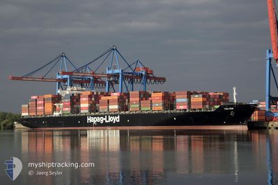
TOLTEN
Container Ship
Current Trip
| Time Travelled | 4 days |
|---|---|
| Remaining Time | --- |
| Distance Travelled | 1530.35 nm |
| Remaining Distance | --- |
| AVG Speed | 14.4 Knots |
| MAX Speed | 18.8 Knots |
| AVG Wind | 12.8 knots |
| MAX Wind | 27.9 knots |
| MIN Temp | 3.6°C / 38.48°F |
| MAX Temp | 10.7°C / 51.26°F |
| Draught | 12.5 m |
| Position Received | 2 d ago |
Current Position
| Longitude | -4.68724° |
|---|---|
| Latitude | 58.75591° |
| Status | Under way using engine |
| Speed | 13.4 Knots |
| Course | 275.2° |
| Area | North Atlantic Ocean |
| Station | T-AIS |
| Position Received | 2 d ago |
Info
Information
The current position of TOLTEN is in North Atlantic Ocean with coordinates 58.75591° / -4.68724° as reported on 2024-04-16 14:17 by AIS to our vessel tracker app. The vessel's current speed is 13.4 Knots and is heading at the port of NEW YORK. The estimated time of arrival as calculated by MyShipTracking vessel tracking app is 2024-04-24 12:30 LT
The vessel TOLTEN (IMO: 9612870, MMSI: 636092678) is a Container Ship that was built in 2012 ( 12 years old ). It's sailing under the flag of [LR] Liberia.
In this page you can find informations about the vessels current position, last detected port calls, and current voyage information. If the vessels is not in coverage by AIS you will find the latest position.
The current position of TOLTEN is detected by our AIS receivers and we are not responsible for the reliability of the data. The last position was recorded while the vessel was in Coverage by the Ais receivers of our vessel tracking app.
The current draught of TOLTEN as reported by AIS is 12.5 meters
Weather
| Temperature | 11.4°C / 52.52°F |
|---|---|
| Wind Speed | 19 knots |
| Direction | 140° SE |
| Pressure | 1018.9 hPa |
| Humidity | 89.3 % |
| Cloud Coverage | 100 % |
Featured Company
Last Port Calls
| Port | Arrival | Departure | Time In Port |
|---|---|---|---|
| 2024-04-13 10:07 | 2024-04-14 23:19 | 1 d | |
| 2024-04-10 04:15 | 2024-04-12 09:33 | 2 d | |
| 2024-04-07 08:40 | 2024-04-08 03:14 | 18 h | |
| 2024-04-06 03:51 | 2024-04-06 19:09 | 15 h | |
| 2024-03-25 06:26 | 2024-03-27 00:20 | 1 d | |
| 2024-03-23 01:33 | 2024-03-23 13:01 | 11 h | |
| 2024-03-19 19:22 | 2024-03-21 22:43 | 2 d | |
| 2024-03-08 16:41 | 2024-03-10 11:01 | 1 d | |
| 2024-03-06 05:57 | 2024-03-07 14:06 | 1 d | |
| 2024-03-03 17:16 | 2024-03-04 16:38 | 23 h |
Most Visited Ports (Last year)
| Port | Arrivals | |
|---|---|---|
| 10 | ||
| 10 | ||
| 9 | ||
| 9 | ||
| 9 | ||
| 9 |
Last Trips
| Origin | Departure | Destination | Arrival | Distance | |
|---|---|---|---|---|---|
| 2024-04-12 11:33 | 2024-04-13 12:07 | 325.46 nm | |||
| 2024-04-08 05:14 | 2024-04-10 06:15 | 361.80 nm | |||
| 2024-04-06 20:09 | 2024-04-07 10:40 | 123.65 nm | |||
| 2024-03-26 20:20 | 2024-04-06 04:51 | 3433.46 nm | |||
| 2024-03-23 09:01 | 2024-03-25 02:26 | 340.47 nm | |||
| 2024-03-21 18:43 | 2024-03-22 21:33 | 266.84 nm | |||
| 2024-03-10 12:01 | 2024-03-19 15:22 | 3723.83 nm | |||
| 2024-03-07 15:06 | 2024-03-08 17:41 | 325.52 nm | |||
| 2024-03-04 17:38 | 2024-03-06 06:57 | 296.53 nm | |||
| 2024-03-02 22:16 | 2024-03-03 18:16 | 136.87 nm |
Events
| Time | Event | Details | Position / Dest | Info |
|---|---|---|---|---|
| 2024-04-16 14:21 | Status Changed | Default Under way using engine |
58.75757 / -4.72475
USNYC
|
Speed: 13.4 kn Course: 275.2° |
| 2024-04-16 14:17 | OUT of Coverage |
58.75591 / -4.68724
North Atlantic Ocean
USNYC
|
Speed: 13.4 kn Course: 275.2° |
|
| 2024-04-16 12:00 | Status Changed | Under way using engine Default |
58.72672 / -3.66573
USNYC
|
Speed: 14.2 kn Course: 270° |
| 2024-04-16 11:57 | Status Changed | Default Under way using engine |
58.72632 / -3.64465
USNYC
|
Speed: 14.1 kn Course: 270.5° |
| 2024-04-16 11:29 | Change Sea Area | United Kingdom part of the North Atlantic Ocean United Kingdom part of the North Sea |
58.72331 / -3.43083
North Atlantic Ocean
USNYC
|
Speed: 14.7 kn Course: 271.8° |
| 2024-04-16 09:01 | Change Sea Area | United Kingdom part of the North Sea Norwegian part of the North Sea |
58.47358 / -2.24902
North Sea
USNYC
|
Speed: 16.4 kn Course: 293.4° |
| 2024-04-16 08:59 | Status Changed | Under way using engine Default |
58.47051 / -2.23544
USNYC
|
Speed: 16.6 kn Course: 294° |
| 2024-04-16 08:49 | IN Coverage |
58.47358 / -2.24902
North Sea
USNYC
|
Speed: 16.4 kn Course: 293.4° |
|
| 2024-04-15 19:15 | Status Changed | Default Under way using engine |
56.84950 / 3.87210
USNYC
|
Speed: 16.3 kn Course: 320.7° |
| 2024-04-15 19:13 | OUT of Coverage |
56.84100 / 3.88449
North Sea
USNYC
|
Speed: 16.3 kn Course: 320.7° |