
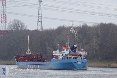
TINNO
General Cargo
Current Trip
| Trip Time | 13 h, 48 mins |
|---|---|
| Trip Distance | 82.28 nm |
| AVG Speed | 5.8 Knots |
| MAX Speed | 12.8 Knots |
| Draught | 3.4 m |
| AVG Wind | 23.4 knots |
| MAX Wind | 27.3 knots |
| MIN Temp | 6.7°C / 44.06°F |
| MAX Temp | 8.5°C / 47.3°F |
| Position Received | 1 m ago |
Current Position
| Longitude | 5.42747° |
|---|---|
| Latitude | 53.18486° |
| Status | Moored |
| Speed | |
| Course | 54° |
| Area | North Sea |
| Station | T-AIS |
| Position Received | 1 m ago |
Info
Information
The current position of TINNO is in North Sea with coordinates 53.18486° / 5.42747° as reported on 2024-04-24 06:50 by AIS to our vessel tracker app. The vessel's current speed is 0 Knots and is currently inside the port of HARLINGEN.
The vessel TINNO (IMO: 8908806, MMSI: 314418000) is a General Cargo that was built in 1991 ( 33 years old ). It's sailing under the flag of [BB] Barbados.
In this page you can find informations about the vessels current position, last detected port calls, and current voyage information. If the vessels is not in coverage by AIS you will find the latest position.
The current position of TINNO is detected by our AIS receivers and we are not responsible for the reliability of the data. The last position was recorded while the vessel was in Coverage by the Ais receivers of our vessel tracking app.
The current draught of TINNO as reported by AIS is 3.4 meters
Weather
| Temperature | 7.4°C / 45.32°F |
|---|---|
| Wind Speed | 26 knots |
| Direction | 341° NNW |
| Pressure | 1008 hPa |
| Humidity | 69.5 % |
| Cloud Coverage | 100 % |
Featured Company
Last Port Calls
| Port | Arrival | Departure | Time In Port |
|---|---|---|---|
| 2024-04-24 06:05 | |||
| 2024-04-23 15:54 | 2024-04-23 16:17 | 22 m | |
| 2024-04-22 15:37 | 2024-04-23 14:29 | 22 h | |
| 2024-04-22 13:56 | 2024-04-22 14:27 | 31 m | |
| 2024-04-19 14:15 | 2024-04-20 17:42 | 1 d | |
| 2024-04-15 04:42 | 2024-04-16 02:56 | 22 h | |
| 2024-04-11 15:39 | 2024-04-11 16:22 | 43 m | |
| 2024-04-10 11:19 | 2024-04-11 13:57 | 1 d | |
| 2024-04-06 05:41 | 2024-04-08 17:23 | 2 d | |
| 2024-04-03 01:37 | 2024-04-04 23:22 | 1 d |
Last Trips
| Origin | Departure | Destination | Arrival | Distance | |
|---|---|---|---|---|---|
| 2024-04-23 18:17 | 2024-04-24 08:05 | 82.28 nm | |||
| 2024-04-23 16:29 | 2024-04-23 17:54 | 10.58 nm | |||
| 2024-04-22 16:27 | 2024-04-22 17:37 | 8.89 nm | |||
| 2024-04-20 18:42 | 2024-04-22 15:56 | 386.83 nm | |||
| 2024-04-16 03:56 | 2024-04-19 15:15 | 611.10 nm | |||
| 2024-04-11 18:22 | 2024-04-15 05:42 | 686.69 nm | |||
| 2024-04-11 15:57 | 2024-04-11 17:39 | 10.01 nm | |||
| 2024-04-08 18:23 | 2024-04-10 13:19 | 275.35 nm | |||
| 2024-04-05 01:22 | 2024-04-06 06:41 | 261.38 nm | |||
| 2024-04-03 00:30 | 2024-04-03 03:37 | 22.56 nm |
Events
| Time | Event | Details | Position / Dest | Info |
|---|---|---|---|---|
| 2024-04-24 06:33 | Status Changed | Moored Under way using engine |
53.18482 / 5.42749
[NL] HARLINGEN
|
Speed: Course: 54° |
| 2024-04-24 06:28 | STOP Moving |
53.18483 / 5.42734
[NL] HARLINGEN
|
Speed: 0.3 kn Course: 55° |
|
| 2024-04-24 06:05 | PORT ARRIVAL |
|
53.17663 / 5.40369
[NL] HARLINGEN
|
Speed: 4 kn Course: 162° |
| 2024-04-24 04:37 | START Moving | 2.37 nm, North East of VLIELAND |
53.32484 / 5.12543
NLHAR
|
Speed: 6.5 kn Course: 84.2° |
| 2024-04-24 04:31 | STOP Moving | 2.29 nm, North East of VLIELAND |
53.32458 / 5.12221
NLHAR
|
Speed: 0.3 kn Course: 295° |
| 2024-04-24 00:41 | Status Changed | Under way using engine Default |
53.20466 / 4.74387
NLHAR
|
Speed: 6.3 kn Course: 85° |
| 2024-04-24 00:28 | Status Changed | Default Under way using engine |
53.19577 / 4.71410
NLHAR
|
Speed: 8.2 kn Course: 99.3° |
| 2024-04-24 00:27 | Status Changed | Under way using engine Default |
53.19561 / 4.71276
NLHAR
|
Speed: 5.7 kn Course: 49° |
| 2024-04-24 00:10 | Status Changed | Default Under way using engine |
53.18145 / 4.67710
NLHAR
|
Speed: 5.2 kn Course: 40.4° |
| 2024-04-23 16:17 | PORT DEPARTURE |
|
52.46408 / 4.56496
NLHAR
|
Speed: 6.7 kn Course: 277° |