
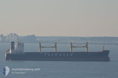
THOR BREEZE
Cargo
Current Trip
ESPADARTE PILOT
| Time Travelled | 16 days |
|---|---|
| Remaining Time | --- |
| Distance Travelled | 4045.77 nm |
| Remaining Distance | --- |
| AVG Speed | 10.5 Knots |
| MAX Speed | 15.2 Knots |
| AVG Wind | 11 knots |
| MAX Wind | 29.8 knots |
| MIN Temp | 21.4°C / 70.52°F |
| MAX Temp | 32.2°C / 89.96°F |
| Draught | 11.8 m |
| Position Received | 13 d ago |
Current Position
| Longitude | -47.81306° |
|---|---|
| Latitude | -0.27765° |
| Status | Under way using engine |
| Speed | 10.8 Knots |
| Course | 6.2° |
| Area | South Atlantic Ocean |
| Station | T-AIS |
| Position Received | 13 d ago |
Info
Information
The current position of THOR BREEZE is in South Atlantic Ocean with coordinates -0.27765° / -47.81306° as reported on 2024-04-10 06:34 by AIS to our vessel tracker app. The vessel's current speed is 10.8 Knots
The vessel THOR BREEZE (IMO: 9474802, MMSI: 566985000) is a Cargo It's sailing under the flag of [SG] Singapore.
In this page you can find informations about the vessels current position, last detected port calls, and current voyage information. If the vessels is not in coverage by AIS you will find the latest position.
The current position of THOR BREEZE is detected by our AIS receivers and we are not responsible for the reliability of the data. The last position was recorded while the vessel was in Coverage by the Ais receivers of our vessel tracking app.
The current draught of THOR BREEZE as reported by AIS is 11.8 meters
Weather
| Temperature | 25.6°C / 78.08°F |
|---|---|
| Wind Speed | 8 knots |
| Direction | 45° NE |
| Pressure | 1012.8 hPa |
| Humidity | 82.9 % |
| Cloud Coverage | --- |
Featured Company
Last Port Calls
| Port | Arrival | Departure | Time In Port |
|---|---|---|---|
| 2024-04-04 07:10 | 2024-04-07 00:22 | 2 d | |
| 2024-03-08 12:03 | 2024-03-13 14:42 | 5 d | |
| 2024-03-04 08:03 | 2024-03-07 23:04 | 3 d | |
| 2024-02-19 14:50 | 2024-02-26 14:41 | 6 d | |
| 2024-02-06 23:45 | 2024-02-14 12:59 | 7 d | |
| 2024-02-03 14:19 |
Most Visited Ports (Last year)
| Port | Arrivals | |
|---|---|---|
| 4 | ||
| 3 | ||
| 2 | ||
| 2 | ||
| 2 | ||
| 1 |
Last Trips
| Origin | Departure | Destination | Arrival | Distance | |
|---|---|---|---|---|---|
| 2024-03-13 09:42 | 2024-04-04 04:10 | 2528.09 nm | |||
| 2024-03-07 18:04 | 2024-03-08 07:03 | 85.34 nm | |||
| 2024-02-26 08:41 | 2024-03-04 03:03 | 1532.53 nm | |||
| 2024-02-14 06:59 | 2024-02-19 08:50 | 802.27 nm | |||
| 2024-02-03 08:19 | 2024-02-06 17:45 | 808.39 nm |
Events
| Time | Event | Details | Position / Dest | Info |
|---|---|---|---|---|
| 2024-04-23 02:48 | START Moving |
19.31060 / -95.65529
ESPADARTE PILOT
|
Speed: 3.9 kn Course: 316° |
|
| 2024-04-22 17:47 | STOP Moving |
19.47079 / -95.78059
ESPADARTE PILOT
|
Speed: 0.3 kn Course: 358° |
|
| 2024-04-18 02:11 | START Moving | 1.55 nm, South East of PORT ROYAL |
17.92814 / -76.81902
ESPADARTE PILOT
|
Speed: 4.7 kn Course: 119° |
| 2024-04-17 16:13 | STOP Moving | 1.43 nm, South East of PORT ROYAL |
17.92864 / -76.82104
ESPADARTE PILOT
|
Speed: 0.2 kn Course: 319° |