
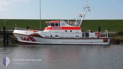
THEODOR STORM
Search and Rescue vessel
Current Trip
| Time Travelled | 8 days |
|---|---|
| Remaining Time | --- |
| Distance Travelled | 62.74 nm |
| Remaining Distance | --- |
| AVG Speed | 9.2 Knots |
| MAX Speed | 11.3 Knots |
| AVG Wind | 5.5 knots |
| MAX Wind | 8.9 knots |
| MIN Temp | 5.7°C / 42.26°F |
| MAX Temp | 8.4°C / 47.12°F |
| Draught | 1.4 m |
| Position Received | 7 d ago |
Current Position
| Longitude | 8.56701° |
|---|---|
| Latitude | 53.17699° |
| Status | Moored |
| Speed | |
| Course | 295° |
| Area | North Sea |
| Station | T-AIS |
| Position Received | 7 d ago |
Info
Information
The current position of THEODOR STORM is in North Sea with coordinates 53.17699° / 8.56701° as reported on 2024-04-18 08:19 by AIS to our vessel tracker app. The vessel's current speed is 0 Knots
The vessel THEODOR STORM (MMSI: 211512630) is a Search and Rescue vessel It's sailing under the flag of [DE] Germany.
In this page you can find informations about the vessels current position, last detected port calls, and current voyage information. If the vessels is not in coverage by AIS you will find the latest position.
The current position of THEODOR STORM is detected by our AIS receivers and we are not responsible for the reliability of the data. The last position was recorded while the vessel was in Coverage by the Ais receivers of our vessel tracking app.
The current draught of THEODOR STORM as reported by AIS is 1.4 meters
Weather
| Temperature | 8.8°C / 47.84°F |
|---|---|
| Wind Speed | 4 knots |
| Direction | 322° NW |
| Pressure | 1016.8 hPa |
| Humidity | 73.8 % |
| Cloud Coverage | 9 % |
Featured Company
Last Port Calls
| Port | Arrival | Departure | Time In Port |
|---|---|---|---|
| 2024-04-17 06:39 | |||
| 2024-03-27 19:24 | 2024-04-02 14:23 | 5 d | |
| 2024-03-27 18:52 | |||
| 2024-03-23 14:07 | |||
| 2024-03-14 13:40 | |||
| 2024-03-11 14:39 | |||
| 2024-02-27 13:28 | |||
| 2024-02-21 14:00 | |||
| 2024-02-15 16:23 | 2024-02-20 16:02 | 4 d | |
| 2024-02-08 09:25 | 2024-02-13 15:28 | 5 d |
Most Visited Ports (Last year)
| Port | Arrivals | |
|---|---|---|
| 64 | ||
| 2 | ||
| 2 | ||
| 1 |
Events
| Time | Event | Details | Position / Dest | Info |
|---|---|---|---|---|
| 2024-04-18 08:19 | OUT of Coverage |
53.17699 / 8.56701
North Sea
|
Speed: Course: 162.2° |
|
| 2024-04-17 15:21 | Status Changed | Moored Under way using engine |
53.17638 / 8.56960
BREMEN
|
Speed: Course: 298° |
| 2024-04-17 15:18 | STOP Moving | 0.44 nm, West of BLUMENTHAL |
53.17638 / 8.56962
BREMEN
|
Speed: 0.2 kn Course: 299° |
| 2024-04-17 10:01 | Destination Changed | BREMEN DEBUM BUESUM |
53.84426 / 8.11772
BREMEN
|
Speed: 10.3 kn Course: 188.4° |
| 2024-04-17 08:42 | IN Coverage |
53.98748 / 8.27670
North Sea
|
Speed: 11.4 kn Course: 270.9° |
|
| 2024-04-17 06:39 | PORT DEPARTURE |
|
53.98773 / 8.28340
DEBUM BUESUM
|
Speed: Course: 194° |
| 2024-04-16 23:22 | OUT of Coverage |
54.12309 / 8.85804
North Sea
[DE] BUESUM
|
Speed: Course: 224.3° |
|
| 2024-04-16 22:56 | ETA Changed | 2024/04/12 19:00 2025/03/24 19:00 |
54.12309 / 8.85802
[DE] BUESUM
|
Speed: Course: 193° |
| 2024-04-16 22:40 | IN Coverage |
54.12308 / 8.85802
North Sea
[DE] BUESUM
|
Speed: Course: 336.8° |