
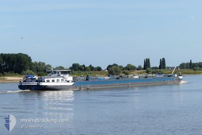
THEODELA V
Tanker
Current Trip
020
| Time Travelled | 21 h, 42 mins |
|---|---|
| Remaining Time | --- |
| Distance Travelled | 150.36 nm |
| Remaining Distance | --- |
| AVG Speed | 12 Knots |
| MAX Speed | 14.4 Knots |
| AVG Wind | 4.8 knots |
| MAX Wind | 7.8 knots |
| MIN Temp | -0.3°C / 31.46°F |
| MAX Temp | 10.2°C / 50.36°F |
| Draught | 0.1 m |
| Position Received | 1 m ago |
Current Position
| Longitude | 7.03092° |
|---|---|
| Latitude | 50.80062° |
| Status | Moored |
| Speed | |
| Course | --- |
| Area | North Sea |
| Station | T-AIS |
| Position Received | 1 m ago |
Info
Information
The current position of THEODELA V is in North Sea with coordinates 50.80062° / 7.03092° as reported on 2024-04-24 02:42 by AIS to our vessel tracker app. The vessel's current speed is 0 Knots
The vessel THEODELA V (MMSI: 205252390) is a Tanker It's sailing under the flag of [BE] Belgium.
In this page you can find informations about the vessels current position, last detected port calls, and current voyage information. If the vessels is not in coverage by AIS you will find the latest position.
The current position of THEODELA V is detected by our AIS receivers and we are not responsible for the reliability of the data. The last position was recorded while the vessel was in Coverage by the Ais receivers of our vessel tracking app.
The current draught of THEODELA V as reported by AIS is 0.1 meters
Weather
| Temperature | 4.4°C / 39.92°F |
|---|---|
| Wind Speed | 9 knots |
| Direction | 304° NW |
| Pressure | 1012.1 hPa |
| Humidity | 93.9 % |
| Cloud Coverage | 100 % |
Featured Company
Last Port Calls
| Port | Arrival | Departure | Time In Port |
|---|---|---|---|
| 2024-04-22 14:22 | 2024-04-23 05:02 | 14 h | |
| 2024-04-22 08:34 | 2024-04-22 09:03 | 29 m | |
| 2024-04-19 18:08 | 2024-04-20 04:53 | 10 h | |
| 2024-04-14 10:23 | 2024-04-18 16:35 | 4 d | |
| 2024-04-14 09:32 | 2024-04-14 10:04 | 31 m | |
| 2024-04-13 14:28 | 2024-04-13 15:35 | 1 h | |
| 2024-04-11 10:59 | 2024-04-12 06:29 | 19 h | |
| 2024-04-09 09:15 | 2024-04-09 09:47 | 32 m | |
| 2024-04-08 07:41 | 2024-04-08 07:49 | 8 m | |
| 2024-04-08 06:45 | 2024-04-08 07:22 | 36 m |
Last Trips
| Origin | Departure | Destination | Arrival | Distance | |
|---|---|---|---|---|---|
| 2024-04-22 11:03 | 2024-04-22 16:22 | 30.33 nm | |||
| 2024-04-20 06:53 | 2024-04-22 10:34 | 179.80 nm | |||
| 2024-04-18 18:35 | 2024-04-19 20:08 | 107.42 nm | |||
| 2024-04-14 12:04 | 2024-04-14 12:23 | 2.83 nm | |||
| 2024-04-13 17:35 | 2024-04-14 11:32 | 65.14 nm | |||
| 2024-04-12 08:29 | 2024-04-13 16:28 | 257.51 nm | |||
| 2024-04-09 11:47 | 2024-04-11 12:59 | 163.00 nm | |||
| 2024-04-08 09:49 | 2024-04-09 11:15 | 93.10 nm | |||
| 2024-04-08 09:22 | 2024-04-08 09:41 | 1.83 nm | |||
| 2024-04-08 05:20 | 2024-04-08 08:45 | 21.93 nm |
Events
| Time | Event | Details | Position / Dest | Info |
|---|---|---|---|---|
| 2024-04-23 18:24 | STOP Moving | 1.46 nm, South of LULSDORF |
50.80059 / 7.03094
020
|
Speed: Course: 511° |
| 2024-04-23 18:16 | Status Changed | Moored Under way using engine |
50.80040 / 7.03059
020
|
Speed: 0.6 kn Course: 511° |
| 2024-04-23 16:16 | Status Changed | Under way using engine Default |
50.46643 / 7.35329
020
|
Speed: 13 kn Course: 334° |
| 2024-04-23 16:16 | IN Coverage |
50.46643 / 7.35329
North Sea
020
|
Speed: 13.3 kn Course: 321.2° |
|
| 2024-04-23 12:25 | OUT of Coverage |
49.97234 / 7.89781
North Sea
020
|
Speed: 11.3 kn Course: 276.5° |
|
| 2024-04-23 05:02 | PORT DEPARTURE |
|
49.08308 / 8.34429
020
|
Speed: 12.5 kn Course: 37.1° |
| 2024-04-23 04:59 | START Moving |
49.07529 / 8.34011
[DE] KARLSRUHE
|
Speed: 7.8 kn Course: 11.6° |
|
| 2024-04-23 04:55 | Status Changed | Under way using engine Moored |
49.07274 / 8.33885
[DE] KARLSRUHE
|
Speed: 0.7 kn Course: 511° |
| 2024-04-23 00:26 | Status Changed | Moored Under way using engine |
49.07297 / 8.33774
[DE] KARLSRUHE
|
Speed: 0.8 kn Course: 511° |
| 2024-04-23 00:23 | STOP Moving |
49.07319 / 8.34051
[DE] KARLSRUHE
|
Speed: 0.2 kn Course: 511° |