
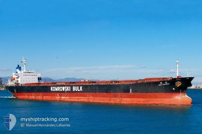
THE ABLE
Bulk Carrier
Current Trip
IRBKM
| Time Travelled | --- |
|---|---|
| Remaining Time | --- |
| Distance Travelled | 1261.22 nm |
| Remaining Distance | --- |
| AVG Speed | 9.6 Knots |
| MAX Speed | 11.7 Knots |
| AVG Wind | 8.9 knots |
| MAX Wind | 30 knots |
| MIN Temp | 24.9°C / 76.82°F |
| MAX Temp | 38.4°C / 101.12°F |
| Draught | 12.3 m |
| Position Received | 35 m ago |
Current Position
| Longitude | --- |
|---|---|
| Latitude | --- |
| Status | At anchor |
| Speed | |
| Course | 150° |
| Area | Persian Gulf |
| Station | T-AIS |
| Position Received | 35 m ago |
Info
Information
The current position of THE ABLE is in Persian Gulf with coordinates 29.85666° / 49.20876° as reported on 2024-12-13 14:34 by AIS to our vessel tracker app. The vessel's current speed is 0 Knots
The vessel THE ABLE (IMO: 9165190, MMSI: 356750000) is a Bulk Carrier that was built in 1998 ( 26 years old ). It's sailing under the flag of [PA] Panama.
In this page you can find informations about the vessels current position, last detected port calls, and current voyage information. If the vessels is not in coverage by AIS you will find the latest position.
The current position of THE ABLE is detected by our AIS receivers and we are not responsible for the reliability of the data. The last position was recorded while the vessel was in Coverage by the Ais receivers of our vessel tracking app.
The current draught of THE ABLE as reported by AIS is 12.3 meters
Weather
| Temperature | 20°C / 68°F |
|---|---|
| Wind Speed | 12 knots |
| Direction | 138° SE |
| Pressure | 1014.3 hPa |
| Humidity | 69.9 % |
| Cloud Coverage | 40 % |
Featured Company
Last Port Calls
Most Visited Ports (Last year)
| Port | Arrivals | |
|---|---|---|
| 3 | ||
| 3 | ||
| 2 | ||
| 1 | ||
| 1 |
Last Trips
| Origin | Departure | Destination | Arrival | Distance |
|---|
Events
| Time | Event | Details | Position / Dest | Info |
|---|---|---|---|---|
| 2024-12-13 14:47 | Status Changed | Default At anchor |
29.85663 / 49.20872
IRBKM
|
Speed: Course: 150° |
| 2024-12-13 14:34 | Status Changed | At anchor Default |
29.85666 / 49.20876
IRBKM
|
Speed: Course: 149° |
| 2024-12-13 14:16 | IN Coverage |
29.85666 / 49.20876
Persian Gulf
|
Speed: Course: 277° |
|
| 2024-12-13 13:23 | Status Changed | Default At anchor |
29.85665 / 49.20904
IRBKM
|
Speed: Course: 158° |
| 2024-12-13 13:10 | OUT of Coverage |
29.85671 / 49.20917
Persian Gulf
|
Speed: Course: 277° |
|
| 2024-12-13 13:05 | Status Changed | At anchor Default |
29.85675 / 49.20925
IRBKM
|
Speed: Course: 164° |
| 2024-12-13 12:55 | IN Coverage |
29.85675 / 49.20925
Persian Gulf
|
Speed: Course: 277° |
|
| 2024-12-13 09:22 | Status Changed | Default At anchor |
29.85393 / 49.21227
IRBKM
|
Speed: Course: 324° |
| 2024-12-13 09:13 | OUT of Coverage |
29.85380 / 49.21200
Persian Gulf
|
Speed: Course: 108.5° |
|
| 2024-12-13 09:10 | Status Changed | At anchor Default |
29.85376 / 49.21189
IRBKM
|
Speed: 0.1 kn Course: 355° |