
TAVISTOCK SQUARE
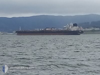
Tanker
Current Trip
USBNC
| Time Travelled | 1 day |
|---|---|
| Remaining Time | --- |
| Distance Travelled | 36.15 nm |
| Remaining Distance | --- |
| AVG Speed | 9.8 Knots |
| MAX Speed | 11.4 Knots |
| AVG Wind | 4.4 knots |
| MAX Wind | 10.8 knots |
| MIN Temp | 10.7°C / 51.26°F |
| MAX Temp | 21.2°C / 70.16°F |
| Draught | 8.9 m |
| Position Received | 3 m ago |
Current Position
| Longitude | -122.34377° |
|---|---|
| Latitude | 37.75291° |
| Status | At anchor |
| Speed | |
| Course | 167° |
| Area | North Pacific Ocean |
| Station | T-AIS |
| Position Received | 3 m ago |
Info
Information
The current position of TAVISTOCK SQUARE is in North Pacific Ocean with coordinates 37.75291° / -122.34377° as reported on 2024-04-23 11:19 by AIS to our vessel tracker app. The vessel's current speed is 0 Knots
The vessel TAVISTOCK SQUARE (IMO: 9784001, MMSI: 636019145) is a Tanker It's sailing under the flag of [LR] Liberia.
In this page you can find informations about the vessels current position, last detected port calls, and current voyage information. If the vessels is not in coverage by AIS you will find the latest position.
The current position of TAVISTOCK SQUARE is detected by our AIS receivers and we are not responsible for the reliability of the data. The last position was recorded while the vessel was in Coverage by the Ais receivers of our vessel tracking app.
The current draught of TAVISTOCK SQUARE as reported by AIS is 8.9 meters
Weather
| Temperature | 11.3°C / 52.34°F |
|---|---|
| Wind Speed | 7 knots |
| Direction | 201° SSW |
| Pressure | 1012.2 hPa |
| Humidity | 83.1 % |
| Cloud Coverage | 15 % |
Featured Company
Last Port Calls
| Port | Arrival | Departure | Time In Port |
|---|---|---|---|
| 2024-04-19 19:26 | 2024-04-21 17:17 | 1 d | |
| 2024-03-28 22:09 | 2024-03-30 22:20 | 2 d | |
| 2024-03-02 00:40 | 2024-03-05 03:21 | 3 d | |
| 2024-02-23 16:27 | 2024-02-25 18:19 | 2 d | |
| 2024-02-13 08:56 | 2024-02-15 08:27 | 1 d |
Most Visited Ports (Last year)
| Port | Arrivals | |
|---|---|---|
| 3 | ||
| 2 | ||
| 2 | ||
| 1 | ||
| 1 |
Last Trips
| Origin | Departure | Destination | Arrival | Distance | |
|---|---|---|---|---|---|
| 2024-03-30 15:20 | 2024-04-19 12:26 | 107.24 nm | |||
| 2024-03-04 19:21 | 2024-03-28 15:09 | 122.52 nm | |||
| 2024-02-25 10:19 | 2024-03-01 16:40 | 780.07 nm | |||
| 2024-02-15 00:27 | 2024-02-23 08:27 | 48.55 nm | |||
| 2024-01-11 14:34 | 2024-02-13 00:56 | 8621.74 nm |
Events
| Time | Event | Details | Position / Dest | Info |
|---|---|---|---|---|
| 2024-04-21 20:55 | Status Changed | At anchor Under way using engine |
37.75284 / -122.34387
USBNC
|
Speed: 0.2 kn Course: 163° |
| 2024-04-21 20:43 | STOP Moving | 2.1 nm, South East of SAN FRANCISCO |
37.75072 / -122.34361
USBNC
|
Speed: 0.3 kn Course: 148° |
| 2024-04-21 18:33 | Draught Changed | 8.9 11 |
38.04825 / -122.33660
USBNC
|
Speed: 9.8 kn Course: 238.6° |
| 2024-04-21 17:59 | Status Changed | Under way using engine Default |
38.06302 / -122.22886
USBNC
|
Speed: 7.9 kn Course: 275° |
| 2024-04-21 17:30 | Status Changed | Default Under way using engine |
38.03051 / -122.16122
USBNC
|
Speed: 8.4 kn Course: 248.3° |
| 2024-04-21 17:17 | Status Changed | Under way using engine Default |
38.04129 / -122.13010
USBNC
|
Speed: 0.7 kn Course: 224° |
| 2024-04-21 17:17 | START Moving | 0.24 nm, East of BENICIA |
38.04129 / -122.13010
USBNC
|
Speed: 4.4 kn Course: 226° |
| 2024-04-21 17:17 | PORT DEPARTURE |
|
38.04129 / -122.13010
USBNC
|
Speed: 0.7 kn Course: 224° |
| 2024-04-21 17:02 | IN Coverage |
38.03930 / -122.13273
North Pacific Ocean
|
Speed: 5.8 kn Course: 229.5° |
|
| 2024-04-19 19:26 | STOP Moving |
38.04499 / -122.12829
[US] BENICIA
|
Speed: 0.1 kn Course: 224° |