
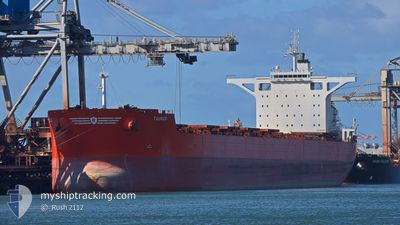
TAURUS
Bulk Carrier
Current Trip
| Time Travelled | 4 days |
|---|---|
| Remaining Time | --- |
| Distance Travelled | 1133.70 nm |
| Remaining Distance | --- |
| AVG Speed | 9.7 Knots |
| MAX Speed | 12.1 Knots |
| AVG Wind | 12.3 knots |
| MAX Wind | 23.3 knots |
| MIN Temp | 26.3°C / 79.34°F |
| MAX Temp | 30°C / 86°F |
| Draught | 17.8 m |
| Position Received | 4 d ago |
Current Position
| Longitude | 118.45166° |
|---|---|
| Latitude | -19.95275° |
| Status | Under way using engine |
| Speed | 10.4 Knots |
| Course | 7.7° |
| Area | Indian Ocean |
| Station | T-AIS |
| Position Received | 4 d ago |
Info
Information
The current position of TAURUS is in Indian Ocean with coordinates -19.95275° / 118.45166° as reported on 2024-04-19 14:37 by AIS to our vessel tracker app. The vessel's current speed is 10.4 Knots and is heading at the port of QINGDAO. The estimated time of arrival as calculated by MyShipTracking vessel tracking app is 2024-05-03 12:00 LT
The vessel TAURUS (IMO: 9403530, MMSI: 235074621) is a Bulk Carrier that was built in 2011 ( 13 years old ). It's sailing under the flag of [GB] United Kingdom.
In this page you can find informations about the vessels current position, last detected port calls, and current voyage information. If the vessels is not in coverage by AIS you will find the latest position.
The current position of TAURUS is detected by our AIS receivers and we are not responsible for the reliability of the data. The last position was recorded while the vessel was in Coverage by the Ais receivers of our vessel tracking app.
The current draught of TAURUS as reported by AIS is 17.8 meters
Weather
| Temperature | 29.4°C / 84.92°F |
|---|---|
| Wind Speed | 6 knots |
| Direction | 253° WSW |
| Pressure | 1008.4 hPa |
| Humidity | 69.5 % |
| Cloud Coverage | 19 % |
Featured Company
Last Port Calls
| Port | Arrival | Departure | Time In Port |
|---|---|---|---|
| 2024-04-18 03:44 | 2024-04-19 12:10 | 1 d | |
| 2024-03-28 23:54 | 2024-03-31 05:13 | 2 d | |
| 2024-02-07 21:18 | 2024-02-09 19:18 | 1 d |
Events
| Time | Event | Details | Position / Dest | Info |
|---|---|---|---|---|
| 2024-04-19 14:57 | Status Changed | Default Under way using engine |
-19.89957 / 118.44428
QINGDAO
|
Speed: 10.4 kn Course: 7.7° |
| 2024-04-19 14:37 | OUT of Coverage |
-19.95275 / 118.45166
Indian Ocean
QINGDAO
|
Speed: 10.4 kn Course: 7.7° |
|
| 2024-04-19 12:10 | PORT DEPARTURE |
|
-20.30344 / 118.57954
QINGDAO
|
Speed: 6.2 kn Course: 49° |
| 2024-04-19 12:05 | START Moving |
-20.30824 / 118.57390
[AU] PORT HEDLAND
|
Speed: 3.2 kn Course: 49° |
|
| 2024-04-19 11:52 | Status Changed | Under way using engine Moored |
-20.30986 / 118.57034
[AU] PORT HEDLAND
|
Speed: Course: 19° |
| 2024-04-19 11:03 | Status Changed | Moored Under way using engine |
-20.30987 / 118.57033
[AU] PORT HEDLAND
|
Speed: Course: 19° |
| 2024-04-19 11:02 | Draught Changed | 17.8 8.6 |
-20.30986 / 118.57034
[AU] PORT HEDLAND
|
Speed: Course: 19° |
| 2024-04-19 11:02 | Destination Changed | QINGDAO PORTHEDLAND |
-20.30986 / 118.57034
[AU] PORT HEDLAND
|
Speed: Course: 19° |
| 2024-04-19 11:02 | ETA Changed | 2024/05/03 12:00 2024/04/14 09:00 |
-20.30986 / 118.57034
[AU] PORT HEDLAND
|
Speed: Course: 19° |
| 2024-04-19 11:02 | Status Changed | Under way using engine Moored |
-20.30986 / 118.57035
[AU] PORT HEDLAND
|
Speed: Course: 19° |