
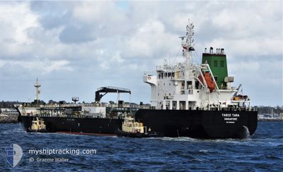
TASCO TARA
Tanker
Current Trip
THRYG
| Time Travelled | 14 days |
|---|---|
| Remaining Time | --- |
| Distance Travelled | 4141.70 nm |
| Remaining Distance | --- |
| AVG Speed | 12.6 Knots |
| MAX Speed | 15 Knots |
| AVG Wind | 15.6 knots |
| MAX Wind | 29 knots |
| MIN Temp | 16.4°C / 61.52°F |
| MAX Temp | 29.7°C / 85.46°F |
| Draught | 6.5 m |
| Position Received | 5 d ago |
Current Position
| Longitude | 142.51045° |
|---|---|
| Latitude | -10.45238° |
| Status | Under way using engine |
| Speed | 14.1 Knots |
| Course | 245.8° |
| Area | Coral Sea |
| Station | T-AIS |
| Position Received | 5 d ago |
Info
Information
The current position of TASCO TARA is in Coral Sea with coordinates -10.45238° / 142.51045° as reported on 2024-04-15 09:32 by AIS to our vessel tracker app. The vessel's current speed is 14.1 Knots
The vessel TASCO TARA (IMO: 9808522, MMSI: 563037600) is a Tanker It's sailing under the flag of [SG] Singapore.
In this page you can find informations about the vessels current position, last detected port calls, and current voyage information. If the vessels is not in coverage by AIS you will find the latest position.
The current position of TASCO TARA is detected by our AIS receivers and we are not responsible for the reliability of the data. The last position was recorded while the vessel was in Coverage by the Ais receivers of our vessel tracking app.
The current draught of TASCO TARA as reported by AIS is 6.5 meters
Weather
| Temperature | 29.6°C / 85.28°F |
|---|---|
| Wind Speed | 10 knots |
| Direction | 63° ENE |
| Pressure | 1005.8 hPa |
| Humidity | 72.6 % |
| Cloud Coverage | 100 % |
Featured Company
Events
| Time | Event | Details | Position / Dest | Info |
|---|---|---|---|---|
| 2024-04-15 09:36 | Status Changed | Default Under way using engine |
-10.45945 / 142.49451
THRYG
|
Speed: 14.1 kn Course: 245.8° |
| 2024-04-15 09:32 | OUT of Coverage |
-10.45238 / 142.51045
Coral Sea
THRYG
|
Speed: 14.1 kn Course: 245.8° |
|
| 2024-04-15 09:27 | Status Changed | Under way using engine Default |
-10.44476 / 142.52770
THRYG
|
Speed: 13.9 kn Course: 246° |
| 2024-04-15 09:00 | Status Changed | Default Under way using engine |
-10.40316 / 142.62341
THRYG
|
Speed: 13.9 kn Course: 246.3° |
| 2024-04-15 08:52 | Status Changed | Under way using engine Default |
-10.39075 / 142.65222
THRYG
|
Speed: 14 kn Course: 246° |
| 2024-04-15 08:44 | Status Changed | Default Under way using engine |
-10.37773 / 142.68218
THRYG
|
Speed: 14.1 kn Course: 246.3° |
| 2024-04-15 08:31 | Status Changed | Under way using engine Default |
-10.35667 / 142.73002
THRYG
|
Speed: 13.9 kn Course: 246° |
| 2024-04-15 08:22 | Status Changed | Default Under way using engine |
-10.34269 / 142.76176
THRYG
|
Speed: 13.9 kn Course: 246.3° |
| 2024-04-15 08:07 | Status Changed | Under way using engine Default |
-10.31935 / 142.81567
THRYG
|
Speed: 13.9 kn Course: 246° |
| 2024-04-15 08:05 | Status Changed | Default Under way using engine |
-10.31616 / 142.82312
THRYG
|
Speed: 13.9 kn Course: 246.7° |