
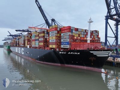
MSC ARINA
Cargo A
Current Trip
| Time Travelled | 2 days |
|---|---|
| Remaining Time | --- |
| Distance Travelled | 448.47 nm |
| Remaining Distance | --- |
| AVG Speed | 10 Knots |
| MAX Speed | 17.3 Knots |
| AVG Wind | 7.5 knots |
| MAX Wind | 21.8 knots |
| MIN Temp | 14.5°C / 58.1°F |
| MAX Temp | 18.4°C / 65.12°F |
| Draught | 14.3 m |
| Position Received | 2 d ago |
Current Position
| Longitude | 127.42428° |
|---|---|
| Latitude | 33.18388° |
| Status | Under way using engine |
| Speed | 9.7 Knots |
| Course | 226.7° |
| Area | Eastern China Sea |
| Station | T-AIS |
| Position Received | 2 d ago |
Info
Information
The current position of MSC ARINA is in Eastern China Sea with coordinates 33.18388° / 127.42428° as reported on 2024-04-13 23:53 by AIS to our vessel tracker app. The vessel's current speed is 9.7 Knots
The vessel MSC ARINA (IMO: 9839284, MMSI: 374607000) is a Cargo A It's sailing under the flag of [PA] Panama.
In this page you can find informations about the vessels current position, last detected port calls, and current voyage information. If the vessels is not in coverage by AIS you will find the latest position.
The current position of MSC ARINA is detected by our AIS receivers and we are not responsible for the reliability of the data. The last position was recorded while the vessel was in Coverage by the Ais receivers of our vessel tracking app.
The current draught of MSC ARINA as reported by AIS is 14.3 meters
Weather
| Temperature | 15°C / 59°F |
|---|---|
| Wind Speed | 10 knots |
| Direction | 139° SE |
| Pressure | 1013.6 hPa |
| Humidity | 94.2 % |
| Cloud Coverage | 100 % |
Featured Company
Last Port Calls
| Port | Arrival | Departure | Time In Port |
|---|---|---|---|
| 2024-04-12 05:46 | 2024-04-13 09:54 | 1 d | |
| 2024-04-06 04:01 | 2024-04-08 12:04 | 2 d | |
| 2024-03-29 00:37 | 2024-03-30 22:47 | 1 d | |
| 2024-02-19 02:57 | 2024-02-20 17:16 | 1 d | |
| 2024-02-14 22:32 | 2024-02-17 19:37 | 2 d |
Most Visited Ports (Last year)
| Port | Arrivals | |
|---|---|---|
| 5 | ||
| 4 | ||
| 3 | ||
| 3 | ||
| 3 | ||
| 3 |
Last Trips
| Origin | Departure | Destination | Arrival | Distance | |
|---|---|---|---|---|---|
| 2024-04-08 20:04 | 2024-04-12 14:46 | 578.31 nm | |||
| 2024-03-31 06:47 | 2024-04-06 12:01 | 2558.25 nm | |||
| 2024-02-20 18:16 | 2024-03-29 08:37 | 12264.96 nm | |||
| 2024-02-17 20:37 | 2024-02-19 03:57 | 278.76 nm | |||
| 2024-01-08 06:49 | 2024-02-14 23:32 | 12219.45 nm |
Events
| Time | Event | Details | Position / Dest | Info |
|---|---|---|---|---|
| 2024-04-15 09:28 | STOP Moving |
29.74667 / 123.28500
KRPUS>CNNGB
|
Speed: Course: -1° |
|
| 2024-04-13 23:55 | Status Changed | Default Under way using engine |
33.18019 / 127.41954
KRPUS>CNNGB
|
Speed: 9.7 kn Course: 226.7° |
| 2024-04-13 23:53 | OUT of Coverage |
33.18388 / 127.42428
Eastern China Sea
KRPUS>CNNGB
|
Speed: 9.7 kn Course: 226.7° |
|
| 2024-04-13 23:47 | Change Sea Area | South Korean part of the Eastern China Sea South Korean part of the Japan Sea |
33.19558 / 127.43936
Eastern China Sea
KRPUS>CNNGB
|
Speed: 9.7 kn Course: 227.3° |
| 2024-04-13 23:37 | Status Changed | Under way using engine Default |
33.21531 / 127.46261
KRPUS>CNNGB
|
Speed: 9.6 kn Course: 214° |
| 2024-04-13 23:00 | Status Changed | Default Under way using engine |
33.29030 / 127.53104
KRPUS>CNNGB
|
Speed: 9.3 kn Course: 225.4° |
| 2024-04-13 22:57 | Status Changed | Under way using engine Default |
33.29544 / 127.53735
KRPUS>CNNGB
|
Speed: 9.4 kn Course: 228° |
| 2024-04-13 22:17 | Status Changed | Default Under way using engine |
33.36735 / 127.63284
KRPUS>CNNGB
|
Speed: 9.7 kn Course: 222.5° |
| 2024-04-13 22:12 | Status Changed | Under way using engine Default |
33.37685 / 127.64401
KRPUS>CNNGB
|
Speed: 9.5 kn Course: 211° |
| 2024-04-13 21:38 | Status Changed | Default Under way using engine |
33.44499 / 127.71455
KRPUS>CNNGB
|
Speed: 9.5 kn Course: 221.4° |