
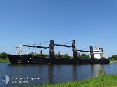
TALI
General Cargo
Current Trip
NO HLV
| Time Travelled | 21 h, 58 mins |
|---|---|
| Remaining Time | --- |
| Distance Travelled | 268.65 nm |
| Remaining Distance | --- |
| AVG Speed | 12.1 Knots |
| MAX Speed | 14.9 Knots |
| AVG Wind | 8.4 knots |
| MAX Wind | 11 knots |
| MIN Temp | 2.2°C / 35.96°F |
| MAX Temp | 7°C / 44.6°F |
| Draught | 6.4 m |
| Position Received | 1 m ago |
Current Position
| Longitude | 14.08195° |
|---|---|
| Latitude | 55.23277° |
| Status | Under way using engine |
| Speed | 12.6 Knots |
| Course | 271.6° |
| Area | Baltic Sea |
| Station | T-AIS |
| Position Received | 1 m ago |
Info
Information
The current position of TALI is in Baltic Sea with coordinates 55.23277° / 14.08195° as reported on 2024-04-25 10:40 by AIS to our vessel tracker app. The vessel's current speed is 12.6 Knots
The vessel TALI (IMO: 9173692, MMSI: 230916000) is a General Cargo that was built in 1998 ( 26 years old ). It's sailing under the flag of [FI] Finland.
In this page you can find informations about the vessels current position, last detected port calls, and current voyage information. If the vessels is not in coverage by AIS you will find the latest position.
The current position of TALI is detected by our AIS receivers and we are not responsible for the reliability of the data. The last position was recorded while the vessel was in Coverage by the Ais receivers of our vessel tracking app.
The current draught of TALI as reported by AIS is 6.4 meters
Weather
| Temperature | 5.2°C / 41.36°F |
|---|---|
| Wind Speed | 12 knots |
| Direction | 109° ESE |
| Pressure | 1005.6 hPa |
| Humidity | 69.4 % |
| Cloud Coverage | 58 % |
Featured Company
Last Port Calls
| Port | Arrival | Departure | Time In Port |
|---|---|---|---|
| 2024-04-23 15:30 | 2024-04-24 12:43 | 21 h | |
| 2024-04-20 15:38 | 2024-04-20 16:57 | 1 h | |
| 2024-04-19 13:29 | 2024-04-20 14:30 | 1 d | |
| 2024-04-17 10:04 | 2024-04-19 00:44 | 1 d | |
| 2024-04-07 13:29 | 2024-04-10 19:11 | 3 d | |
| 2024-04-05 13:29 | 2024-04-07 06:13 | 1 d | |
| 2024-04-04 11:33 | 2024-04-04 23:29 | 11 h | |
| 2024-03-30 08:22 | 2024-04-03 17:13 | 4 d | |
| 2024-03-26 20:53 | 2024-03-28 11:17 | 1 d | |
| 2024-03-25 08:09 | 2024-03-26 13:25 | 1 d |
Last Trips
| Origin | Departure | Destination | Arrival | Distance | |
|---|---|---|---|---|---|
| 2024-04-20 18:57 | 2024-04-23 17:30 | 736.72 nm | |||
| 2024-04-20 16:30 | 2024-04-20 17:38 | 4.92 nm | |||
| 2024-04-19 02:44 | 2024-04-19 15:29 | 145.00 nm | |||
| 2024-04-10 22:11 | 2024-04-17 12:04 | 1282.27 nm | |||
| 2024-04-07 09:13 | 2024-04-07 16:29 | 72.08 nm | |||
| 2024-04-05 01:29 | 2024-04-05 16:29 | 83.91 nm | |||
| 2024-04-03 20:13 | 2024-04-04 13:33 | 120.65 nm | |||
| 2024-03-28 12:17 | 2024-03-30 10:22 | 444.40 nm | |||
| 2024-03-26 14:25 | 2024-03-26 21:53 | 75.61 nm | |||
| 2024-03-23 13:41 | 2024-03-25 09:09 | 508.25 nm |
Events
| Time | Event | Details | Position / Dest | Info |
|---|---|---|---|---|
| 2024-04-25 08:20 | Change Sea Area | Swedish part of the Baltic Sea Danish part of the Kattegat |
55.48372 / 14.71917
Baltic Sea
NO HLV
|
Speed: 12 kn Course: 240.3° |
| 2024-04-25 06:44 | Detected in Sea | Danish part of the Kattegat |
55.65051 / 15.21801
Kattegat
NO HLV
|
Speed: 12.1 kn Course: 240.6° |
| 2024-04-25 00:05 | Status Changed | Under way using engine Default |
56.51303 / 16.92739
NO HLV
|
Speed: 12.4 kn Course: 197° |
| 2024-04-25 00:05 | IN Coverage |
56.51303 / 16.92739
Baltic Sea
NO HLV
|
Speed: 12.4 kn Course: 196.4° |
|
| 2024-04-24 23:04 | Status Changed | Default Under way using engine |
56.71543 / 17.03592
NO HLV
|
Speed: 12.4 kn Course: 195.8° |
| 2024-04-24 22:58 | OUT of Coverage |
56.73702 / 17.04737
Baltic Sea
NO HLV
|
Speed: 12.4 kn Course: 195.8° |
|
| 2024-04-24 22:50 | Status Changed | Under way using engine Default |
56.76096 / 17.05968
NO HLV
|
Speed: 12.5 kn Course: 196° |
| 2024-04-24 22:32 | IN Coverage |
56.76096 / 17.05968
Baltic Sea
NO HLV
|
Speed: 12.5 kn Course: 195.7° |
|
| 2024-04-24 21:32 | Status Changed | Default Under way using engine |
57.02561 / 17.19810
NO HLV
|
Speed: 12.7 kn Course: 196.6° |
| 2024-04-24 21:26 | OUT of Coverage |
57.04535 / 17.20894
Baltic Sea
NO HLV
|
Speed: 12.7 kn Course: 196.6° |