
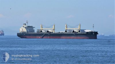
TAI STAR
Cargo
Current Trip
PANAMA
| Time Travelled | 33 days |
|---|---|
| Remaining Time | --- |
| Distance Travelled | 9083.30 nm |
| Remaining Distance | --- |
| AVG Speed | 12 Knots |
| MAX Speed | 14.9 Knots |
| AVG Wind | 11.3 knots |
| MAX Wind | 26 knots |
| MIN Temp | 14.7°C / 58.46°F |
| MAX Temp | 29.5°C / 85.1°F |
| Draught | 10.1 m |
| Position Received | 1 d ago |
Current Position
| Longitude | --- |
|---|---|
| Latitude | --- |
| Status | Under way using engine |
| Speed | 11.3 Knots |
| Course | 0.3° |
| Area | Caribbean Sea |
| Station | T-AIS |
| Position Received | 1 d ago |
Info
Information
The current position of TAI STAR is in Caribbean Sea with coordinates 9.82148° / -79.96420° as reported on 2024-12-11 19:47 by AIS to our vessel tracker app. The vessel's current speed is 11.3 Knots
The vessel TAI STAR (IMO: 9774460, MMSI: 354857000) is a Cargo It's sailing under the flag of [PA] Panama.
In this page you can find informations about the vessels current position, last detected port calls, and current voyage information. If the vessels is not in coverage by AIS you will find the latest position.
The current position of TAI STAR is detected by our AIS receivers and we are not responsible for the reliability of the data. The last position was recorded while the vessel was in Coverage by the Ais receivers of our vessel tracking app.
The current draught of TAI STAR as reported by AIS is 10.1 meters
Weather
| Temperature | 28°C / 82.4°F |
|---|---|
| Wind Speed | 19 knots |
| Direction | 50° NE |
| Pressure | 1014 hPa |
| Humidity | 76.1 % |
| Cloud Coverage | 98 % |
Featured Company
Most Visited Ports (Last year)
| Port | Arrivals | |
|---|---|---|
| 2 | ||
| 2 | ||
| 1 | ||
| 1 | ||
| 1 | ||
| 1 |
Last Trips
Events
| Time | Event | Details | Position / Dest | Info |
|---|---|---|---|---|
| 2024-12-11 19:52 | Status Changed | Default Under way using engine |
9.83945 / -79.96410
PANAMA
|
Speed: 11.3 kn Course: 0.3° |
| 2024-12-11 19:47 | OUT of Coverage |
9.82148 / -79.96420
Caribbean Sea
|
Speed: 11.3 kn Course: 0.3° |
|
| 2024-12-11 19:44 | Status Changed | Under way using engine Default |
9.81318 / -79.96429
PANAMA
|
Speed: 11.4 kn Course: 0° |
| 2024-12-11 19:40 | Status Changed | Default Under way using engine |
9.79992 / -79.96439
PANAMA
|
Speed: 11.5 kn Course: 1.6° |
| 2024-12-11 19:25 | Change Sea Area | Panamanian part of the Caribbean Sea Panamanian part of the North Pacific Ocean |
9.75217 / -79.96461
Caribbean Sea
|
Speed: 11.6 kn Course: 359.2° |
| 2024-12-11 19:25 | Status Changed | Under way using engine Default |
9.75217 / -79.96461
PANAMA
|
Speed: 11.5 kn Course: 1° |
| 2024-12-11 19:25 | IN Coverage |
9.75217 / -79.96461
Caribbean Sea
|
Speed: 11.6 kn Course: 359.2° |
|
| 2024-12-11 16:39 | Status Changed | Default Under way using engine |
9.29465 / -79.91950
PANAMA
|
Speed: 1.2 kn Course: 8° |
| 2024-12-11 16:39 | START Moving | 3.14 nm, South of CRISTOBAL |
9.29465 / -79.91950
PANAMA
|
Speed: 6 kn Course: 5° |
| 2024-12-11 16:23 | OUT of Coverage |
9.27763 / -79.92202
North Pacific Ocean
|
Speed: 1.2 kn Course: 4.1° |