
T PRIME
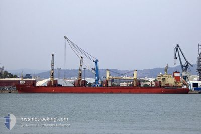
Bulk Carrier
Current Trip
| Time Travelled | 28 days |
|---|---|
| Remaining Time | --- |
| Distance Travelled | 7048.81 nm |
| Remaining Distance | --- |
| AVG Speed | 10.3 Knots |
| MAX Speed | 14 Knots |
| AVG Wind | 12.2 knots |
| MAX Wind | 27 knots |
| MIN Temp | 13°C / 55.4°F |
| MAX Temp | 30.2°C / 86.36°F |
| Draught | 9.5 m |
| Position Received | 7 d ago |
Current Position
| Longitude | 17.87836° |
|---|---|
| Latitude | -34.14526° |
| Status | Under way using engine |
| Speed | 10.8 Knots |
| Course | 319.6° |
| Area | South Atlantic Ocean |
| Station | T-AIS |
| Position Received | 7 d ago |
Info
Information
The current position of T PRIME is in South Atlantic Ocean with coordinates -34.14526° / 17.87836° as reported on 2024-04-16 04:48 by AIS to our vessel tracker app. The vessel's current speed is 10.8 Knots and is heading at the port of DOMVRAINA. The estimated time of arrival as calculated by MyShipTracking vessel tracking app is 2024-05-11 03:00 LT
The vessel T PRIME (IMO: 9611503, MMSI: 538007082) is a Bulk Carrier that was built in 2011 ( 13 years old ). It's sailing under the flag of [MH] Marshall Is.
In this page you can find informations about the vessels current position, last detected port calls, and current voyage information. If the vessels is not in coverage by AIS you will find the latest position.
The current position of T PRIME is detected by our AIS receivers and we are not responsible for the reliability of the data. The last position was recorded while the vessel was in Coverage by the Ais receivers of our vessel tracking app.
The current draught of T PRIME as reported by AIS is 9.5 meters
Weather
| Temperature | 26.6°C / 79.88°F |
|---|---|
| Wind Speed | 14 knots |
| Direction | 134° SE |
| Pressure | 1011.8 hPa |
| Humidity | 73.9 % |
| Cloud Coverage | 93 % |
Featured Company
Most Visited Ports (Last year)
| Port | Arrivals | |
|---|---|---|
| 2 | ||
| 2 | ||
| 2 | ||
| 1 | ||
| 1 | ||
| 1 |
Events
| Time | Event | Details | Position / Dest | Info |
|---|---|---|---|---|
| 2024-04-16 04:52 | Status Changed | Default Under way using engine |
-34.13810 / 17.87100
GR THI
|
Speed: 10.8 kn Course: 319.6° |
| 2024-04-16 04:48 | Status Changed | Under way using engine Default |
-34.14526 / 17.87836
GR THI
|
Speed: 11 kn Course: 320° |
| 2024-04-16 04:48 | OUT of Coverage |
-34.14526 / 17.87836
South Atlantic Ocean
GR THI
|
Speed: 10.8 kn Course: 319.6° |
|
| 2024-04-16 04:05 | Status Changed | Default Under way using engine |
-34.24333 / 17.97833
GR THI
|
Speed: 10.8 kn Course: 321.2° |
| 2024-04-16 03:57 | Status Changed | Under way using engine Default |
-34.26280 / 17.99790
GR THI
|
Speed: 10.6 kn Course: 318° |
| 2024-04-16 03:50 | Status Changed | Default Under way using engine |
-34.27955 / 18.01452
GR THI
|
Speed: 10.5 kn Course: 320.2° |
| 2024-04-16 03:35 | Status Changed | Under way using engine Default |
-34.31159 / 18.04559
GR THI
|
Speed: 10.6 kn Course: 319° |
| 2024-04-16 03:20 | Status Changed | Default Under way using engine |
-34.34601 / 18.08131
GR THI
|
Speed: 10.8 kn Course: 317.5° |
| 2024-04-16 03:11 | Status Changed | Under way using engine Default |
-34.36656 / 18.10292
GR THI
|
Speed: 10.9 kn Course: 308° |
| 2024-04-16 03:05 | Status Changed | Default Under way using engine |
-34.37872 / 18.12070
GR THI
|
Speed: 10.9 kn Course: 309° |