
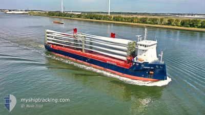
FWN SUN
Cargo
Current Trip
| Time Travelled | 1 day |
|---|---|
| Remaining Time | 13 h, 26 mins |
| Distance Travelled | 292.08 nm |
| Remaining Distance | 154.60 nm |
| AVG Speed | 8 Knots |
| MAX Speed | 14.1 Knots |
| AVG Wind | 4.9 knots |
| MAX Wind | 25.9 knots |
| MIN Temp | 1.2°C / 34.16°F |
| MAX Temp | 9.5°C / 49.1°F |
| Draught | 6.4 m |
| Position Received | Now |
Current Position
| Longitude | 4.92652° |
|---|---|
| Latitude | 53.54303° |
| Status | Under way using engine |
| Speed | 11.2 Knots |
| Course | 248.8° |
| Area | North Sea |
| Station | T-AIS |
| Position Received | Now |
Info
Information
The current position of FWN SUN is in North Sea with coordinates 53.54303° / 4.92652° as reported on 2024-04-18 22:14 by AIS to our vessel tracker app. The vessel's current speed is 11.2 Knots and is heading at the port of VLISSINGEN. The estimated time of arrival as calculated by MyShipTracking vessel tracking app is 2024-04-19 11:41 LT
The vessel FWN SUN (IMO: 9721669, MMSI: 244770393) is a Cargo It's sailing under the flag of [NL] Netherlands.
In this page you can find informations about the vessels current position, last detected port calls, and current voyage information. If the vessels is not in coverage by AIS you will find the latest position.
The current position of FWN SUN is detected by our AIS receivers and we are not responsible for the reliability of the data. The last position was recorded while the vessel was in Coverage by the Ais receivers of our vessel tracking app.
The current draught of FWN SUN as reported by AIS is 6.4 meters
Weather
| Temperature | 7.6°C / 45.68°F |
|---|---|
| Wind Speed | 26 knots |
| Direction | 248° WSW |
| Pressure | 1011.8 hPa |
| Humidity | 89.3 % |
| Cloud Coverage | 100 % |
Featured Company
Last Port Calls
| Port | Arrival | Departure | Time In Port |
|---|---|---|---|
| 2024-04-15 23:16 | 2024-04-17 14:28 | 1 d | |
| 2024-04-08 22:04 | 2024-04-15 13:25 | 6 d | |
| 2024-03-29 09:24 | 2024-04-05 12:49 | 7 d | |
| 2024-03-06 21:41 | 2024-03-11 14:14 | 4 d | |
| 2024-03-02 09:49 | 2024-03-02 22:07 | 12 h | |
| 2024-02-29 06:00 | 2024-02-29 12:20 | 6 h | |
| 2024-02-26 07:17 | 2024-02-26 17:28 | 10 h | |
| 2024-02-20 10:26 | 2024-02-23 13:36 | 3 d | |
| 2024-02-15 07:53 | 2024-02-16 07:15 | 23 h | |
| 2024-02-12 07:18 | 2024-02-12 19:43 | 12 h |
Last Trips
| Origin | Departure | Destination | Arrival | Distance | |
|---|---|---|---|---|---|
| 2024-04-15 15:25 | 2024-04-16 01:16 | 117.24 nm | |||
| 2024-04-05 14:49 | 2024-04-09 00:04 | 986.98 nm | |||
| 2024-03-11 17:14 | 2024-03-29 10:24 | 4428.61 nm | |||
| 2024-03-03 01:07 | 2024-03-07 00:41 | 53.58 nm | |||
| 2024-02-29 14:20 | 2024-03-02 12:49 | 317.33 nm | |||
| 2024-02-26 18:28 | 2024-02-29 08:00 | 671.04 nm | |||
| 2024-02-23 14:36 | 2024-02-26 08:17 | 539.96 nm | |||
| 2024-02-16 07:15 | 2024-02-20 11:26 | 1148.07 nm | |||
| 2024-02-12 20:43 | 2024-02-15 07:53 | 514.91 nm | |||
| 2024-02-06 17:57 | 2024-02-12 08:18 | 1225.68 nm |
Events
| Time | Event | Details | Position / Dest | Info |
|---|---|---|---|---|
| 2024-04-18 18:56 | ETA Changed | 2024/04/19 10:00 2024/04/19 09:00 |
53.74192 / 5.92502
NLVLI
|
Speed: 11.3 kn Course: 251.9° |
| 2024-04-18 17:47 | Change Sea Area | Dutch part of the North Sea German part of the North Sea |
53.80812 / 6.26570
North Sea
NLVLI
|
Speed: 10.7 kn Course: 253° |
| 2024-04-18 08:30 | START Moving | 0.9 nm, South West of BRUNSBUETTEL |
53.89252 / 9.14190
NLVLI
|
Speed: 3.1 kn Course: 228° |
| 2024-04-18 08:29 | ETA Changed | 2024/04/19 09:00 2024/04/19 06:00 |
53.89330 / 9.14338
NLVLI
|
Speed: 2.1 kn Course: 230° |
| 2024-04-18 08:29 | Change Sea Area | German part of the North Sea German part of the Baltic Sea |
53.89330 / 9.14338
North Sea
NLVLI
|
Speed: 2.1 kn Course: 230.7° |
| 2024-04-18 07:45 | STOP Moving | 0.75 nm, South West of BRUNSBUETTEL |
53.89408 / 9.14505
NLVLI
|
Speed: 0.1 kn Course: 226° |
| 2024-04-18 00:44 | START Moving | 7.22 nm, West of KIEL |
54.34192 / 9.95473
NLVLI
|
Speed: 3.1 kn Course: 260° |
| 2024-04-18 00:32 | STOP Moving | 7.08 nm, West of KIEL |
54.34243 / 9.95882
NLVLI
|
Speed: 0.3 kn Course: 265° |
| 2024-04-17 23:15 | START Moving | 1.44 nm, South West of STICKENHΟRN SPORT |
54.36680 / 10.13755
NLVLI
|
Speed: 3.1 kn Course: 287° |
| 2024-04-17 22:34 | STOP Moving | 1.38 nm, South West of STICKENHΟRN SPORT |
54.36615 / 10.14103
NLVLI
|
Speed: 0.3 kn Course: 284° |