
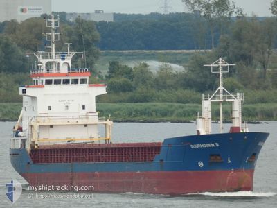
SUURHUSEN.S
General Cargo
Current Trip
| Time Travelled | 7 days |
|---|---|
| Remaining Time | --- |
| Distance Travelled | 1359.93 nm |
| Remaining Distance | --- |
| AVG Speed | 8 Knots |
| MAX Speed | 11.9 Knots |
| AVG Wind | 10.1 knots |
| MAX Wind | 32.9 knots |
| MIN Temp | 5.9°C / 42.62°F |
| MAX Temp | 17.6°C / 63.68°F |
| Draught | 6 m |
| Position Received | 1 m ago |
Current Position
| Longitude | 1.93020° |
|---|---|
| Latitude | 51.56637° |
| Status | Under way using engine |
| Speed | 8.1 Knots |
| Course | 316.8° |
| Area | North Sea |
| Station | T-AIS |
| Position Received | 1 m ago |
Info
Information
The current position of SUURHUSEN.S is in North Sea with coordinates 51.56637° / 1.93020° as reported on 2024-04-25 07:24 by AIS to our vessel tracker app. The vessel's current speed is 8.1 Knots and is heading at the port of MONTROSE. The estimated time of arrival as calculated by MyShipTracking vessel tracking app is 2024-04-26 18:00 LT
The vessel SUURHUSEN.S (IMO: 9123245, MMSI: 304369000) is a General Cargo that was built in 1996 ( 28 years old ). It's sailing under the flag of [AG] Antigua Barbuda.
In this page you can find informations about the vessels current position, last detected port calls, and current voyage information. If the vessels is not in coverage by AIS you will find the latest position.
The current position of SUURHUSEN.S is detected by our AIS receivers and we are not responsible for the reliability of the data. The last position was recorded while the vessel was in Coverage by the Ais receivers of our vessel tracking app.
The current draught of SUURHUSEN.S as reported by AIS is 6 meters
Weather
| Temperature | 7°C / 44.6°F |
|---|---|
| Wind Speed | 12 knots |
| Direction | 244° WSW |
| Pressure | 1007.2 hPa |
| Humidity | 68.5 % |
| Cloud Coverage | 100 % |
Featured Company
Last Port Calls
| Port | Arrival | Departure | Time In Port |
|---|---|---|---|
| 2024-04-15 21:12 | 2024-04-17 20:36 | 1 d | |
| 2024-04-09 03:46 | 2024-04-12 07:43 | 3 d | |
| 2024-03-28 19:41 | 2024-03-28 19:45 | 4 m | |
| 2024-03-25 00:29 | |||
| 2024-03-10 18:52 | 2024-03-12 23:43 | 2 d | |
| 2024-03-03 10:35 | 2024-03-04 21:32 | 1 d | |
| 2024-02-21 18:38 | 2024-02-25 11:32 | 3 d | |
| 2024-02-17 04:55 | 2024-02-19 16:11 | 2 d | |
| 2024-02-14 10:25 | 2024-02-15 19:14 | 1 d | |
| 2024-02-08 18:03 | 2024-02-10 16:15 | 1 d |
Last Trips
| Origin | Departure | Destination | Arrival | Distance | |
|---|---|---|---|---|---|
| 2024-04-12 09:43 | 2024-04-15 22:12 | 320.70 nm | |||
| 2024-03-28 22:45 | 2024-04-09 05:46 | 1981.54 nm | |||
| 2024-03-25 04:29 | 2024-03-28 22:41 | 625.45 nm | |||
| 2024-03-05 00:32 | 2024-03-10 20:52 | 302.23 nm | |||
| 2024-02-25 12:32 | 2024-03-03 13:35 | 1150.08 nm | |||
| 2024-02-19 17:11 | 2024-02-21 19:38 | 185.17 nm | |||
| 2024-02-15 20:14 | 2024-02-17 05:55 | 246.90 nm | |||
| 2024-02-10 17:15 | 2024-02-14 11:25 | 70.73 nm | |||
| 2024-01-25 18:18 | 2024-02-08 19:03 | 1758.69 nm |
Events
| Time | Event | Details | Position / Dest | Info |
|---|---|---|---|---|
| 2024-04-25 07:18 | ETA Changed | 2024/04/27 08:00 2024/04/26 18:00 |
51.55579 / 1.94639
GBMON
|
Speed: 8 kn Course: 318.1° |
| 2024-04-25 03:08 | Change Sea Area | United Kingdom part of the North Sea French part of the North Sea |
51.06728 / 1.62739
North Sea
GBMON
|
Speed: 9.6 kn Course: 37.6° |
| 2024-04-25 02:50 | Change Sea Area | French part of the North Sea French part of the English Channel |
51.02862 / 1.57859
North Sea
GBMON
|
Speed: 10 kn Course: 38° |
| 2024-04-25 01:39 | Status Changed | Under way using engine Default |
50.85422 / 1.41643
GBMON
|
Speed: 10.6 kn Course: 14° |
| 2024-04-25 01:36 | Status Changed | Default Under way using engine |
50.84627 / 1.41329
GBMON
|
Speed: 10.5 kn Course: 14.4° |
| 2024-04-25 01:30 | Status Changed | Under way using engine Default |
50.82873 / 1.40653
GBMON
|
Speed: 10.5 kn Course: 14° |
| 2024-04-25 01:04 | Status Changed | Default Under way using engine |
50.75725 / 1.37902
GBMON
|
Speed: 10.2 kn Course: 13.3° |
| 2024-04-25 00:41 | Detected in Sea | French part of the English Channel |
50.70204 / 1.33062
English Channel
GBMON
|
Speed: 10 kn Course: 48.6° |
| 2024-04-25 00:40 | Status Changed | Under way using engine Default |
50.70113 / 1.32898
GBMON
|
Speed: 10 kn Course: 47° |
| 2024-04-25 00:40 | IN Coverage |
50.70204 / 1.33062
English Channel
GBMON
|
Speed: 10 kn Course: 48.6° |