
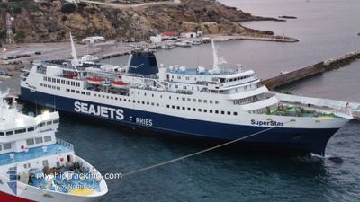
SUPERSTAR
Ro-Ro/Passenger Ship
Current Trip
V S S A S S V
| Time Travelled | 3 h, 17 mins |
|---|---|
| Remaining Time | --- |
| Distance Travelled | 28.52 nm |
| Remaining Distance | --- |
| AVG Speed | 16.5 Knots |
| MAX Speed | 19 Knots |
| AVG Wind | 10.9 knots |
| MAX Wind | 13.3 knots |
| MIN Temp | 16.5°C / 61.7°F |
| MAX Temp | 17.2°C / 62.96°F |
| Draught | 4.7 m |
| Position Received | 5 h, 16 m ago |
Current Position
| Longitude | 23.02136° |
|---|---|
| Latitude | 39.13485° |
| Status | Under way using engine |
| Speed | 18.6 Knots |
| Course | 164.4° |
| Area | Aegean Sea |
| Station | T-AIS |
| Position Received | 5 h, 16 m ago |
Info
Information
The current position of SUPERSTAR is in Aegean Sea with coordinates 39.13485° / 23.02136° as reported on 2024-04-25 05:32 by AIS to our vessel tracker app. The vessel's current speed is 18.6 Knots
The vessel SUPERSTAR (IMO: 7346221, MMSI: 237001000) is a Ro-Ro/Passenger Ship that was built in 1974 ( 50 years old ). It's sailing under the flag of [GR] Greece.
In this page you can find informations about the vessels current position, last detected port calls, and current voyage information. If the vessels is not in coverage by AIS you will find the latest position.
The current position of SUPERSTAR is detected by our AIS receivers and we are not responsible for the reliability of the data. The last position was recorded while the vessel was in Coverage by the Ais receivers of our vessel tracking app.
The current draught of SUPERSTAR as reported by AIS is 4.7 meters
Weather
| Temperature | 16.6°C / 61.88°F |
|---|---|
| Wind Speed | 13 knots |
| Direction | 337° NNW |
| Pressure | 1003.9 hPa |
| Humidity | 68 % |
| Cloud Coverage | 56 % |
Featured Company
Last Port Calls
| Port | Arrival | Departure | Time In Port |
|---|---|---|---|
| 2024-04-25 06:54 | 2024-04-25 07:32 | 37 m | |
| 2024-04-24 14:24 | 2024-04-25 04:50 | 14 h | |
| 2024-04-24 07:14 | 2024-04-24 07:54 | 40 m | |
| 2024-04-23 14:34 | 2024-04-24 05:02 | 14 h | |
| 2024-04-23 11:49 | 2024-04-23 12:29 | 40 m | |
| 2024-04-23 10:33 | 2024-04-23 10:45 | 11 m | |
| 2024-04-23 08:41 | 2024-04-23 09:10 | 28 m | |
| 2024-04-23 07:14 | 2024-04-23 07:42 | 28 m | |
| 2024-04-22 14:28 | 2024-04-23 04:56 | 14 h | |
| 2024-04-21 14:12 | 2024-04-22 04:57 | 14 h |
Last Trips
| Origin | Departure | Destination | Arrival | Distance | |
|---|---|---|---|---|---|
| 2024-04-25 07:50 | 2024-04-25 09:54 | 38.85 nm | |||
| 2024-04-24 10:54 | 2024-04-24 17:24 | 80.91 nm | |||
| 2024-04-24 08:02 | 2024-04-24 10:14 | 38.39 nm | |||
| 2024-04-23 15:29 | 2024-04-23 17:34 | 38.65 nm | |||
| 2024-04-23 13:45 | 2024-04-23 14:49 | 16.35 nm | |||
| 2024-04-23 12:10 | 2024-04-23 13:33 | 8.74 nm | |||
| 2024-04-23 10:42 | 2024-04-23 11:41 | 14.26 nm | |||
| 2024-04-23 07:56 | 2024-04-23 10:14 | 39.17 nm | |||
| 2024-04-22 07:57 | 2024-04-22 17:28 | 114.14 nm | |||
| 2024-04-21 10:25 | 2024-04-21 17:12 | 80.29 nm |
Events
| Time | Event | Details | Position / Dest | Info |
|---|---|---|---|---|
| 2024-04-25 10:02 | START Moving | 0.64 nm, South of ALONNISOS |
39.13167 / 23.86833
V S S A S S V
|
Speed: 14 kn Course: 220° |
| 2024-04-25 09:35 | STOP Moving | 0.09 nm, South East of ALONNISOS |
39.14167 / 23.86833
V S S A S S V
|
Speed: Course: -1° |
| 2024-04-25 07:32 | START Moving | 0.36 nm, South of SKIATHOS |
39.15667 / 23.49167
V S S A S S V
|
Speed: 13 kn Course: -1° |
| 2024-04-25 07:32 | PORT DEPARTURE |
|
39.15667 / 23.49167
V S S A S S V
|
Speed: Course: -1° |
| 2024-04-25 07:23 | STOP Moving |
39.16167 / 23.49167
[GR] SKIATHOS
|
Speed: Course: -1° |
|
| 2024-04-25 06:54 | PORT ARRIVAL |
|
39.16167 / 23.49167
[GR] SKIATHOS
|
Speed: 18.7 kn Course: 60° |
| 2024-04-25 05:41 | Status Changed | Default Under way using engine |
39.09114 / 23.03801
V S S A S S V
|
Speed: 18.6 kn Course: 164.4° |
| 2024-04-25 05:32 | Status Changed | Under way using engine Default |
39.13485 / 23.02136
V S S A S S V
|
Speed: 18.5 kn Course: 165° |
| 2024-04-25 05:32 | OUT of Coverage |
39.13485 / 23.02136
Aegean Sea
|
Speed: 18.6 kn Course: 164.4° |
|
| 2024-04-25 05:17 | Status Changed | Default Under way using engine |
39.21069 / 22.99614
V S S A S S V
|
Speed: 18.5 kn Course: 165.3° |