
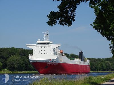
SUPER FAST LEVANTE
Ro-Ro/Passenger Ship
Current Trip
| Time Travelled | 9 days |
|---|---|
| Remaining Time | --- |
| Distance Travelled | 3219.26 nm |
| Remaining Distance | --- |
| AVG Speed | 14.8 Knots |
| MAX Speed | 17.1 Knots |
| AVG Wind | 9.9 knots |
| MAX Wind | 22.4 knots |
| MIN Temp | 21.9°C / 71.42°F |
| MAX Temp | 30.5°C / 86.9°F |
| Draught | 6.3 m |
| Position Received | 2 d ago |
Current Position
| Longitude | 54.51799° |
|---|---|
| Latitude | -21.17072° |
| Status | Under way using engine |
| Speed | 15.1 Knots |
| Course | 234° |
| Area | Indian Ocean |
| Station | T-AIS |
| Position Received | 2 d ago |
Info
Information
The current position of SUPER FAST LEVANTE is in Indian Ocean with coordinates -21.17072° / 54.51799° as reported on 2024-04-21 18:16 by AIS to our vessel tracker app. The vessel's current speed is 15.1 Knots and is heading at the port of THESSALONIKI. The estimated time of arrival as calculated by MyShipTracking vessel tracking app is 2024-05-17 08:00 LT
The vessel SUPER FAST LEVANTE (IMO: 9204362, MMSI: 224901000) is a Ro-Ro/Passenger Ship that was built in 2001 ( 23 years old ). It's sailing under the flag of [ES] Spain.
In this page you can find informations about the vessels current position, last detected port calls, and current voyage information. If the vessels is not in coverage by AIS you will find the latest position.
The current position of SUPER FAST LEVANTE is detected by our AIS receivers and we are not responsible for the reliability of the data. The last position was recorded while the vessel was in Coverage by the Ais receivers of our vessel tracking app.
The current draught of SUPER FAST LEVANTE as reported by AIS is 6.3 meters
Weather
| Temperature | 23.1°C / 73.58°F |
|---|---|
| Wind Speed | 15 knots |
| Direction | 89° E |
| Pressure | 1017 hPa |
| Humidity | 75 % |
| Cloud Coverage | 4 % |
Featured Company
Last Trips
| Origin | Departure | Destination | Arrival | Distance | |
|---|---|---|---|---|---|
| 2024-03-22 17:03 | 2024-03-26 16:01 | 9.15 nm | |||
| 2024-02-15 23:22 | 2024-03-19 21:05 | 8888.45 nm | |||
| 2024-02-10 01:20 | 2024-02-15 08:09 | 2007.91 nm | |||
| 2024-02-07 22:11 | 2024-02-09 21:46 | 460.97 nm |
Events
| Time | Event | Details | Position / Dest | Info |
|---|---|---|---|---|
| 2024-04-21 18:22 | Status Changed | Default Under way using engine |
-21.18380 / 54.49865
GR SKG
|
Speed: 15.1 kn Course: 234° |
| 2024-04-21 18:16 | OUT of Coverage |
-21.17072 / 54.51799
Indian Ocean
GR SKG
|
Speed: 15.1 kn Course: 234° |
|
| 2024-04-21 18:08 | Status Changed | Under way using engine Default |
-21.14948 / 54.55025
GR SKG
|
Speed: 15.4 kn Course: 236° |
| 2024-04-21 18:03 | Status Changed | Default Under way using engine |
-21.13736 / 54.56936
GR SKG
|
Speed: 15.4 kn Course: 234.5° |
| 2024-04-21 13:15 | Change Sea Area | R�union part of the Indian Ocean Mauritian part of the Indian Ocean |
-20.60615 / 55.73696
Indian Ocean
GR SKG
|
Speed: 16 kn Course: 255.7° |
| 2024-04-21 13:15 | Status Changed | Under way using engine Default |
-20.60615 / 55.73696
GR SKG
|
Speed: 15.9 kn Course: 256° |
| 2024-04-21 13:15 | IN Coverage |
-20.60615 / 55.73696
Indian Ocean
GR SKG
|
Speed: 16 kn Course: 255.7° |
|
| 2024-04-21 06:39 | START Moving | 2.51 nm, West of PORT LOUIS |
-20.14415 / 57.43819
GR SKG
|
Speed: 11.8 kn Course: 259° |
| 2024-04-20 10:27 | STOP Moving | 1.85 nm, West of PORT LOUIS |
-20.14645 / 57.45022
GR SKG
|
Speed: 0.2 kn Course: 75° |
| 2024-04-20 09:47 | OUT of Coverage |
-20.12240 / 57.44055
Indian Ocean
GR SKG
|
Speed: 12.6 kn Course: 179.8° |