
NAGUAL
Bulk Carrier
Current Trip
| Time Travelled | 37 days |
|---|---|
| Remaining Time | 6 days |
| Distance Travelled | 4376.39 nm |
| Remaining Distance | 1876.86 nm |
| AVG Speed | 10.4 Knots |
| MAX Speed | 10.4 Knots |
| AVG Wind | 9 knots |
| MAX Wind | 24.9 knots |
| MIN Temp | 4.7°C / 40.46°F |
| MAX Temp | 30.1°C / 86.18°F |
| Draught | 10.6 m |
| Position Received | 23 h, 45 m ago |
Current Position
| Longitude | 38.79848° |
|---|---|
| Latitude | 19.33900° |
| Status | Under way using engine |
| Speed | 12.2 Knots |
| Course | 155° |
| Area | Red Sea |
| Station | T-AIS |
| Position Received | 23 h, 45 m ago |
Info
Information
The current position of NAGUAL is in Red Sea with coordinates 19.33900° / 38.79848° as reported on 2024-04-24 05:39 by AIS to our vessel tracker app. The vessel's current speed is 12.2 Knots and is heading at the port of JEBEL ALI. The estimated time of arrival as calculated by MyShipTracking vessel tracking app is 2024-05-01 23:18 LT
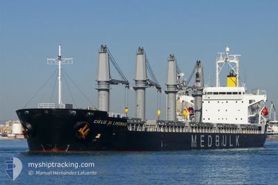
The vessel NAGUAL (IMO: 9380829, MMSI: 538007314) is a Bulk Carrier that was built in 2008 ( 16 years old ). It's sailing under the flag of [MH] Marshall Is.
In this page you can find informations about the vessels current position, last detected port calls, and current voyage information. If the vessels is not in coverage by AIS you will find the latest position.
The current position of NAGUAL is detected by our AIS receivers and we are not responsible for the reliability of the data. The last position was recorded while the vessel was in Coverage by the Ais receivers of our vessel tracking app.
The current draught of NAGUAL as reported by AIS is 10.6 meters
Weather
| Temperature | 30°C / 86°F |
|---|---|
| Wind Speed | 17 knots |
| Direction | 151° SSE |
| Pressure | 1006 hPa |
| Humidity | 73.7 % |
| Cloud Coverage | 69 % |
Featured Company
Last Port Calls
| Port | Arrival | Departure | Time In Port |
|---|---|---|---|
| 2024-04-20 23:55 | 2024-04-21 17:22 | 17 h | |
| 2024-03-03 12:02 | 2024-03-19 00:36 | 15 d | |
| 2024-02-28 09:16 | 2024-02-28 18:50 | 9 h | |
| 2024-02-16 13:23 |
Most Visited Ports (Last year)
| Port | Arrivals | |
|---|---|---|
| 5 | ||
| 2 | ||
| 2 | ||
| 1 | ||
| 1 | ||
| 1 |
Last Trips
| Origin | Departure | Destination | Arrival | Distance | |
|---|---|---|---|---|---|
| 2024-03-19 03:36 | 2024-04-21 01:55 | 3284.85 nm | |||
| 2024-02-16 17:23 | 2024-03-03 15:02 | 3906.07 nm | |||
| 2024-02-16 17:23 | 2024-02-28 11:16 | 2964.84 nm |
Events
| Time | Event | Details | Position / Dest | Info |
|---|---|---|---|---|
| 2024-04-24 05:43 | Status Changed | Default Under way using engine |
19.32492 / 38.80528
UAE JEBEL ALI
|
Speed: 12.2 kn Course: 155° |
| 2024-04-24 05:39 | Status Changed | Under way using engine Default |
19.33900 / 38.79848
UAE JEBEL ALI
|
Speed: 12.3 kn Course: 155° |
| 2024-04-24 05:39 | OUT of Coverage |
19.33900 / 38.79848
Red Sea
UAE JEBEL ALI
|
Speed: 12.2 kn Course: 155° |
|
| 2024-04-24 05:31 | Status Changed | Default Under way using engine |
19.35975 / 38.78840
UAE JEBEL ALI
|
Speed: 12.3 kn Course: 155° |
| 2024-04-24 05:21 | Status Changed | Under way using engine Default |
19.39473 / 38.77153
UAE JEBEL ALI
|
Speed: 12.3 kn Course: 155° |
| 2024-04-24 05:14 | Status Changed | Default Under way using engine |
19.41357 / 38.76243
UAE JEBEL ALI
|
Speed: 12.2 kn Course: 155° |
| 2024-04-24 05:11 | Status Changed | Under way using engine Default |
19.42507 / 38.75697
UAE JEBEL ALI
|
Speed: 12.3 kn Course: 157° |
| 2024-04-24 05:01 | Status Changed | Default Under way using engine |
19.45427 / 38.74337
UAE JEBEL ALI
|
Speed: 12.3 kn Course: 157° |
| 2024-04-24 03:37 | Status Changed | Under way using engine Default |
19.72067 / 38.62330
UAE JEBEL ALI
|
Speed: 12.1 kn Course: 159° |
| 2024-04-24 03:13 | Status Changed | Default Under way using engine |
19.79453 / 38.59313
UAE JEBEL ALI
|
Speed: 12.1 kn Course: 157° |