
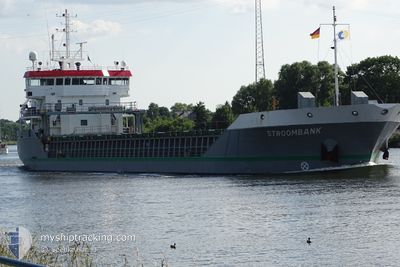
STROOMBANK
General Cargo
Current Trip
| Time Travelled | 3 days |
|---|---|
| Remaining Time | --- |
| Distance Travelled | 665.35 nm |
| Remaining Distance | --- |
| AVG Speed | 9 Knots |
| MAX Speed | 11 Knots |
| AVG Wind | 16.8 knots |
| MAX Wind | 32.3 knots |
| MIN Temp | 12.2°C / 53.96°F |
| MAX Temp | 19.1°C / 66.38°F |
| Draught | 6.1 m |
| Position Received | 1 d ago |
Current Position
| Longitude | -9.81133° |
|---|---|
| Latitude | 41.87667° |
| Status | Under way using engine |
| Speed | 4.2 Knots |
| Course | 7° |
| Area | North Atlantic Ocean |
| Station | T-AIS |
| Position Received | 1 d ago |
Info
Information
The current position of STROOMBANK is in North Atlantic Ocean with coordinates 41.87667° / -9.81133° as reported on 2024-04-17 01:14 by AIS to our vessel tracker app. The vessel's current speed is 4.2 Knots and is heading at the port of RUNCORN. The estimated time of arrival as calculated by MyShipTracking vessel tracking app is 2024-04-20 06:00 LT
The vessel STROOMBANK (IMO: 9356543, MMSI: 244617000) is a General Cargo that was built in 2009 ( 15 years old ). It's sailing under the flag of [NL] Netherlands.
In this page you can find informations about the vessels current position, last detected port calls, and current voyage information. If the vessels is not in coverage by AIS you will find the latest position.
The current position of STROOMBANK is detected by our AIS receivers and we are not responsible for the reliability of the data. The last position was recorded while the vessel was in Coverage by the Ais receivers of our vessel tracking app.
The current draught of STROOMBANK as reported by AIS is 6.1 meters
Weather
| Temperature | 12.2°C / 53.96°F |
|---|---|
| Wind Speed | 21 knots |
| Direction | 52° NE |
| Pressure | 1023.3 hPa |
| Humidity | 75.7 % |
| Cloud Coverage | 41 % |
Featured Company
Last Port Calls
| Port | Arrival | Departure | Time In Port |
|---|---|---|---|
| 2024-04-14 07:01 | 2024-04-14 09:37 | 2 h | |
| 2024-04-08 15:31 | 2024-04-11 06:03 | 2 d | |
| 2024-04-03 10:50 | 2024-04-05 13:39 | 2 d | |
| 2024-03-28 23:15 | 2024-03-30 14:56 | 1 d | |
| 2024-03-20 22:42 | 2024-03-21 21:22 | 22 h | |
| 2024-03-16 22:43 | 2024-03-20 13:20 | 3 d | |
| 2024-03-08 12:26 | 2024-03-10 15:00 | 2 d | |
| 2024-02-21 01:58 | 2024-02-24 16:26 | 3 d | |
| 2024-02-13 06:18 | 2024-02-17 19:49 | 4 d | |
| 2024-02-08 00:59 | 2024-02-09 16:30 | 1 d |
Last Trips
| Origin | Departure | Destination | Arrival | Distance | |
|---|---|---|---|---|---|
| 2024-04-11 08:03 | 2024-04-14 09:01 | 732.90 nm | |||
| 2024-04-05 16:39 | 2024-04-08 17:31 | 865.86 nm | |||
| 2024-03-30 15:56 | 2024-04-03 13:50 | 957.42 nm | |||
| 2024-03-21 22:22 | 2024-03-29 00:15 | 1474.53 nm | |||
| 2024-03-20 13:20 | 2024-03-20 23:42 | 84.44 nm | |||
| 2024-03-10 15:00 | 2024-03-16 22:43 | 1137.94 nm | |||
| 2024-02-24 17:26 | 2024-03-08 12:26 | 876.12 nm | |||
| 2024-02-17 19:49 | 2024-02-21 02:58 | 765.29 nm | |||
| 2024-02-09 17:30 | 2024-02-13 06:18 | 768.61 nm | |||
| 2024-02-06 18:13 | 2024-02-08 01:59 | 343.45 nm |
Events
| Time | Event | Details | Position / Dest | Info |
|---|---|---|---|---|
| 2024-04-17 02:12 | Status Changed | Default Under way using engine |
41.95317 / -9.81133
RUNCORN
|
Speed: 4.2 kn Course: 7° |
| 2024-04-17 01:14 | OUT of Coverage |
41.87667 / -9.81133
North Atlantic Ocean
RUNCORN
|
Speed: 4.2 kn Course: 4° |
|
| 2024-04-17 01:04 | Detected in Sea | Spanish part of the North Atlantic Ocean |
41.86233 / -9.81183
North Atlantic Ocean
RUNCORN
|
Speed: 4.5 kn Course: 1° |
| 2024-04-17 01:04 | Status Changed | Under way using engine Default |
41.86217 / -9.81183
RUNCORN
|
Speed: 5 kn Course: 0° |
| 2024-04-17 00:54 | IN Coverage |
41.86233 / -9.81183
North Atlantic Ocean
RUNCORN
|
Speed: 4.5 kn Course: 1° |
|
| 2024-04-16 23:30 | Status Changed | Default Under way using engine |
41.72833 / -9.81167
RUNCORN
|
Speed: 4.9 kn Course: 8° |
| 2024-04-16 23:24 | OUT of Coverage |
41.72183 / -9.81250
North Atlantic Ocean
RUNCORN
|
Speed: 4.9 kn Course: 9° |
|
| 2024-04-16 23:20 | Status Changed | Under way using engine Default |
41.71717 / -9.81333
RUNCORN
|
Speed: 5 kn Course: 8° |
| 2024-04-16 23:15 | IN Coverage |
41.71767 / -9.81333
North Atlantic Ocean
RUNCORN
|
Speed: 5.1 kn Course: 6° |
|
| 2024-04-16 19:24 | OUT of Coverage |
41.40167 / -9.81917
North Atlantic Ocean
RUNCORN
|
Speed: 4.9 kn Course: 3° |