
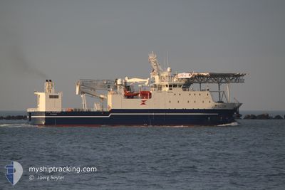
STRIL EXPLORER
Offshore Supply Ship
Current Trip
| Trip Time | 5 days |
|---|---|
| Trip Distance | 29.71 nm |
| AVG Speed | 6 Knots |
| MAX Speed | 10.1 Knots |
| Draught | 4.5 m |
| AVG Wind | 8.2 knots |
| MAX Wind | 11 knots |
| MIN Temp | 24.8°C / 76.64°F |
| MAX Temp | 26°C / 78.8°F |
| Position Received | 3 h, 49 m ago |
Current Position
| Longitude | -41.00972° |
|---|---|
| Latitude | -21.85558° |
| Status | Moored |
| Speed | |
| Course | 242° |
| Area | South Atlantic Ocean |
| Station | T-AIS |
| Position Received | 3 h, 49 m ago |
Info
Information
The current position of STRIL EXPLORER is in South Atlantic Ocean with coordinates -21.85558° / -41.00972° as reported on 2024-04-16 17:23 by AIS to our vessel tracker app. The vessel's current speed is 0 Knots and is currently inside the port of PORTO DO ACU.
The vessel STRIL EXPLORER (IMO: 9484845, MMSI: 259006000) is a Offshore Supply Ship that was built in 2010 ( 14 years old ). It's sailing under the flag of [NO] Norway.
In this page you can find informations about the vessels current position, last detected port calls, and current voyage information. If the vessels is not in coverage by AIS you will find the latest position.
The current position of STRIL EXPLORER is detected by our AIS receivers and we are not responsible for the reliability of the data. The last position was recorded while the vessel was in Coverage by the Ais receivers of our vessel tracking app.
The current draught of STRIL EXPLORER as reported by AIS is 4.5 meters
Weather
| Temperature | 26°C / 78.8°F |
|---|---|
| Wind Speed | 12 knots |
| Direction | 58° ENE |
| Pressure | 1017.3 hPa |
| Humidity | 76 % |
| Cloud Coverage | 99 % |
Featured Company
Last Port Calls
| Port | Arrival | Departure | Time In Port |
|---|---|---|---|
| 2024-04-16 10:06 | |||
| 2024-04-10 13:23 | 2024-04-11 02:12 | 12 h | |
| 2024-04-03 18:29 | 2024-04-10 11:37 | 6 d | |
| 2024-04-03 10:22 |
Most Visited Ports (Last year)
| Port | Arrivals | |
|---|---|---|
| 9 | ||
| 5 | ||
| 5 | ||
| 3 | ||
| 1 | ||
| 1 |
Last Trips
| Origin | Departure | Destination | Arrival | Distance | |
|---|---|---|---|---|---|
| 2024-04-10 23:12 | 2024-04-16 07:06 | 29.71 nm | |||
| 2024-04-10 08:37 | 2024-04-10 10:23 | 5.77 nm | |||
| 2024-04-03 07:22 | 2024-04-03 15:29 | 3.12 nm |
Events
| Time | Event | Details | Position / Dest | Info |
|---|---|---|---|---|
| 2024-04-16 17:23 | OUT of Coverage |
-21.85558 / -41.00972
South Atlantic Ocean
[BR] PORTO DO ACU
|
Speed: Course: 88.1° |
|
| 2024-04-16 10:42 | Status Changed | Moored Under way using engine |
-21.85555 / -41.00978
[BR] PORTO DO ACU
|
Speed: Course: 241° |
| 2024-04-16 10:27 | STOP Moving |
-21.85537 / -41.00973
[BR] PORTO DO ACU
|
Speed: 0.3 kn Course: 240° |
|
| 2024-04-16 10:06 | PORT ARRIVAL |
|
-21.84624 / -40.99971
[BR] PORTO DO ACU
|
Speed: 6.8 kn Course: 238.4° |
| 2024-04-16 09:33 | START Moving | 3.1 nm, East of PORTO DO ACU |
-21.84534 / -40.95675
BRACU
|
Speed: 3.1 kn Course: 12° |
| 2024-04-16 09:31 | Status Changed | Under way using engine At anchor |
-21.84700 / -40.95732
BRACU
|
Speed: Course: 36° |
| 2024-04-16 09:14 | Destination Changed | BRACU P57 |
-21.84724 / -40.95756
BRACU
|
Speed: 0.1 kn Course: 38° |
| 2024-04-16 09:14 | ETA Changed | 2024/04/16 02:30 2024/04/11 06:30 |
-21.84724 / -40.95756
BRACU
|
Speed: 0.1 kn Course: 38° |
| 2024-04-16 08:41 | IN Coverage |
-21.84723 / -40.95754
South Atlantic Ocean
|
Speed: Course: 335.3° |
|
| 2024-04-11 04:13 | OUT of Coverage |
-21.72817 / -40.77491
South Atlantic Ocean
P57
|
Speed: 9.4 kn Course: 48.6° |