
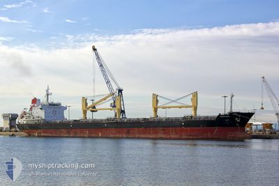
STRATEGIC ENDEAVOR
Bulk Carrier
Current Trip
BR VDC
| Time Travelled | 6 days |
|---|---|
| Remaining Time | --- |
| Distance Travelled | 1747.15 nm |
| Remaining Distance | --- |
| AVG Speed | 11.4 Knots |
| MAX Speed | 13.5 Knots |
| AVG Wind | 14.4 knots |
| MAX Wind | 20 knots |
| MIN Temp | 26.1°C / 78.98°F |
| MAX Temp | 28.5°C / 83.3°F |
| Draught | 6.5 m |
| Position Received | 1 d ago |
Current Position
| Longitude | -61.63753° |
|---|---|
| Latitude | 11.65240° |
| Status | Under way using engine |
| Speed | 11.8 Knots |
| Course | 270.1° |
| Area | Caribbean Sea |
| Station | T-AIS |
| Position Received | 1 d ago |
Info
Information
The current position of STRATEGIC ENDEAVOR is in Caribbean Sea with coordinates 11.65240° / -61.63753° as reported on 2024-04-17 23:54 by AIS to our vessel tracker app. The vessel's current speed is 11.8 Knots
The vessel STRATEGIC ENDEAVOR (IMO: 9475727, MMSI: 564180000) is a Bulk Carrier that was built in 2010 ( 14 years old ). It's sailing under the flag of [SG] Singapore.
In this page you can find informations about the vessels current position, last detected port calls, and current voyage information. If the vessels is not in coverage by AIS you will find the latest position.
The current position of STRATEGIC ENDEAVOR is detected by our AIS receivers and we are not responsible for the reliability of the data. The last position was recorded while the vessel was in Coverage by the Ais receivers of our vessel tracking app.
The current draught of STRATEGIC ENDEAVOR as reported by AIS is 6.5 meters
Weather
| Temperature | 27.4°C / 81.32°F |
|---|---|
| Wind Speed | 12 knots |
| Direction | 78° ENE |
| Pressure | 1011.1 hPa |
| Humidity | 80 % |
| Cloud Coverage | 100 % |
Featured Company
Last Port Calls
| Port | Arrival | Departure | Time In Port |
|---|---|---|---|
| 2024-04-10 19:30 | 2024-04-13 09:47 | 2 d | |
| 2024-03-13 20:48 | 2024-03-20 20:07 | 6 d | |
| 2024-02-29 08:32 | 2024-03-02 08:51 | 2 d |
Most Visited Ports (Last year)
| Port | Arrivals | |
|---|---|---|
| 3 | ||
| 1 | ||
| 1 | ||
| 1 | ||
| 1 | ||
| 1 |
Last Trips
| Origin | Departure | Destination | Arrival | Distance | |
|---|---|---|---|---|---|
| 2024-03-20 17:07 | 2024-04-10 16:30 | 1178.22 nm | |||
| 2024-03-02 05:51 | 2024-03-13 17:48 | 2382.86 nm | |||
| 2024-01-28 23:52 | 2024-02-29 05:32 | 5559.35 nm |
Events
| Time | Event | Details | Position / Dest | Info |
|---|---|---|---|---|
| 2024-04-17 23:58 | Status Changed | Default Under way using engine |
11.65224 / -61.64967
BR VDC
|
Speed: 11.8 kn Course: 270.1° |
| 2024-04-17 23:54 | Status Changed | Under way using engine Default |
11.65240 / -61.63753
BR VDC
|
Speed: 11.8 kn Course: 269° |
| 2024-04-17 23:54 | OUT of Coverage |
11.65240 / -61.63753
Caribbean Sea
|
Speed: 11.8 kn Course: 270.1° |
|
| 2024-04-17 23:51 | Status Changed | Default Under way using engine |
11.65235 / -61.62644
BR VDC
|
Speed: 11.7 kn Course: 270.3° |
| 2024-04-17 23:46 | Status Changed | Under way using engine Default |
11.65236 / -61.61099
BR VDC
|
Speed: 11.6 kn Course: 269° |
| 2024-04-17 23:36 | Status Changed | Default Under way using engine |
11.65220 / -61.57856
BR VDC
|
Speed: 11.5 kn Course: 269.5° |
| 2024-04-17 23:30 | Status Changed | Under way using engine Default |
11.65208 / -61.55734
BR VDC
|
Speed: 11.4 kn Course: 269° |
| 2024-04-17 23:25 | Status Changed | Default Under way using engine |
11.65188 / -61.54323
BR VDC
|
Speed: 11.3 kn Course: 269.2° |
| 2024-04-17 23:19 | Change Sea Area | Grenadian part of the Caribbean Sea Brazilian part of the South Atlantic Ocean |
11.65188 / -61.52273
Caribbean Sea
|
Speed: 11.3 kn Course: 269.2° |
| 2024-04-17 23:19 | Status Changed | Under way using engine Default |
11.65188 / -61.52273
BR VDC
|
Speed: 11.3 kn Course: 270° |