
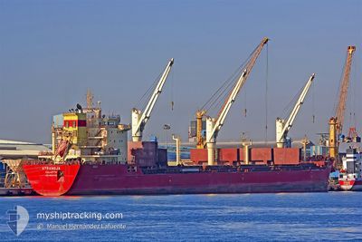
STRANDJA
Bulk Carrier
Current Trip
| Trip Time | 7 days |
|---|---|
| Trip Distance | 1351.23 nm |
| AVG Speed | 10.7 Knots |
| MAX Speed | 13.1 Knots |
| Draught | 9.7 m |
| AVG Wind | 9.4 knots |
| MAX Wind | 20 knots |
| MIN Temp | 17.2°C / 62.96°F |
| MAX Temp | 25.3°C / 77.54°F |
| Position Received | 24 d ago |
Current Position
| Longitude | -73.88214° |
|---|---|
| Latitude | -32.02412° |
| Status | Under way using engine |
| Speed | 11.1 Knots |
| Course | 8.6° |
| Area | South Pacific Ocean |
| Station | T-AIS |
| Position Received | 24 d ago |
Info
Information
The current position of STRANDJA is in South Pacific Ocean with coordinates -32.02412° / -73.88214° as reported on 2024-03-31 22:44 by AIS to our vessel tracker app. The vessel's current speed is 11.1 Knots and is currently inside the port of MEJILLONES.
The vessel STRANDJA (IMO: 9564140, MMSI: 248724000) is a Bulk Carrier that was built in 2010 ( 14 years old ). It's sailing under the flag of [MT] Malta.
In this page you can find informations about the vessels current position, last detected port calls, and current voyage information. If the vessels is not in coverage by AIS you will find the latest position.
The current position of STRANDJA is detected by our AIS receivers and we are not responsible for the reliability of the data. The last position was recorded while the vessel was in Coverage by the Ais receivers of our vessel tracking app.
The current draught of STRANDJA as reported by AIS is 9.7 meters
Weather
| Temperature | 17.7°C / 63.86°F |
|---|---|
| Wind Speed | 17 knots |
| Direction | 198° SSW |
| Pressure | 1014.1 hPa |
| Humidity | 82.4 % |
| Cloud Coverage | 95 % |
Featured Company
Last Port Calls
| Port | Arrival | Departure | Time In Port |
|---|---|---|---|
| 2024-04-22 22:51 | |||
| 2024-04-14 00:52 | 2024-04-15 01:24 | 1 d | |
| 2024-04-12 01:18 | 2024-04-13 01:14 | 23 h | |
| 2024-04-08 19:22 | 2024-04-10 06:00 | 1 d | |
| 2024-04-04 22:54 | 2024-04-06 11:57 | 1 d | |
| 2024-02-01 01:38 | 2024-02-13 02:24 | 12 d |
Most Visited Ports (Last year)
| Port | Arrivals | |
|---|---|---|
| 4 | ||
| 2 | ||
| 2 | ||
| 2 | ||
| 2 | ||
| 2 |
Last Trips
| Origin | Departure | Destination | Arrival | Distance | |
|---|---|---|---|---|---|
| 2024-04-14 20:24 | 2024-04-22 18:51 | 1351.23 nm | |||
| 2024-04-12 20:14 | 2024-04-13 19:52 | 261.21 nm | |||
| 2024-04-10 01:00 | 2024-04-11 20:18 | 268.54 nm | |||
| 2024-04-06 06:57 | 2024-04-08 14:22 | 468.08 nm | |||
| 2024-02-13 05:24 | 2024-04-04 17:54 | 8760.93 nm | |||
| 2024-01-11 15:59 | 2024-02-01 04:38 | 4339.74 nm |
Events
| Time | Event | Details | Position / Dest | Info |
|---|---|---|---|---|
| 2024-04-22 22:51 | PORT ARRIVAL |
|
-23.05167 / -70.38834
[CL] MEJILLONES
|
Speed: 2.1 kn Course: 113° |
| 2024-04-22 22:12 | STOP Moving | 1.74 nm, North of MEJILLONES |
-23.04500 / -70.40500
MATARANI/PERU
|
Speed: Course: -1° |
| 2024-04-22 21:28 | START Moving | 5.06 nm, North of MEJILLONES |
-22.98886 / -70.40181
MATARANI/PERU
|
Speed: 3.2 kn Course: 274° |
| 2024-04-22 20:48 | STOP Moving | 4.8 nm, North of MEJILLONES |
-22.99333 / -70.40166
MATARANI/PERU
|
Speed: Course: -1° |
| 2024-04-22 19:49 | START Moving | 2.48 nm, North of MEJILLONES |
-23.03370 / -70.39941
MATARANI/PERU
|
Speed: 7 kn Course: 359° |
| 2024-04-22 13:51 | STOP Moving | 5.52 nm, North of MEJILLONES |
-22.98167 / -70.39833
MATARANI/PERU
|
Speed: Course: -1° |
| 2024-04-22 11:32 | START Moving | 11.99 nm, North of MEJILLONES |
-22.87513 / -70.37797
MATARANI/PERU
|
Speed: 7.1 kn Course: 205° |
| 2024-04-21 14:09 | STOP Moving | 4.64 nm, North West of MEJILLONES |
-23.00167 / -70.44833
MATARANI/PERU
|
Speed: Course: -1° |
| 2024-04-21 12:52 | START Moving | 10.16 nm, North of MEJILLONES |
-22.90528 / -70.44550
MATARANI/PERU
|
Speed: 5.3 kn Course: 180° |
| 2024-04-20 16:01 | STOP Moving | 5.02 nm, North of MEJILLONES |
-22.99167 / -70.43833
MATARANI/PERU
|
Speed: Course: -1° |