
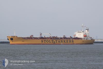
STOLT STRENGTH
Oil/Chemical Tanker
Current Trip
| Time Travelled | 13 days |
|---|---|
| Remaining Time | 30 days |
| Distance Travelled | 4209.43 nm |
| Remaining Distance | 8968.46 nm |
| AVG Speed | 12.5 Knots |
| MAX Speed | 15.1 Knots |
| AVG Wind | 16.5 knots |
| MAX Wind | 24 knots |
| MIN Temp | 19.1°C / 66.38°F |
| MAX Temp | 29.2°C / 84.56°F |
| Draught | 10.9 m |
| Position Received | 6 d ago |
Current Position
| Longitude | -60.80156° |
|---|---|
| Latitude | 14.16612° |
| Status | Under way using engine |
| Speed | 11.3 Knots |
| Course | 119° |
| Area | Caribbean Sea |
| Station | T-AIS |
| Position Received | 6 d ago |
Info
Information
The current position of STOLT STRENGTH is in Caribbean Sea with coordinates 14.16612° / -60.80156° as reported on 2024-04-13 10:04 by AIS to our vessel tracker app. The vessel's current speed is 11.3 Knots and is heading at the port of SINGAPORE. The estimated time of arrival as calculated by MyShipTracking vessel tracking app is 2024-05-20 22:03 LT
The vessel STOLT STRENGTH (IMO: 9311024, MMSI: 636014974) is a Oil/Chemical Tanker that was built in 2005 ( 19 years old ). It's sailing under the flag of [LR] Liberia.
In this page you can find informations about the vessels current position, last detected port calls, and current voyage information. If the vessels is not in coverage by AIS you will find the latest position.
The current position of STOLT STRENGTH is detected by our AIS receivers and we are not responsible for the reliability of the data. The last position was recorded while the vessel was in Coverage by the Ais receivers of our vessel tracking app.
The current draught of STOLT STRENGTH as reported by AIS is 10.9 meters
Weather
| Temperature | 29°C / 84.2°F |
|---|---|
| Wind Speed | 11 knots |
| Direction | 118° ESE |
| Pressure | 1010.9 hPa |
| Humidity | 74.9 % |
| Cloud Coverage | 100 % |
Featured Company
Last Port Calls
| Port | Arrival | Departure | Time In Port |
|---|---|---|---|
| 2024-03-31 18:44 | 2024-04-06 11:18 | 5 d | |
| 2024-03-30 20:38 | 2024-03-31 16:35 | 19 h | |
| 2024-03-28 18:48 | 2024-03-30 09:20 | 1 d | |
| 2024-03-24 02:35 | 2024-03-25 01:35 | 23 h | |
| 2024-03-16 20:35 | 2024-03-21 19:50 | 4 d | |
| 2024-03-11 11:22 | 2024-03-12 10:08 | 22 h |
Most Visited Ports (Last year)
| Port | Arrivals | |
|---|---|---|
| 8 | ||
| 8 | ||
| 5 | ||
| 2 | ||
| 2 | ||
| 2 |
Last Trips
| Origin | Departure | Destination | Arrival | Distance | |
|---|---|---|---|---|---|
| 2024-03-31 11:35 | 2024-03-31 13:44 | 22.31 nm | |||
| 2024-03-30 04:20 | 2024-03-30 15:38 | 12.48 nm | |||
| 2024-03-24 20:35 | 2024-03-28 13:48 | 531.30 nm | |||
| 2024-03-21 14:50 | 2024-03-23 21:35 | 88.73 nm | |||
| 2024-03-12 05:08 | 2024-03-16 15:35 | 445.33 nm | |||
| 2024-01-27 15:00 | 2024-03-11 06:22 | 13075.78 nm |
Events
| Time | Event | Details | Position / Dest | Info |
|---|---|---|---|---|
| 2024-04-13 10:16 | Status Changed | Default Under way using engine |
14.14699 / -60.76798
SG SIN
|
Speed: 11.3 kn Course: 119° |
| 2024-04-13 10:04 | OUT of Coverage |
14.16612 / -60.80156
Caribbean Sea
|
Speed: 11.3 kn Course: 119° |
|
| 2024-04-13 10:04 | Status Changed | Under way using engine Default |
14.16638 / -60.80203
SG SIN
|
Speed: 11.5 kn Course: 121° |
| 2024-04-13 09:52 | Status Changed | Default Under way using engine |
14.18685 / -60.83786
SG SIN
|
Speed: 11.2 kn Course: 119.5° |
| 2024-04-13 09:43 | Status Changed | Under way using engine Default |
14.19869 / -60.85857
SG SIN
|
Speed: 11 kn Course: 120° |
| 2024-04-13 09:39 | Status Changed | Default Under way using engine |
14.20492 / -60.86960
SG SIN
|
Speed: 10.5 kn Course: 120° |
| 2024-04-13 09:00 | Draught Changed | 10.9 10 |
14.25599 / -60.97944
SG SIN
|
Speed: 10.9 kn Course: 113.6° |
| 2024-04-13 09:00 | ETA Changed | 2024/05/19 02:00 |
14.25599 / -60.97944
SG SIN
|
Speed: 10.9 kn Course: 113.6° |
| 2024-04-13 08:50 | Change Sea Area | Saint Lucia part of the Caribbean Sea Guadeloupe and Martinique part of the Caribbean Sea |
14.26863 / -61.00758
Caribbean Sea
|
Speed: 11.2 kn Course: 116° |
| 2024-04-13 08:36 | Draught Changed | 10 10.9 |
14.28764 / -61.04981
SG SIN
|
Speed: 11.4 kn Course: 117° |