
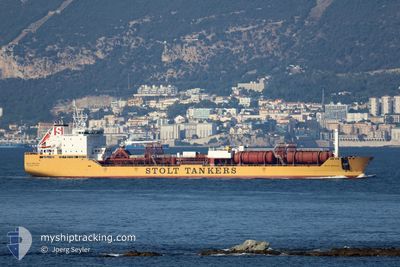
STOLT STREAM
Oil/Chemical Tanker
Current Trip
| Time Travelled | 1 day |
|---|---|
| Remaining Time | --- |
| Distance Travelled | 404.13 nm |
| Remaining Distance | --- |
| AVG Speed | 13.8 Knots |
| MAX Speed | 17.2 Knots |
| AVG Wind | 8.3 knots |
| MAX Wind | 13.8 knots |
| MIN Temp | 17.6°C / 63.68°F |
| MAX Temp | 23.1°C / 73.58°F |
| Draught | 8.5 m |
| Position Received | 6 h, 56 m ago |
Current Position
| Longitude | -94.41138° |
|---|---|
| Latitude | 29.18859° |
| Status | Under way using engine |
| Speed | 13.8 Knots |
| Course | 306.9° |
| Area | Gulf of Mexico |
| Station | T-AIS |
| Position Received | 6 h, 56 m ago |
Info
Information
The current position of STOLT STREAM is in Gulf of Mexico with coordinates 29.18859° / -94.41138° as reported on 2024-04-25 05:51 by AIS to our vessel tracker app. The vessel's current speed is 13.8 Knots
The vessel STOLT STREAM (IMO: 9169940, MMSI: 319469000) is a Oil/Chemical Tanker that was built in 2000 ( 24 years old ). It's sailing under the flag of [KY] Cayman Is.
In this page you can find informations about the vessels current position, last detected port calls, and current voyage information. If the vessels is not in coverage by AIS you will find the latest position.
The current position of STOLT STREAM is detected by our AIS receivers and we are not responsible for the reliability of the data. The last position was recorded while the vessel was in Coverage by the Ais receivers of our vessel tracking app.
The current draught of STOLT STREAM as reported by AIS is 8.5 meters
Weather
| Temperature | 22.5°C / 72.5°F |
|---|---|
| Wind Speed | 12 knots |
| Direction | 141° SE |
| Pressure | 1017.3 hPa |
| Humidity | 90.3 % |
| Cloud Coverage | 54 % |
Featured Company
Last Port Calls
| Port | Arrival | Departure | Time In Port |
|---|---|---|---|
| 2024-04-22 15:46 | 2024-04-24 00:34 | 1 d | |
| 2024-04-17 10:55 | 2024-04-18 13:29 | 1 d | |
| 2024-04-01 02:13 | 2024-04-02 12:41 | 1 d | |
| 2024-03-25 06:03 | 2024-03-25 14:53 | 8 h | |
| 2024-03-09 04:11 | 2024-03-09 13:24 | 9 h | |
| 2024-02-24 15:42 | 2024-02-25 12:08 | 20 h | |
| 2024-02-19 05:24 | 2024-02-20 15:04 | 1 d | |
| 2024-02-18 11:14 | 2024-02-19 03:44 | 16 h | |
| 2024-02-16 08:21 | 2024-02-16 22:23 | 14 h | |
| 2024-02-13 11:38 | 2024-02-14 10:47 | 23 h |
Most Visited Ports (Last year)
| Port | Arrivals | |
|---|---|---|
| 11 | ||
| 10 | ||
| 4 | ||
| 2 | ||
| 2 | ||
| 2 |
Last Trips
| Origin | Departure | Destination | Arrival | Distance | |
|---|---|---|---|---|---|
| 2024-04-18 09:29 | 2024-04-22 10:46 | 1236.04 nm | |||
| 2024-04-02 14:41 | 2024-04-17 06:55 | 4453.11 nm | |||
| 2024-02-25 15:08 | 2024-04-01 04:13 | 3925.44 nm | |||
| 2024-02-25 15:08 | 2024-03-25 08:03 | 2324.51 nm | |||
| 2024-02-25 15:08 | 2024-03-09 06:11 | 904.65 nm | |||
| 2024-02-20 18:04 | 2024-02-24 18:42 | 312.40 nm | |||
| 2024-02-19 06:44 | 2024-02-19 08:24 | 16.21 nm | |||
| 2024-02-17 00:23 | 2024-02-18 14:14 | 415.99 nm | |||
| 2024-02-14 11:47 | 2024-02-16 10:21 | 525.99 nm | |||
| 2024-02-11 00:00 | 2024-02-13 12:38 | 749.96 nm |
Events
| Time | Event | Details | Position / Dest | Info |
|---|---|---|---|---|
| 2024-04-25 06:54 | STOP Moving | 16.56 nm, East of GALVESTON |
29.25615 / -94.48593
HOUSTON
|
Speed: 0.1 kn Course: 139° |
| 2024-04-25 05:58 | Status Changed | Default Under way using engine |
29.20496 / -94.43709
HOUSTON
|
Speed: 13.8 kn Course: 306.9° |
| 2024-04-25 05:51 | OUT of Coverage |
29.18859 / -94.41138
Gulf of Mexico
HOUSTON
|
Speed: 13.8 kn Course: 306.9° |
|
| 2024-04-25 05:12 | Status Changed | Under way using engine Default |
29.10045 / -94.27500
HOUSTON
|
Speed: 13.7 kn Course: 307° |
| 2024-04-25 05:02 | Status Changed | Default Under way using engine |
29.07726 / -94.24043
HOUSTON
|
Speed: 13.9 kn Course: 306.7° |
| 2024-04-25 04:12 | Draught Changed | 8.5 8.4 |
28.96595 / -94.05591
HOUSTON
|
Speed: 13.9 kn Course: 302.2° |
| 2024-04-25 04:12 | ETA Changed | 2024/04/25 07:00 2024/04/25 00:00 |
28.96595 / -94.05591
HOUSTON
|
Speed: 13.9 kn Course: 302.2° |
| 2024-04-25 03:36 | Status Changed | Under way using engine Default |
28.88390 / -93.92636
HOUSTON
|
Speed: 14.2 kn Course: 306° |
| 2024-04-25 03:26 | IN Coverage |
28.88390 / -93.92636
Gulf of Mexico
HOUSTON
|
Speed: 14.3 kn Course: 306.8° |
|
| 2024-04-25 02:19 | OUT of Coverage |
28.70721 / -93.65078
Gulf of Mexico
HOUSTON
|
Speed: 13.8 kn Course: 305.4° |