
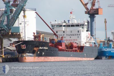
STOLT FULMAR
Oil/Chemical Tanker
Current Trip
| Time Travelled | 2 days |
|---|---|
| Remaining Time | --- |
| Distance Travelled | 533.57 nm |
| Remaining Distance | --- |
| AVG Speed | 10 Knots |
| MAX Speed | 13.9 Knots |
| AVG Wind | 17 knots |
| MAX Wind | 26.8 knots |
| MIN Temp | 13.2°C / 55.76°F |
| MAX Temp | 18.5°C / 65.3°F |
| Draught | 5.5 m |
| Position Received | 2 d ago |
Current Position
| Longitude | -80.60096° |
|---|---|
| Latitude | 31.91709° |
| Status | Under way using engine |
| Speed | 9.5 Knots |
| Course | 114° |
| Area | North Atlantic Ocean |
| Station | T-AIS |
| Position Received | 2 d ago |
Info
Information
The current position of STOLT FULMAR is in North Atlantic Ocean with coordinates 31.91709° / -80.60096° as reported on 2024-04-22 03:44 by AIS to our vessel tracker app. The vessel's current speed is 9.5 Knots and is heading at the port of BAYONNE. The estimated time of arrival as calculated by MyShipTracking vessel tracking app is 2024-05-05 16:00 LT
The vessel STOLT FULMAR (IMO: 9148972, MMSI: 255806426) is a Oil/Chemical Tanker that was built in 2000 ( 24 years old ). It's sailing under the flag of [PT] Portugal.
In this page you can find informations about the vessels current position, last detected port calls, and current voyage information. If the vessels is not in coverage by AIS you will find the latest position.
The current position of STOLT FULMAR is detected by our AIS receivers and we are not responsible for the reliability of the data. The last position was recorded while the vessel was in Coverage by the Ais receivers of our vessel tracking app.
The current draught of STOLT FULMAR as reported by AIS is 5.5 meters
Weather
| Temperature | 16.9°C / 62.42°F |
|---|---|
| Wind Speed | 11 knots |
| Direction | 305° NW |
| Pressure | 1020 hPa |
| Humidity | 58.9 % |
| Cloud Coverage | --- |
Featured Company
Last Port Calls
| Port | Arrival | Departure | Time In Port |
|---|---|---|---|
| 2024-04-21 05:12 | 2024-04-22 01:19 | 20 h | |
| 2024-04-18 01:08 | 2024-04-18 16:40 | 15 h | |
| 2024-04-01 14:46 | 2024-04-03 20:29 | 2 d | |
| 2024-03-25 12:05 | 2024-03-26 21:38 | 1 d | |
| 2024-03-23 04:18 | 2024-03-24 05:35 | 1 d | |
| 2024-03-20 05:34 | 2024-03-21 03:37 | 22 h | |
| 2024-03-17 15:57 | 2024-03-18 14:46 | 22 h | |
| 2024-03-15 21:12 | 2024-03-15 22:40 | 1 h | |
| 2024-03-15 01:06 | 2024-03-15 20:41 | 19 h | |
| 2024-03-07 09:16 | 2024-03-09 08:25 | 1 d |
Last Trips
| Origin | Departure | Destination | Arrival | Distance | |
|---|---|---|---|---|---|
| 2024-04-18 12:40 | 2024-04-21 01:12 | 241.47 nm | |||
| 2024-04-03 21:29 | 2024-04-17 21:08 | 3936.11 nm | |||
| 2024-03-26 22:38 | 2024-04-01 15:46 | 1062.42 nm | |||
| 2024-03-24 06:35 | 2024-03-25 13:05 | 281.86 nm | |||
| 2024-03-21 04:37 | 2024-03-23 05:18 | 492.00 nm | |||
| 2024-03-18 14:46 | 2024-03-20 06:34 | 426.81 nm | |||
| 2024-03-15 23:40 | 2024-03-17 15:57 | 182.08 nm | |||
| 2024-03-15 21:41 | 2024-03-15 22:12 | 2.00 nm | |||
| 2024-03-09 08:25 | 2024-03-15 02:06 | 722.78 nm | |||
| 2024-03-04 19:32 | 2024-03-07 09:16 | 702.73 nm |
Events
| Time | Event | Details | Position / Dest | Info |
|---|---|---|---|---|
| 2024-04-22 03:46 | Status Changed | Default Under way using engine |
31.91333 / -80.59167
FRBAY
|
Speed: 9.5 kn Course: 114° |
| 2024-04-22 03:44 | OUT of Coverage |
31.91709 / -80.60096
North Atlantic Ocean
FRBAY
|
Speed: 9.5 kn Course: 114° |
|
| 2024-04-22 01:19 | PORT DEPARTURE |
|
32.08000 / -81.05176
FRBAY
|
Speed: 10.7 kn Course: 94° |
| 2024-04-22 00:28 | START Moving |
32.11646 / -81.12877
[US] SAVANNAH
|
Speed: 3.1 kn Course: 137° |
|
| 2024-04-21 23:28 | Status Changed | Under way using engine Moored |
32.11745 / -81.13128
[US] SAVANNAH
|
Speed: Course: 147° |
| 2024-04-21 22:52 | Draught Changed | 5.5 5.1 |
32.11747 / -81.13128
[US] SAVANNAH
|
Speed: Course: 147° |
| 2024-04-21 22:52 | ETA Changed | 2024/05/05 16:00 2024/05/05 14:00 |
32.11747 / -81.13128
[US] SAVANNAH
|
Speed: Course: 147° |
| 2024-04-21 22:46 | Destination Changed | FRBAY USSAV |
32.11746 / -81.13126
[US] SAVANNAH
|
Speed: Course: 147° |
| 2024-04-21 22:35 | ETA Changed | 2024/05/05 14:00 2024/04/19 14:00 |
32.11747 / -81.13128
[US] SAVANNAH
|
Speed: Course: 147° |
| 2024-04-21 06:34 | Status Changed | Moored Under way using engine |
32.11745 / -81.13129
[US] SAVANNAH
|
Speed: Course: 148° |