
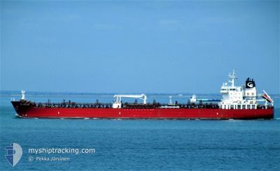
STI POPLAR
Tanker
Current Trip
| Time Travelled | 9 h, 53 mins |
|---|---|
| Remaining Time | 21 h, 1 mins |
| Distance Travelled | 114.37 nm |
| Remaining Distance | 251.04 nm |
| AVG Speed | 10.1 Knots |
| MAX Speed | 12.7 Knots |
| AVG Wind | 7.9 knots |
| MAX Wind | 11.5 knots |
| MIN Temp | 6.4°C / 43.52°F |
| MAX Temp | 7.7°C / 45.86°F |
| Draught | 11.1 m |
| Position Received | Now |
Current Position
| Longitude | 8.28912° |
|---|---|
| Latitude | 57.43978° |
| Status | Under way using engine |
| Speed | 11.8 Knots |
| Course | 236° |
| Area | Skaggerak |
| Station | T-AIS |
| Position Received | Now |
Info
Information
The current position of STI POPLAR is in Skaggerak with coordinates 57.43978° / 8.28912° as reported on 2024-04-17 22:19 by AIS to our vessel tracker app. The vessel's current speed is 11.8 Knots and is heading at the port of WILHELMSHAVEN. The estimated time of arrival as calculated by MyShipTracking vessel tracking app is 2024-04-18 19:20 LT
The vessel STI POPLAR (IMO: 9696589, MMSI: 538005408) is a Tanker It's sailing under the flag of [MH] Marshall Is.
In this page you can find informations about the vessels current position, last detected port calls, and current voyage information. If the vessels is not in coverage by AIS you will find the latest position.
The current position of STI POPLAR is detected by our AIS receivers and we are not responsible for the reliability of the data. The last position was recorded while the vessel was in Coverage by the Ais receivers of our vessel tracking app.
The current draught of STI POPLAR as reported by AIS is 11.1 meters
Weather
| Temperature | 6.4°C / 43.52°F |
|---|---|
| Wind Speed | 10 knots |
| Direction | 333° NNW |
| Pressure | 1012.9 hPa |
| Humidity | 84.1 % |
| Cloud Coverage | 71 % |
Featured Company
Last Port Calls
| Port | Arrival | Departure | Time In Port |
|---|---|---|---|
| 2024-04-16 11:07 | 2024-04-17 12:26 | 1 d | |
| 2024-04-10 16:58 | 2024-04-13 06:59 | 2 d | |
| 2024-04-08 18:04 | 2024-04-09 13:30 | 19 h | |
| 2024-04-05 05:42 | 2024-04-06 14:55 | 1 d | |
| 2024-04-01 15:06 | 2024-04-03 03:07 | 1 d | |
| 2024-03-26 06:59 | 2024-03-27 17:42 | 1 d | |
| 2024-03-22 18:38 | 2024-03-24 07:53 | 1 d | |
| 2024-03-18 09:42 | 2024-03-19 22:20 | 1 d | |
| 2024-03-14 19:48 | 2024-03-15 16:58 | 21 h | |
| 2024-03-09 17:56 | 2024-03-11 11:26 | 1 d |
Most Visited Ports (Last year)
| Port | Arrivals | |
|---|---|---|
| 9 | ||
| 5 | ||
| 4 | ||
| 4 | ||
| 3 | ||
| 3 |
Last Trips
| Origin | Departure | Destination | Arrival | Distance | |
|---|---|---|---|---|---|
| 2024-04-13 08:59 | 2024-04-16 13:07 | 341.63 nm | |||
| 2024-04-09 15:30 | 2024-04-10 18:58 | 312.77 nm | |||
| 2024-04-06 16:55 | 2024-04-08 20:04 | 462.20 nm | |||
| 2024-04-03 05:07 | 2024-04-05 07:42 | 588.80 nm | |||
| 2024-03-27 18:42 | 2024-04-01 17:06 | 471.51 nm | |||
| 2024-03-24 08:53 | 2024-03-26 07:59 | 578.86 nm | |||
| 2024-03-19 23:20 | 2024-03-22 19:38 | 467.79 nm | |||
| 2024-03-15 17:58 | 2024-03-18 10:42 | 581.93 nm | |||
| 2024-03-11 13:26 | 2024-03-14 20:48 | 776.87 nm | |||
| 2024-02-29 03:50 | 2024-03-09 19:56 | 2446.97 nm |
Events
| Time | Event | Details | Position / Dest | Info |
|---|---|---|---|---|
| 2024-04-17 15:20 | Change Sea Area | Danish part of the Skaggerak Swedish part of the Skaggerak |
58.09703 / 10.58715
Skaggerak
DEWVN
|
Speed: 12.4 kn Course: 243.9° |
| 2024-04-17 13:45 | ETA Changed | 2024/04/18 18:00 2024/04/18 16:00 |
58.23734 / 11.13921
DEWVN
|
Speed: 11.8 kn Course: 245° |
| 2024-04-17 12:46 | Draught Changed | 11.1 6.9 |
58.33265 / 11.38469
DEWVN
|
Speed: 8 kn Course: 224.2° |
| 2024-04-17 12:46 | Destination Changed | DEWVN SEBRO |
58.33265 / 11.38469
DEWVN
|
Speed: 8 kn Course: 224.2° |
| 2024-04-17 12:46 | ETA Changed | 2024/04/18 16:00 2024/04/15 12:00 |
58.33265 / 11.38469
DEWVN
|
Speed: 8 kn Course: 224.2° |
| 2024-04-17 12:26 | PORT DEPARTURE |
|
58.35727 / 11.42638
SEBRO
|
Speed: 3.8 kn Course: 284° |
| 2024-04-17 12:24 | START Moving |
58.35623 / 11.42969
[SE] BROFJORDEN
|
Speed: 3.1 kn Course: 300° |
|
| 2024-04-17 12:22 | Status Changed | Under way using engine Default |
58.35535 / 11.43223
[SE] BROFJORDEN
|
Speed: Course: 297° |
| 2024-04-17 12:14 | IN Coverage |
58.35558 / 11.43165
Skaggerak
[SE] BROFJORDEN
|
Speed: 2.1 kn Course: 305° |
|
| 2024-04-17 05:38 | OUT of Coverage |
58.35466 / 11.43316
Skaggerak
[SE] BROFJORDEN
|
Speed: Course: 126.4° |