
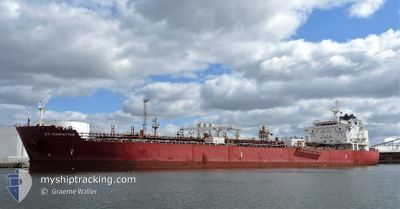
STI MANHATTAN
Tanker
Current Trip
| Time Travelled | 5 days |
|---|---|
| Remaining Time | --- |
| Distance Travelled | 1504.69 nm |
| Remaining Distance | 2112.62 nm |
| AVG Speed | 11.3 Knots |
| MAX Speed | 14 Knots |
| AVG Wind | 7.3 knots |
| MAX Wind | 15 knots |
| MIN Temp | 25.7°C / 78.26°F |
| MAX Temp | 30.1°C / 86.18°F |
| Draught | 12.1 m |
| Position Received | 5 d ago |
Current Position
| Longitude | 103.51131° |
|---|---|
| Latitude | 1.22512° |
| Status | Under way using engine |
| Speed | 9.1 Knots |
| Course | 281.9° |
| Area | Singapore Strait |
| Station | T-AIS |
| Position Received | 5 d ago |
Info
Information
The current position of STI MANHATTAN is in Singapore Strait with coordinates 1.22512° / 103.51131° as reported on 2024-04-19 13:38 by AIS to our vessel tracker app. The vessel's current speed is 9.1 Knots and is heading at the port of REUNION. The estimated time of arrival as calculated by MyShipTracking vessel tracking app is 2024-05-01 07:00 LT
The vessel STI MANHATTAN (IMO: 9707261, MMSI: 538005415) is a Tanker It's sailing under the flag of [MH] Marshall Is.
In this page you can find informations about the vessels current position, last detected port calls, and current voyage information. If the vessels is not in coverage by AIS you will find the latest position.
The current position of STI MANHATTAN is detected by our AIS receivers and we are not responsible for the reliability of the data. The last position was recorded while the vessel was in Coverage by the Ais receivers of our vessel tracking app.
The current draught of STI MANHATTAN as reported by AIS is 12.1 meters
Weather
| Temperature | 28.9°C / 84.02°F |
|---|---|
| Wind Speed | 3 knots |
| Direction | 129° SE |
| Pressure | 1005.9 hPa |
| Humidity | 72.4 % |
| Cloud Coverage | 100 % |
Featured Company
Last Port Calls
| Port | Arrival | Departure | Time In Port |
|---|---|---|---|
| 2024-04-18 13:07 | 2024-04-19 11:36 | 22 h | |
| 2024-04-15 18:08 | 2024-04-18 12:14 | 2 d | |
| 2024-03-28 12:22 | 2024-03-29 15:20 | 1 d | |
| 2024-03-24 22:27 | 2024-03-26 11:57 | 1 d | |
| 2024-03-14 17:10 | 2024-03-15 21:35 | 1 d |
Most Visited Ports (Last year)
| Port | Arrivals | |
|---|---|---|
| 3 | ||
| 2 | ||
| 2 | ||
| 2 | ||
| 2 | ||
| 1 |
Last Trips
| Origin | Departure | Destination | Arrival | Distance | |
|---|---|---|---|---|---|
| 2024-04-18 20:14 | 2024-04-18 21:07 | 3.82 nm | |||
| 2024-03-30 02:20 | 2024-04-16 02:08 | 4604.53 nm | |||
| 2024-03-26 21:57 | 2024-03-28 23:22 | 565.20 nm | |||
| 2024-03-16 07:35 | 2024-03-25 08:27 | 1509.52 nm | |||
| 2024-01-29 09:54 | 2024-03-15 03:10 | 10524.10 nm |
Events
| Time | Event | Details | Position / Dest | Info |
|---|---|---|---|---|
| 2024-04-19 13:38 | OUT of Coverage |
1.22512 / 103.51131
Singapore Strait
LA REUNION, FRANCE
|
Speed: 9.1 kn Course: 281.9° |
|
| 2024-04-19 13:05 | Change Sea Area | Malaysian part of the Singapore Strait Indonesian part of the Singapore Strait |
1.20691 / 103.59463
Singapore Strait
LA REUNION, FRANCE
|
Speed: 9.5 kn Course: 280.4° |
| 2024-04-19 12:46 | Change Sea Area | Indonesian part of the Singapore Strait Singaporean part of the Singapore Strait |
1.19840 / 103.64106
Singapore Strait
LA REUNION, FRANCE
|
Speed: 9.4 kn Course: 259.8° |
| 2024-04-19 11:50 | START Moving | 2.44 nm, North of BUKOM ISLAND |
1.27635 / 103.74386
LA REUNION, FRANCE
|
Speed: 3.1 kn Course: 154° |
| 2024-04-19 11:36 | PORT DEPARTURE |
|
1.27815 / 103.74174
LA REUNION, FRANCE
|
Speed: 1.1 kn Course: 278° |
| 2024-04-19 11:31 | Draught Changed | 12.1 12.3 |
1.27737 / 103.74078
[SG] JURONG ISLAND
|
Speed: 0.6 kn Course: 313° |
| 2024-04-19 11:31 | Destination Changed | LA REUNION, FRANCE SINGAPORE PEBGC |
1.27737 / 103.74078
[SG] JURONG ISLAND
|
Speed: 0.6 kn Course: 313° |
| 2024-04-19 11:31 | ETA Changed | 2024/05/01 07:00 2024/04/18 21:30 |
1.27737 / 103.74078
[SG] JURONG ISLAND
|
Speed: 0.6 kn Course: 313° |
| 2024-04-19 11:26 | IN Coverage |
1.27709 / 103.74051
Singapore Strait
[SG] JURONG ISLAND
|
Speed: 0.5 kn Course: 42.9° |
|
| 2024-04-19 09:41 | OUT of Coverage |
1.27693 / 103.74042
Singapore Strait
[SG] JURONG ISLAND
|
Speed: Course: 165.7° |