
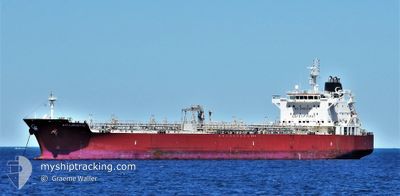
GEM TURQUOISE
Tanker
Current Trip
| Time Travelled | 28 days |
|---|---|
| Remaining Time | 2 days |
| Distance Travelled | 5528.50 nm |
| Remaining Distance | 678.64 nm |
| AVG Speed | 12.2 Knots |
| MAX Speed | 18.2 Knots |
| AVG Wind | 8.2 knots |
| MAX Wind | 25.7 knots |
| MIN Temp | 6.9°C / 44.42°F |
| MAX Temp | 30.6°C / 87.08°F |
| Draught | 8.2 m |
| Position Received | 3 h, 12 m ago |
Current Position
| Longitude | 104.41477° |
|---|---|
| Latitude | 1.35082° |
| Status | Under way using engine |
| Speed | 12.6 Knots |
| Course | 49.2° |
| Area | South China Sea |
| Station | T-AIS |
| Position Received | 3 h, 12 m ago |
Info
Information
The current position of GEM TURQUOISE is in South China Sea with coordinates 1.35082° / 104.41477° as reported on 2024-04-25 05:25 by AIS to our vessel tracker app. The vessel's current speed is 12.6 Knots and is heading at the port of MUARA. The estimated time of arrival as calculated by MyShipTracking vessel tracking app is 2024-04-27 12:01 LT
The vessel GEM TURQUOISE (IMO: 9645774, MMSI: 538005119) is a Tanker It's sailing under the flag of [MH] Marshall Is.
In this page you can find informations about the vessels current position, last detected port calls, and current voyage information. If the vessels is not in coverage by AIS you will find the latest position.
The current position of GEM TURQUOISE is detected by our AIS receivers and we are not responsible for the reliability of the data. The last position was recorded while the vessel was in Coverage by the Ais receivers of our vessel tracking app.
The current draught of GEM TURQUOISE as reported by AIS is 8.2 meters
Weather
| Temperature | 29.9°C / 85.82°F |
|---|---|
| Wind Speed | 4 knots |
| Direction | 58° ENE |
| Pressure | 1005.2 hPa |
| Humidity | 71.9 % |
| Cloud Coverage | 18 % |
Featured Company
Last Port Calls
| Port | Arrival | Departure | Time In Port |
|---|---|---|---|
| 2024-03-26 19:52 | 2024-03-27 22:52 | 1 d | |
| 2024-03-20 15:39 | 2024-03-21 05:27 | 13 h | |
| 2024-03-17 21:52 | 2024-03-19 01:51 | 1 d | |
| 2024-03-15 17:50 | 2024-03-16 20:16 | 1 d | |
| 2024-02-21 01:31 | 2024-02-22 00:19 | 22 h | |
| 2024-02-17 21:54 | 2024-02-19 01:04 | 1 d | |
| 2024-02-03 02:25 | 2024-02-04 09:37 | 1 d |
Most Visited Ports (Last year)
| Port | Arrivals | |
|---|---|---|
| 2 | ||
| 2 | ||
| 2 | ||
| 1 | ||
| 1 | ||
| 1 |
Last Trips
| Origin | Departure | Destination | Arrival | Distance | |
|---|---|---|---|---|---|
| 2024-03-21 18:27 | 2024-03-27 08:52 | 534.68 nm | |||
| 2024-03-19 14:51 | 2024-03-21 04:39 | 468.33 nm | |||
| 2024-03-17 09:16 | 2024-03-18 10:52 | 284.23 nm | |||
| 2024-02-22 09:19 | 2024-03-16 06:50 | 5113.31 nm | |||
| 2024-02-19 10:04 | 2024-02-21 10:31 | 532.76 nm | |||
| 2024-02-04 19:07 | 2024-02-18 06:54 | 3594.46 nm | |||
| 2024-01-29 18:51 | 2024-02-03 11:55 | 1370.94 nm |
Events
| Time | Event | Details | Position / Dest | Info |
|---|---|---|---|---|
| 2024-04-25 05:32 | Status Changed | Default Under way using engine |
1.36880 / 104.43518
BN MUA
|
Speed: 12.6 kn Course: 49.2° |
| 2024-04-25 05:25 | Detected in Sea | Malaysian part of the South China Sea |
1.35082 / 104.41477
South China Sea
BN MUA
|
Speed: 12.6 kn Course: 49.2° |
| 2024-04-25 05:25 | Status Changed | Under way using engine Default |
1.35082 / 104.41477
BN MUA
|
Speed: 12.4 kn Course: 48° |
| 2024-04-25 05:25 | OUT of Coverage |
1.35082 / 104.41477
South China Sea
BN MUA
|
Speed: 12.6 kn Course: 49.2° |
|
| 2024-04-25 04:36 | Status Changed | Default Under way using engine |
1.26887 / 104.27440
BN MUA
|
Speed: 12.1 kn Course: 83.7° |
| 2024-04-25 04:26 | Status Changed | Under way using engine Default |
1.26541 / 104.23980
BN MUA
|
Speed: 12.2 kn Course: 84° |
| 2024-04-25 04:24 | Status Changed | Default Under way using engine |
1.26483 / 104.23419
BN MUA
|
Speed: 12.4 kn Course: 81° |
| 2024-04-25 04:05 | Detected in Sea | Malaysian part of the Singapore Strait |
1.25724 / 104.16704
Singapore Strait
BN MUA
|
Speed: 12.7 kn Course: 83.6° |
| 2024-04-25 00:20 | Change Sea Area | Indonesian part of the Singapore Strait Malaysian part of the Singapore Strait |
1.13919 / 103.54032
Singapore Strait
BN MUA
|
Speed: 11.1 kn Course: 169.1° |
| 2024-04-25 00:05 | Change Sea Area | Malaysian part of the Singapore Strait Indonesian part of the Singapore Strait |
1.17221 / 103.56197
Singapore Strait
BN MUA
|
Speed: 13.3 kn Course: 254.4° |