
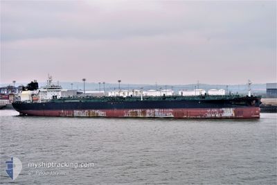
STI GALLANTRY
Tanker
Current Trip
| Time Travelled | --- |
|---|---|
| Remaining Time | --- |
| Distance Travelled | 6103.41 nm |
| Remaining Distance | --- |
| AVG Speed | 12.4 Knots |
| MAX Speed | 15.2 Knots |
| AVG Wind | 8.4 knots |
| MAX Wind | 20 knots |
| MIN Temp | 20.1°C / 68.18°F |
| MAX Temp | 33.3°C / 91.94°F |
| Draught | 14.8 m |
| Position Received | 4 d ago |
Current Position
| Longitude | 17.90647° |
|---|---|
| Latitude | -34.36870° |
| Status | Under way using engine |
| Speed | 11.9 Knots |
| Course | 317.5° |
| Area | South Atlantic Ocean |
| Station | T-AIS |
| Position Received | 4 d ago |
Info
Information
The current position of STI GALLANTRY is in South Atlantic Ocean with coordinates -34.36870° / 17.90647° as reported on 2024-04-18 09:47 by AIS to our vessel tracker app. The vessel's current speed is 11.9 Knots and is heading at the port of ROTTERDAM. The estimated time of arrival as calculated by MyShipTracking vessel tracking app is 2024-05-09 02:00 LT
The vessel STI GALLANTRY (IMO: 9712876, MMSI: 538005820) is a Tanker It's sailing under the flag of [MH] Marshall Is.
In this page you can find informations about the vessels current position, last detected port calls, and current voyage information. If the vessels is not in coverage by AIS you will find the latest position.
The current position of STI GALLANTRY is detected by our AIS receivers and we are not responsible for the reliability of the data. The last position was recorded while the vessel was in Coverage by the Ais receivers of our vessel tracking app.
The current draught of STI GALLANTRY as reported by AIS is 14.8 meters
Weather
| Temperature | 23.8°C / 74.84°F |
|---|---|
| Wind Speed | 19 knots |
| Direction | 142° SE |
| Pressure | 1014.2 hPa |
| Humidity | 83.4 % |
| Cloud Coverage | 7 % |
Featured Company
Last Port Calls
Most Visited Ports (Last year)
| Port | Arrivals | |
|---|---|---|
| 13 | ||
| 3 | ||
| 2 | ||
| 1 | ||
| 1 |
Last Trips
| Origin | Departure | Destination | Arrival | Distance |
|---|
Events
| Time | Event | Details | Position / Dest | Info |
|---|---|---|---|---|
| 2024-04-18 10:25 | Status Changed | Default Under way using engine |
-34.27172 / 17.80404
NLRTM FOR ORDERS
|
Speed: 11.9 kn Course: 317.5° |
| 2024-04-18 09:47 | OUT of Coverage |
-34.36870 / 17.90647
South Atlantic Ocean
NLRTM FOR ORDERS
|
Speed: 11.9 kn Course: 317.5° |
|
| 2024-04-18 09:45 | Status Changed | Under way using engine Default |
-34.37421 / 17.91317
NLRTM FOR ORDERS
|
Speed: 12.1 kn Course: 320° |
| 2024-04-18 09:29 | Status Changed | Default Under way using engine |
-34.41227 / 17.95966
NLRTM FOR ORDERS
|
Speed: 13.2 kn Course: 309.6° |
| 2024-04-18 09:06 | Status Changed | Under way using engine Default |
-34.46827 / 18.03090
NLRTM FOR ORDERS
|
Speed: 13.8 kn Course: 309° |
| 2024-04-18 09:03 | Status Changed | Default Under way using engine |
-34.47448 / 18.04035
NLRTM FOR ORDERS
|
Speed: 13.8 kn Course: 310.9° |
| 2024-04-18 08:38 | Status Changed | Under way using engine Default |
-34.54459 / 18.11680
NLRTM FOR ORDERS
|
Speed: 13.6 kn Course: 318° |
| 2024-04-18 08:24 | Status Changed | Default Under way using engine |
-34.58582 / 18.15936
NLRTM FOR ORDERS
|
Speed: 13.6 kn Course: 318.9° |
| 2024-04-18 08:14 | Status Changed | Under way using engine Default |
-34.61157 / 18.18708
NLRTM FOR ORDERS
|
Speed: 13.5 kn Course: 313° |
| 2024-04-18 07:32 | Status Changed | Default Under way using engine |
-34.72430 / 18.32796
NLRTM FOR ORDERS
|
Speed: 13.6 kn Course: 314.1° |