
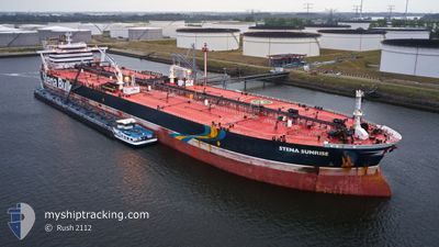
STENA SUNRISE
Crude Oil Tanker
Current Trip
EGSKT
| Time Travelled | 16 days |
|---|---|
| Remaining Time | --- |
| Distance Travelled | 3440.46 nm |
| Remaining Distance | --- |
| AVG Speed | 12 Knots |
| MAX Speed | 14.5 Knots |
| AVG Wind | 9.5 knots |
| MAX Wind | 30 knots |
| MIN Temp | 12.5°C / 54.5°F |
| MAX Temp | 23.8°C / 74.84°F |
| Draught | 9 m |
| Position Received | 5 h, 5 m ago |
Current Position
| Longitude | 25.57390° |
|---|---|
| Latitude | 33.09919° |
| Status | Under way using engine |
| Speed | 12.7 Knots |
| Course | 298.7° |
| Area | Mediterranean Sea - Eastern Basin |
| Station | T-AIS |
| Position Received | 5 h, 5 m ago |
Info
Information
The current position of STENA SUNRISE is in Mediterranean Sea - Eastern Basin with coordinates 33.09919° / 25.57390° as reported on 2024-04-19 19:17 by AIS to our vessel tracker app. The vessel's current speed is 12.7 Knots
The vessel STENA SUNRISE (IMO: 9592214, MMSI: 310654000) is a Crude Oil Tanker that was built in 2013 ( 11 years old ). It's sailing under the flag of [BM] Bermuda.
In this page you can find informations about the vessels current position, last detected port calls, and current voyage information. If the vessels is not in coverage by AIS you will find the latest position.
The current position of STENA SUNRISE is detected by our AIS receivers and we are not responsible for the reliability of the data. The last position was recorded while the vessel was in Coverage by the Ais receivers of our vessel tracking app.
The current draught of STENA SUNRISE as reported by AIS is 9 meters
Weather
| Temperature | 16.7°C / 62.06°F |
|---|---|
| Wind Speed | 26 knots |
| Direction | 285° WNW |
| Pressure | 1010.1 hPa |
| Humidity | 75.1 % |
| Cloud Coverage | 75 % |
Featured Company
Last Trips
| Origin | Departure | Destination | Arrival | Distance | |
|---|---|---|---|---|---|
| 2024-01-28 20:32 | 2024-04-01 09:45 | 8636.35 nm |
Events
| Time | Event | Details | Position / Dest | Info |
|---|---|---|---|---|
| 2024-04-19 19:24 | Status Changed | Default Under way using engine |
33.11077 / 25.54845
EGSKT
|
Speed: 12.7 kn Course: 298.7° |
| 2024-04-19 19:17 | OUT of Coverage |
33.09919 / 25.57390
Mediterranean Sea - Eastern Basin
|
Speed: 12.7 kn Course: 298.7° |
|
| 2024-04-19 17:14 | Change Sea Area | Libyan part of the Mediterranean Sea - Eastern Basin Egyptian part of the Mediterranean Sea - Eastern Basin |
32.88430 / 26.00712
Mediterranean Sea - Eastern Basin
|
Speed: 12.5 kn Course: 299.7° |
| 2024-04-19 14:20 | Detected in Sea | Egyptian part of the Mediterranean Sea - Eastern Basin |
32.58479 / 26.62738
Mediterranean Sea - Eastern Basin
|
Speed: 11.9 kn Course: 300.1° |
| 2024-04-19 14:17 | IN Coverage |
32.58479 / 26.62738
Mediterranean Sea - Eastern Basin
|
Speed: 11.9 kn Course: 300.1° |
|
| 2024-04-16 20:38 | Status Changed | Default Under way using engine |
34.16614 / 21.93151
EGSKT
|
Speed: 13.1 kn Course: 103.3° |
| 2024-04-16 20:36 | OUT of Coverage |
34.16782 / 21.92293
Mediterranean Sea - Eastern Basin
EGSKT
|
Speed: 13.1 kn Course: 103.3° |
|
| 2024-04-16 20:34 | Status Changed | Under way using engine Default |
34.16923 / 21.91582
EGSKT
|
Speed: 13.2 kn Course: 103° |
| 2024-04-16 20:15 | IN Coverage |
34.16923 / 21.91582
Mediterranean Sea - Eastern Basin
EGSKT
|
Speed: 13.1 kn Course: 103.5° |
|
| 2024-04-16 18:09 | OUT of Coverage |
34.28028 / 21.28746
Mediterranean Sea - Eastern Basin
EGSKT
|
Speed: 13.2 kn Course: 102.1° |