
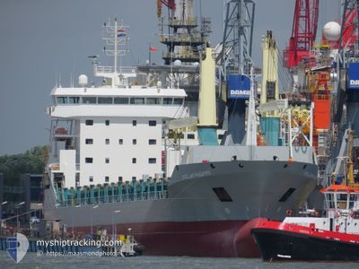
STELLAR MAESTRO
General Cargo
Current Trip
| Time Travelled | 29 days |
|---|---|
| Remaining Time | --- |
| Distance Travelled | 7535.58 nm |
| Remaining Distance | --- |
| AVG Speed | 12.1 Knots |
| MAX Speed | 15 Knots |
| AVG Wind | 13.8 knots |
| MAX Wind | 26 knots |
| MIN Temp | 18.2°C / 64.76°F |
| MAX Temp | 29.3°C / 84.74°F |
| Draught | 7 m |
| Position Received | 2 m ago |
Current Position
| Longitude | -97.79817° |
|---|---|
| Latitude | 22.44517° |
| Status | At anchor |
| Speed | 0.1 Knots |
| Course | 149° |
| Area | Gulf of Mexico |
| Station | T-AIS |
| Position Received | 2 m ago |
Info
Information
The current position of STELLAR MAESTRO is in Gulf of Mexico with coordinates 22.44517° / -97.79817° as reported on 2024-04-18 06:40 by AIS to our vessel tracker app. The vessel's current speed is 0.1 Knots
The vessel STELLAR MAESTRO (IMO: 9549566, MMSI: 305869000) is a General Cargo that was built in 2012 ( 12 years old ). It's sailing under the flag of [AG] Antigua Barbuda.
In this page you can find informations about the vessels current position, last detected port calls, and current voyage information. If the vessels is not in coverage by AIS you will find the latest position.
The current position of STELLAR MAESTRO is detected by our AIS receivers and we are not responsible for the reliability of the data. The last position was recorded while the vessel was in Coverage by the Ais receivers of our vessel tracking app.
The current draught of STELLAR MAESTRO as reported by AIS is 7 meters
Weather
| Temperature | 24.9°C / 76.82°F |
|---|---|
| Wind Speed | 8 knots |
| Direction | 104° ESE |
| Pressure | 1012 hPa |
| Humidity | 93.1 % |
| Cloud Coverage | 59 % |
Featured Company
Most Visited Ports (Last year)
| Port | Arrivals | |
|---|---|---|
| 4 | ||
| 3 | ||
| 3 | ||
| 2 | ||
| 2 | ||
| 2 |
Events
| Time | Event | Details | Position / Dest | Info |
|---|---|---|---|---|
| 2024-04-17 08:54 | Status Changed | At anchor Default |
22.44439 / -97.79807
MX ATM
|
Speed: Course: -1° |
| 2024-04-17 08:49 | Status Changed | Default At anchor |
22.44333 / -97.79667
MX ATM
|
Speed: 0.1 kn Course: 111° |
| 2024-04-17 07:54 | Status Changed | At anchor Default |
22.44455 / -97.79794
MX ATM
|
Speed: Course: -1° |
| 2024-04-17 07:49 | Status Changed | Default At anchor |
22.44333 / -97.79667
MX ATM
|
Speed: 0.2 kn Course: 142° |
| 2024-04-16 11:45 | Status Changed | At anchor Default |
22.44453 / -97.79623
MX ATM
|
Speed: Course: -1° |
| 2024-04-16 11:40 | Status Changed | Default At anchor |
22.44333 / -97.79500
MX ATM
|
Speed: 0.4 kn Course: 156° |
| 2024-04-13 23:42 | STOP Moving | 5.37 nm, South East of ALTAMIRA |
22.44461 / -97.79663
MX ATM
|
Speed: 0.2 kn Course: 138° |
| 2024-04-13 23:29 | Status Changed | At anchor Under way using engine |
22.44370 / -97.79345
MX ATM
|
Speed: 1.2 kn Course: 212° |
| 2024-04-13 21:59 | ETA Changed | 2024/04/14 00:00 2024/04/14 14:00 |
22.48485 / -97.51032
MX ATM
|
Speed: 12.6 kn Course: 270.7° |
| 2024-04-13 21:44 | Change Sea Area | Mexican part of the Gulf of Mexico High seas of the South Atlantic Ocean |
22.48419 / -97.45195
Gulf of Mexico
MX ATM
|
Speed: 12.6 kn Course: 270° |