
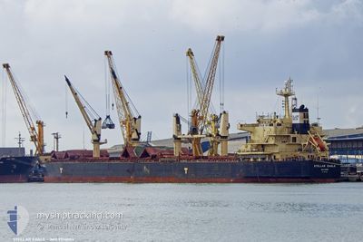
STELLAR EAGLE
Bulk Carrier
Current Position
| Longitude | 140.70298° |
|---|---|
| Latitude | 35.43300° |
| Status | At anchor |
| Speed | |
| Course | 174° |
| Area | North Pacific Ocean |
| Station | T-AIS |
| Position Received | 1 m ago |
Info
Information
The current position of STELLAR EAGLE is in North Pacific Ocean with coordinates 35.43300° / 140.70298° as reported on 2024-04-25 10:22 by AIS to our vessel tracker app. The vessel's current speed is 0 Knots and is heading at the port of ONAHAMA. The estimated time of arrival as calculated by MyShipTracking vessel tracking app is 2024-04-26 16:39 LT
The vessel STELLAR EAGLE (IMO: 9514004, MMSI: 538003521) is a Bulk Carrier that was built in 2009 ( 15 years old ). It's sailing under the flag of [MH] Marshall Is.
In this page you can find informations about the vessels current position, last detected port calls, and current voyage information. If the vessels is not in coverage by AIS you will find the latest position.
The current position of STELLAR EAGLE is detected by our AIS receivers and we are not responsible for the reliability of the data. The last position was recorded while the vessel was in Coverage by the Ais receivers of our vessel tracking app.
The current draught of STELLAR EAGLE as reported by AIS is 12.2 meters
Weather
| Temperature | 19.1°C / 66.38°F |
|---|---|
| Wind Speed | 11 knots |
| Direction | 78° ENE |
| Pressure | 1007.6 hPa |
| Humidity | 86.3 % |
| Cloud Coverage | 26 % |
Featured Company
Last Port Calls
| Port | Arrival | Departure | Time In Port |
|---|---|---|---|
| 2024-03-13 20:48 | |||
| 2024-03-09 20:55 | 2024-03-12 15:37 | 2 d |
Most Visited Ports (Last year)
| Port | Arrivals | |
|---|---|---|
| 7 | ||
| 3 | ||
| 2 | ||
| 2 | ||
| 2 | ||
| 1 |
Last Trips
| Origin | Departure | Destination | Arrival | Distance | |
|---|---|---|---|---|---|
| 2024-03-12 12:37 | 2024-03-13 17:48 | 216.84 nm | |||
| 2024-01-28 11:59 | 2024-03-09 17:55 | 6554.61 nm |
Events
| Time | Event | Details | Position / Dest | Info |
|---|---|---|---|---|
| 2024-04-25 06:58 | STOP Moving | 17.36 nm, South of INUWAKA |
35.43268 / 140.70207
JP ONA
|
Speed: 0.2 kn Course: 145° |
| 2024-04-25 06:49 | ETA Changed | 2024/04/24 01:00 2024/04/23 06:00 |
35.43225 / 140.70195
JP ONA
|
Speed: 0.7 kn Course: 164° |
| 2024-04-25 06:43 | Draught Changed | 12.2 12.4 |
35.43158 / 140.70312
JP ONA
|
Speed: 0.6 kn Course: 179° |
| 2024-04-25 06:43 | Status Changed | At anchor Under way using engine |
35.43158 / 140.70312
JP ONA
|
Speed: 0.5 kn Course: 179° |
| 2024-04-25 03:07 | Status Changed | Under way using engine Default |
35.46552 / 141.14028
JP ONA
|
Speed: 6.3 kn Course: 266° |
| 2024-04-25 02:52 | Status Changed | Default Under way using engine |
35.46752 / 141.17096
JP ONA
|
Speed: 6.4 kn Course: 264° |
| 2024-04-25 02:46 | Status Changed | Under way using engine Default |
35.46803 / 141.18512
JP ONA
|
Speed: 6.2 kn Course: 263° |
| 2024-04-25 02:33 | Status Changed | Default Under way using engine |
35.46973 / 141.21422
JP ONA
|
Speed: 6.2 kn Course: 265° |
| 2024-04-25 02:24 | Status Changed | Under way using engine Default |
35.47095 / 141.23290
JP ONA
|
Speed: 6.3 kn Course: 263° |
| 2024-04-25 01:52 | Status Changed | Default Under way using engine |
35.47422 / 141.30321
JP ONA
|
Speed: 7 kn Course: 265° |