
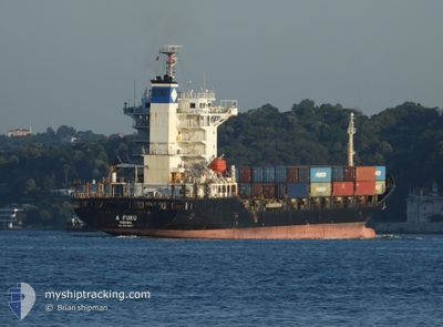
FESCO EKATERINA
Container Ship
Current Trip
| Time Travelled | 15 days |
|---|---|
| Remaining Time | 16 h, 24 mins |
| Distance Travelled | 4101.94 nm |
| Remaining Distance | 214.44 nm |
| AVG Speed | 11.3 Knots |
| MAX Speed | 18.7 Knots |
| AVG Wind | 10.6 knots |
| MAX Wind | 29.9 knots |
| MIN Temp | 11°C / 51.8°F |
| MAX Temp | 28.5°C / 83.3°F |
| Draught | 8 m |
| Position Received | 16 h, 25 m ago |
Current Position
| Longitude | 29.67560° |
|---|---|
| Latitude | 41.37968° |
| Status | At anchor |
| Speed | 13.3 Knots |
| Course | 71° |
| Area | Black Sea |
| Station | T-AIS |
| Position Received | 16 h, 25 m ago |
Info
Information
The current position of FESCO EKATERINA is in Black Sea with coordinates 41.37968° / 29.67560° as reported on 2024-04-19 06:32 by AIS to our vessel tracker app. The vessel's current speed is 13.3 Knots and is heading at the port of NOVOROSSIYSK. The estimated time of arrival as calculated by MyShipTracking vessel tracking app is 2024-04-20 15:21 LT
The vessel FESCO EKATERINA (IMO: 9343687, MMSI: 352297000) is a Container Ship that was built in 2007 ( 17 years old ). It's sailing under the flag of [PA] Panama.
In this page you can find informations about the vessels current position, last detected port calls, and current voyage information. If the vessels is not in coverage by AIS you will find the latest position.
The current position of FESCO EKATERINA is detected by our AIS receivers and we are not responsible for the reliability of the data. The last position was recorded while the vessel was in Coverage by the Ais receivers of our vessel tracking app.
The current draught of FESCO EKATERINA as reported by AIS is 8 meters
Weather
| Temperature | 12.6°C / 54.68°F |
|---|---|
| Wind Speed | 15 knots |
| Direction | 91° E |
| Pressure | 1011.4 hPa |
| Humidity | 84.8 % |
| Cloud Coverage | 98 % |
Featured Company
Last Port Calls
| Port | Arrival | Departure | Time In Port |
|---|---|---|---|
| 2024-04-15 03:40 | 2024-04-15 13:26 | 9 h | |
| 2024-04-03 15:54 | 2024-04-04 01:06 | 9 h | |
| 2024-04-01 05:57 | 2024-04-01 17:57 | 11 h | |
| 2024-03-21 02:40 | 2024-03-21 11:11 | 8 h | |
| 2024-03-15 07:21 | |||
| 2024-03-09 15:05 | 2024-03-12 01:47 | 2 d | |
| 2024-03-04 08:55 | 2024-03-04 18:06 | 9 h | |
| 2024-02-22 12:43 | 2024-02-22 23:49 | 11 h | |
| 2024-02-18 00:39 | 2024-02-18 11:47 | 11 h | |
| 2024-02-08 03:50 | 2024-02-08 12:21 | 8 h |
Most Visited Ports (Last year)
| Port | Arrivals | |
|---|---|---|
| 23 | ||
| 22 | ||
| 21 | ||
| 7 | ||
| 5 | ||
| 4 |
Last Trips
| Origin | Departure | Destination | Arrival | Distance | |
|---|---|---|---|---|---|
| 2024-04-04 06:36 | 2024-04-15 05:40 | 2915.91 nm | |||
| 2024-04-01 23:27 | 2024-04-03 21:24 | 431.67 nm | |||
| 2024-03-15 10:21 | 2024-04-01 11:27 | 4389.77 nm | |||
| 2024-03-15 10:21 | 2024-03-21 04:40 | 1287.69 nm | |||
| 2024-02-23 05:19 | 2024-03-09 18:05 | 4301.11 nm | |||
| 2024-02-23 05:19 | 2024-03-04 10:55 | 2899.31 nm | |||
| 2024-02-18 17:17 | 2024-02-22 18:13 | 420.77 nm | |||
| 2024-02-02 12:06 | 2024-02-18 06:09 | 4421.27 nm | |||
| 2024-02-02 12:06 | 2024-02-08 05:50 | 1327.49 nm |
Events
| Time | Event | Details | Position / Dest | Info |
|---|---|---|---|---|
| 2024-04-19 06:32 | OUT of Coverage |
41.37968 / 29.67560
Black Sea
RUNVS
|
Speed: 13.3 kn Course: 71° |
|
| 2024-04-19 04:34 | Change Sea Area | Turkish part of the Black Sea Turkish part of the Sea of Marmara |
41.23545 / 29.15335
Black Sea
RUNVS
|
Speed: 12.8 kn Course: 45° |
| 2024-04-19 01:22 | START Moving | 10.32 nm, South of YESILKOY |
40.78458 / 28.85412
RUNVS
|
Speed: 3.3 kn Course: 356° |
| 2024-04-19 01:14 | STOP Moving | 10.49 nm, South of YESILKOY |
40.78162 / 28.85275
RUNVS
|
Speed: 0.2 kn Course: 56° |
| 2024-04-18 21:38 | START Moving | 11.07 nm, South of YESILKOY |
40.77168 / 28.84927
RUNVS
|
Speed: 3.3 kn Course: 90° |
| 2024-04-18 18:18 | STOP Moving | 8.66 nm, South of YESILKOY |
40.81862 / 28.88675
RUNVS
|
Speed: 0.1 kn Course: 60° |
| 2024-04-18 13:59 | START Moving | 9.4 nm, South of YESILKOY |
40.80153 / 28.86463
RUNVS
|
Speed: 3.4 kn Course: 44° |
| 2024-04-18 10:20 | STOP Moving | 7.42 nm, South East of YESILKOY |
40.84595 / 28.90178
RUNVS
|
Speed: 0.3 kn Course: 19° |
| 2024-04-18 09:37 | START Moving | 9.83 nm, South of YESILKOY |
40.79652 / 28.87905
RUNVS
|
Speed: 3.3 kn Course: 2° |
| 2024-04-18 05:24 | STOP Moving | 8.07 nm, South East of YESILKOY |
40.83410 / 28.90248
RUNVS
|
Speed: 0.3 kn Course: 174° |