
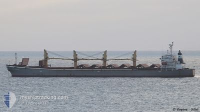
BR VICTORY
Bulk Carrier
Current Trip
| Time Travelled | 5 days |
|---|---|
| Remaining Time | --- |
| Distance Travelled | 718.30 nm |
| Remaining Distance | --- |
| AVG Speed | 9.4 Knots |
| MAX Speed | 11.8 Knots |
| AVG Wind | 7.8 knots |
| MAX Wind | 24.7 knots |
| MIN Temp | 13.4°C / 56.12°F |
| MAX Temp | 24.3°C / 75.74°F |
| Draught | 12 m |
| Position Received | 5 h, 22 m ago |
Current Position
| Longitude | 25.71656° |
|---|---|
| Latitude | 39.19138° |
| Status | Under way using engine |
| Speed | 9.4 Knots |
| Course | 189.8° |
| Area | Aegean Sea |
| Station | T-AIS |
| Position Received | 5 h, 22 m ago |
Info
Information
The current position of BR VICTORY is in Aegean Sea with coordinates 39.19138° / 25.71656° as reported on 2024-04-17 22:58 by AIS to our vessel tracker app. The vessel's current speed is 9.4 Knots and is heading at the port of ABU QIR. The estimated time of arrival as calculated by MyShipTracking vessel tracking app is 2024-04-20 06:00 LT
The vessel BR VICTORY (IMO: 9145956, MMSI: 356370000) is a Bulk Carrier that was built in 1996 ( 28 years old ). It's sailing under the flag of [PA] Panama.
In this page you can find informations about the vessels current position, last detected port calls, and current voyage information. If the vessels is not in coverage by AIS you will find the latest position.
The current position of BR VICTORY is detected by our AIS receivers and we are not responsible for the reliability of the data. The last position was recorded while the vessel was in Coverage by the Ais receivers of our vessel tracking app.
The current draught of BR VICTORY as reported by AIS is 12 meters
Weather
| Temperature | 17.5°C / 63.5°F |
|---|---|
| Wind Speed | 6 knots |
| Direction | 190° S |
| Pressure | 1002.3 hPa |
| Humidity | 88.5 % |
| Cloud Coverage | --- |
Featured Company
Last Port Calls
| Port | Arrival | Departure | Time In Port |
|---|---|---|---|
| 2024-04-12 14:11 | |||
| 2024-04-12 14:11 | |||
| 2024-04-12 12:24 | |||
| 2024-02-13 00:42 | 2024-02-13 18:23 | 17 h |
Most Visited Ports (Last year)
| Port | Arrivals | |
|---|---|---|
| 4 | ||
| 3 | ||
| 2 | ||
| 2 | ||
| 2 | ||
| 2 |
Last Trips
| Origin | Departure | Destination | Arrival | Distance | |
|---|---|---|---|---|---|
| 2024-04-12 17:11 | 2024-04-12 17:11 | --- | |||
| 2024-01-12 10:52 | 2024-02-13 02:42 | 7632.73 nm |
Events
| Time | Event | Details | Position / Dest | Info |
|---|---|---|---|---|
| 2024-04-17 22:59 | Status Changed | Default Under way using engine |
39.18922 / 25.71608
EGAKI
|
Speed: 9.4 kn Course: 189.8° |
| 2024-04-17 22:58 | OUT of Coverage |
39.19138 / 25.71656
Aegean Sea
EGAKI
|
Speed: 9.4 kn Course: 189.8° |
|
| 2024-04-17 20:02 | Detected in Sea | Greek part of the Aegean Sea |
39.65608 / 25.82287
Aegean Sea
EGAKI
|
Speed: 9.9 kn Course: 188.7° |
| 2024-04-17 20:02 | Status Changed | Under way using engine Default |
39.65608 / 25.82287
EGAKI
|
Speed: 9.7 kn Course: 184° |
| 2024-04-17 20:02 | IN Coverage |
39.65608 / 25.82287
Aegean Sea
EGAKI
|
Speed: 9.9 kn Course: 188.7° |
|
| 2024-04-17 16:35 | Status Changed | Default Under way using engine |
40.03484 / 26.21777
EGAKI
|
Speed: 9.6 kn Course: 219.1° |
| 2024-04-17 15:45 | OUT of Coverage |
40.12643 / 26.36488
Sea of Marmara
EGAKI
|
Speed: 9.6 kn Course: 219.1° |
|
| 2024-04-17 14:56 | Status Changed | Under way using engine Default |
40.22140 / 26.43526
EGAKI
|
Speed: 9.8 kn Course: 228° |
| 2024-04-17 14:56 | IN Coverage |
40.21877 / 26.42897
Sea of Marmara
EGAKI
|
Speed: 9.8 kn Course: 244.7° |
|
| 2024-04-17 12:06 | START Moving | 5.74 nm, North East of CARDAK |
40.42650 / 26.82047
EGAKI
|
Speed: 3.4 kn Course: 292° |