
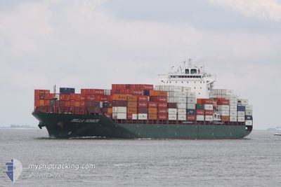
SPYROS V
Container Ship
Current Trip
VNQNH
| Time Travelled | 5 days |
|---|---|
| Remaining Time | --- |
| Distance Travelled | 1956.39 nm |
| Remaining Distance | --- |
| AVG Speed | 13.4 Knots |
| MAX Speed | 20 Knots |
| AVG Wind | 9.2 knots |
| MAX Wind | 17.8 knots |
| MIN Temp | 12.9°C / 55.22°F |
| MAX Temp | 16.9°C / 62.42°F |
| Draught | 8.5 m |
| Position Received | 5 d ago |
Current Position
| Longitude | -123.65982° |
|---|---|
| Latitude | 34.51278° |
| Status | Under way using engine |
| Speed | 13.9 Knots |
| Course | 266.9° |
| Area | North Pacific Ocean |
| Station | T-AIS |
| Position Received | 5 d ago |
Info
Information
The current position of SPYROS V is in North Pacific Ocean with coordinates 34.51278° / -123.65982° as reported on 2024-04-18 09:13 by AIS to our vessel tracker app. The vessel's current speed is 13.9 Knots
The vessel SPYROS V (IMO: 9453365, MMSI: 538007681) is a Container Ship that was built in 2011 ( 13 years old ). It's sailing under the flag of [MH] Marshall Is.
In this page you can find informations about the vessels current position, last detected port calls, and current voyage information. If the vessels is not in coverage by AIS you will find the latest position.
The current position of SPYROS V is detected by our AIS receivers and we are not responsible for the reliability of the data. The last position was recorded while the vessel was in Coverage by the Ais receivers of our vessel tracking app.
The current draught of SPYROS V as reported by AIS is 8.5 meters
Weather
| Temperature | 16.2°C / 61.16°F |
|---|---|
| Wind Speed | 6 knots |
| Direction | 251° WSW |
| Pressure | 1026.9 hPa |
| Humidity | 83.4 % |
| Cloud Coverage | 100 % |
Featured Company
Last Port Calls
| Port | Arrival | Departure | Time In Port |
|---|---|---|---|
| 2024-04-15 21:40 | 2024-04-17 11:38 | 1 d | |
| 2024-04-01 03:28 | 2024-04-01 22:49 | 19 h | |
| 2024-03-29 00:21 | 2024-03-29 17:53 | 17 h | |
| 2024-02-19 18:05 | 2024-02-20 05:13 | 11 h | |
| 2024-02-17 15:59 | 2024-02-18 18:23 | 1 d | |
| 2024-02-15 09:21 | 2024-02-15 21:47 | 12 h | |
| 2024-02-13 09:00 | 2024-02-14 07:10 | 22 h | |
| 2024-02-07 17:30 | 2024-02-08 07:49 | 14 h |
Most Visited Ports (Last year)
| Port | Arrivals | |
|---|---|---|
| 7 | ||
| 6 | ||
| 6 | ||
| 6 | ||
| 4 | ||
| 4 |
Last Trips
| Origin | Departure | Destination | Arrival | Distance | |
|---|---|---|---|---|---|
| 2024-04-02 06:49 | 2024-04-15 14:40 | 6512.39 nm | |||
| 2024-03-30 00:53 | 2024-04-01 11:28 | 555.80 nm | |||
| 2024-02-20 00:13 | 2024-03-29 07:21 | 13554.63 nm | |||
| 2024-02-18 13:23 | 2024-02-19 13:05 | 306.14 nm | |||
| 2024-02-15 16:47 | 2024-02-17 10:59 | 295.90 nm | |||
| 2024-02-14 02:10 | 2024-02-15 04:21 | 200.56 nm | |||
| 2024-02-08 02:49 | 2024-02-13 04:00 | 1776.81 nm | |||
| 2024-01-14 15:31 | 2024-02-07 12:30 | 9387.16 nm |
Events
| Time | Event | Details | Position / Dest | Info |
|---|---|---|---|---|
| 2024-04-18 09:47 | Status Changed | Default Under way using engine |
34.50891 / -123.81808
VNQNH
|
Speed: 13.9 kn Course: 266.9° |
| 2024-04-18 09:13 | OUT of Coverage |
34.51278 / -123.65982
North Pacific Ocean
VNQNH
|
Speed: 13.9 kn Course: 266.9° |
|
| 2024-04-18 09:02 | IN Coverage |
34.51276 / -123.60847
North Pacific Ocean
VNQNH
|
Speed: 13.8 kn Course: 273.3° |
|
| 2024-04-17 14:33 | Status Changed | Default Under way using engine |
33.82087 / -118.74075
VNQNH
|
Speed: 12 kn Course: 299.7° |
| 2024-04-17 14:12 | OUT of Coverage |
33.78675 / -118.66969
North Pacific Ocean
VNQNH
|
Speed: 12 kn Course: 299.7° |
|
| 2024-04-17 13:36 | Status Changed | Under way using engine Default |
33.72656 / -118.54191
VNQNH
|
Speed: 11.6 kn Course: 298° |
| 2024-04-17 13:18 | IN Coverage |
33.72656 / -118.54191
North Pacific Ocean
VNQNH
|
Speed: 11.9 kn Course: 298.7° |
|
| 2024-04-17 12:09 | Status Changed | Default Under way using engine |
33.64167 / -118.22667
VNQNH
|
Speed: 11.6 kn Course: 227.2° |
| 2024-04-17 12:04 | OUT of Coverage |
33.65037 / -118.21087
North Pacific Ocean
VNQNH
|
Speed: 11.6 kn Course: 227.2° |
|
| 2024-04-17 11:38 | PORT DEPARTURE |
|
33.71862 / -118.18522
VNQNH
|
Speed: 6.4 kn Course: 195° |