
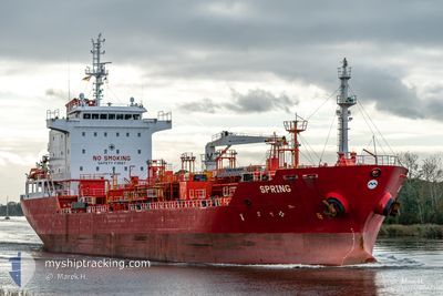
SPRING
Oil/Chemical Tanker
Current Trip
| Time Travelled | 6 days |
|---|---|
| Remaining Time | --- |
| Distance Travelled | 708.71 nm |
| Remaining Distance | --- |
| AVG Speed | 10.2 Knots |
| MAX Speed | 12.7 Knots |
| AVG Wind | 12.1 knots |
| MAX Wind | 21.6 knots |
| MIN Temp | 10.5°C / 50.9°F |
| MAX Temp | 22°C / 71.6°F |
| Draught | 6.2 m |
| Position Received | 3 m ago |
Current Position
| Longitude | 23.54172° |
|---|---|
| Latitude | 37.89157° |
| Status | At anchor |
| Speed | 0.1 Knots |
| Course | 285° |
| Area | Aegean Sea |
| Station | T-AIS |
| Position Received | 3 m ago |
Info
Information
The current position of SPRING is in Aegean Sea with coordinates 37.89157° / 23.54172° as reported on 2024-04-20 04:17 by AIS to our vessel tracker app. The vessel's current speed is 0.1 Knots
The vessel SPRING (IMO: 9416812, MMSI: 538003325) is a Oil/Chemical Tanker that was built in 2009 ( 15 years old ). It's sailing under the flag of [MH] Marshall Is.
In this page you can find informations about the vessels current position, last detected port calls, and current voyage information. If the vessels is not in coverage by AIS you will find the latest position.
The current position of SPRING is detected by our AIS receivers and we are not responsible for the reliability of the data. The last position was recorded while the vessel was in Coverage by the Ais receivers of our vessel tracking app.
The current draught of SPRING as reported by AIS is 6.2 meters
Weather
| Temperature | 10.4°C / 50.72°F |
|---|---|
| Wind Speed | 18 knots |
| Direction | 285° WNW |
| Pressure | 1001.8 hPa |
| Humidity | 80.3 % |
| Cloud Coverage | 54 % |
Featured Company
Last Port Calls
| Port | Arrival | Departure | Time In Port |
|---|---|---|---|
| 2024-04-12 09:00 | 2024-04-13 08:55 | 23 h | |
| 2024-04-05 08:45 | 2024-04-05 08:47 | 2 m | |
| 2024-03-28 21:26 | 2024-03-29 12:25 | 14 h | |
| 2024-03-26 14:13 | 2024-03-27 19:41 | 1 d | |
| 2024-03-21 14:10 | 2024-03-22 15:19 | 1 d | |
| 2024-03-14 11:30 | 2024-03-16 02:53 | 1 d | |
| 2024-03-11 08:06 | 2024-03-13 21:26 | 2 d | |
| 2024-03-09 12:54 | 2024-03-10 16:30 | 1 d | |
| 2024-03-06 09:57 | 2024-03-07 22:46 | 1 d | |
| 2024-03-01 17:28 | 2024-03-03 10:49 | 1 d |
Last Trips
| Origin | Departure | Destination | Arrival | Distance | |
|---|---|---|---|---|---|
| 2024-04-05 10:47 | 2024-04-12 11:00 | 8.95 nm | |||
| 2024-03-29 13:25 | 2024-04-05 10:45 | 953.23 nm | |||
| 2024-03-27 20:41 | 2024-03-28 22:26 | 9.62 nm | |||
| 2024-03-22 16:19 | 2024-03-26 15:13 | 836.27 nm | |||
| 2024-03-16 03:53 | 2024-03-21 15:10 | 1385.33 nm | |||
| 2024-03-13 22:26 | 2024-03-14 12:30 | 149.24 nm | |||
| 2024-03-10 17:30 | 2024-03-11 09:06 | 151.60 nm | |||
| 2024-03-07 22:46 | 2024-03-09 13:54 | 397.91 nm | |||
| 2024-03-03 11:49 | 2024-03-06 09:57 | 492.79 nm | |||
| 2024-02-29 14:47 | 2024-03-01 18:28 | 125.76 nm |
Events
| Time | Event | Details | Position / Dest | Info |
|---|---|---|---|---|
| 2024-04-17 02:19 | STOP Moving | 2.64 nm, East of PERANI |
37.89052 / 23.53866
GRPIR
|
Speed: 0.3 kn Course: 19° |
| 2024-04-17 02:06 | Status Changed | At anchor Under way using engine |
37.89189 / 23.54031
GRPIR
|
Speed: 1.2 kn Course: 338° |
| 2024-04-16 15:20 | Status Changed | Under way using engine Default |
36.28152 / 23.39695
GRPIR
|
Speed: 11.8 kn Course: 31° |
| 2024-04-16 15:05 | Status Changed | Default Under way using engine |
36.23980 / 23.36477
GRPIR
|
Speed: 11.9 kn Course: 31.5° |
| 2024-04-16 14:28 | Status Changed | Under way using engine Default |
36.13360 / 23.28066
GRPIR
|
Speed: 12 kn Course: 32° |
| 2024-04-16 14:17 | Status Changed | Default Under way using engine |
36.10349 / 23.25656
GRPIR
|
Speed: 12 kn Course: 34.8° |
| 2024-04-16 13:47 | Change Sea Area | Greek part of the Aegean Sea Greek part of the Mediterranean Sea - Eastern Basin |
36.01936 / 23.18372
Aegean Sea
GRPIR
|
Speed: 12.1 kn Course: 40.8° |
| 2024-04-16 13:03 | ETA Changed | 2024/04/17 06:00 2024/04/17 04:00 |
36.00725 / 23.00484
GRPIR
|
Speed: 11.9 kn Course: 88.3° |
| 2024-04-16 12:32 | Status Changed | Under way using engine Default |
36.00183 / 22.87689
GRPIR
|
Speed: 12.3 kn Course: 86° |
| 2024-04-16 11:46 | Status Changed | Default Under way using engine |
35.99711 / 22.68077
GRPIR
|
Speed: 12.1 kn Course: 89.9° |