
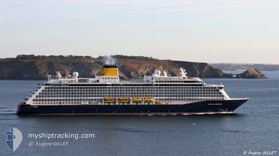
SPIRIT OF ADVENTURE
Not available
Current Trip
| Trip Time | 2 days |
|---|---|
| Trip Distance | 1001.88 nm |
| AVG Speed | 15.3 Knots |
| MAX Speed | 20 Knots |
| Draught | 7.3 m |
| AVG Wind | 11.2 knots |
| MAX Wind | 18.8 knots |
| MIN Temp | 12.2°C / 53.96°F |
| MAX Temp | 17.1°C / 62.78°F |
| Position Received | 7 h, 4 m ago |
Current Position
| Longitude | 14.52164° |
|---|---|
| Latitude | 35.89981° |
| Status | Under way using engine |
| Speed | 7.3 Knots |
| Course | 218° |
| Area | Mediterranean Sea - Eastern Basin |
| Station | T-AIS |
| Position Received | 7 h, 4 m ago |
Info
Information
The current position of SPIRIT OF ADVENTURE is in Mediterranean Sea - Eastern Basin with coordinates 35.89981° / 14.52164° as reported on 2024-04-24 05:33 by AIS to our vessel tracker app. The vessel's current speed is 7.3 Knots and is currently inside the port of VALLETTA.
The vessel SPIRIT OF ADVENTURE (IMO: 9818084, MMSI: 232026551) is a Not available It's sailing under the flag of [GB] United Kingdom.
In this page you can find informations about the vessels current position, last detected port calls, and current voyage information. If the vessels is not in coverage by AIS you will find the latest position.
The current position of SPIRIT OF ADVENTURE is detected by our AIS receivers and we are not responsible for the reliability of the data. The last position was recorded while the vessel was in Coverage by the Ais receivers of our vessel tracking app.
The current draught of SPIRIT OF ADVENTURE as reported by AIS is 7.3 meters
Weather
| Temperature | 14.6°C / 58.28°F |
|---|---|
| Wind Speed | 9 knots |
| Direction | 318° NW |
| Pressure | 1012 hPa |
| Humidity | 78.8 % |
| Cloud Coverage | 65 % |
Featured Company
Last Port Calls
| Port | Arrival | Departure | Time In Port |
|---|---|---|---|
| 2024-04-24 05:32 | |||
| 2024-04-21 05:29 | 2024-04-21 15:53 | 10 h | |
| 2024-04-17 05:43 | 2024-04-17 16:36 | 10 h | |
| 2024-04-08 21:35 | 2024-04-09 16:15 | 18 h | |
| 2024-04-05 09:03 | 2024-04-05 16:19 | 7 h | |
| 2024-04-03 05:35 | 2024-04-03 19:30 | 13 h | |
| 2024-03-31 05:19 | 2024-03-31 15:46 | 10 h | |
| 2024-03-28 07:25 | 2024-03-28 17:10 | 9 h | |
| 2024-03-25 15:12 | 2024-03-27 16:49 | 2 d | |
| 2024-03-21 20:49 | 2024-03-23 06:17 | 1 d |
Last Trips
| Origin | Departure | Destination | Arrival | Distance | |
|---|---|---|---|---|---|
| 2024-04-21 17:53 | 2024-04-24 07:32 | 1001.88 nm | |||
| 2024-04-17 17:36 | 2024-04-21 07:29 | 1233.61 nm | |||
| 2024-04-09 17:15 | 2024-04-17 06:43 | 2137.34 nm | |||
| 2024-04-05 18:19 | 2024-04-08 22:35 | 1067.44 nm | |||
| 2024-04-03 20:30 | 2024-04-05 11:03 | 576.99 nm | |||
| 2024-03-31 17:46 | 2024-04-03 06:35 | 830.36 nm | |||
| 2024-03-28 18:10 | 2024-03-31 07:19 | 804.61 nm | |||
| 2024-03-27 17:49 | 2024-03-28 08:25 | 161.61 nm | |||
| 2024-03-23 07:17 | 2024-03-25 16:12 | 866.28 nm | |||
| 2024-03-19 17:30 | 2024-03-21 21:49 | 773.27 nm |
Events
| Time | Event | Details | Position / Dest | Info |
|---|---|---|---|---|
| 2024-04-24 05:48 | STOP Moving |
35.88833 / 14.51134
[MT] VALLETTA
|
Speed: Course: 67° |
|
| 2024-04-24 05:41 | Status Changed | Default Under way using engine |
35.89006 / 14.51123
[MT] VALLETTA
|
Speed: 7.3 kn Course: 218° |
| 2024-04-24 05:33 | OUT of Coverage |
35.89981 / 14.52164
Mediterranean Sea - Eastern Basin
[MT] VALLETTA
|
Speed: 7.3 kn Course: 220.2° |
|
| 2024-04-24 05:32 | PORT ARRIVAL |
|
35.90139 / 14.52481
[MT] VALLETTA
|
Speed: 8.9 kn Course: 261° |
| 2024-04-24 02:24 | Change Sea Area | Maltese part of the Mediterranean Sea - Eastern Basin Algerian part of the Mediterranean Sea - Western Basin |
36.31564 / 13.90704
Mediterranean Sea - Eastern Basin
GI GIB>MT MLA
|
Speed: 15.6 kn Course: 115.7° |
| 2024-04-24 02:23 | Status Changed | Under way using engine Default |
36.31785 / 13.90123
GI GIB>MT MLA
|
Speed: 15.7 kn Course: 116° |
| 2024-04-24 02:12 | IN Coverage |
36.31564 / 13.90704
Mediterranean Sea - Eastern Basin
GI GIB>MT MLA
|
Speed: 15.6 kn Course: 115.7° |
|
| 2024-04-22 08:27 | Status Changed | Default Under way using engine |
36.79117 / .51593
GI GIB>MT MLA
|
Speed: 16.2 kn Course: 80.8° |
| 2024-04-22 08:04 | OUT of Coverage |
36.77260 / .37598
Mediterranean Sea - Western Basin
GI GIB>MT MLA
|
Speed: 16.2 kn Course: 80.8° |
|
| 2024-04-22 07:24 | Status Changed | Under way using engine Default |
36.74068 / .13383
GI GIB>MT MLA
|
Speed: 16.3 kn Course: 82° |