
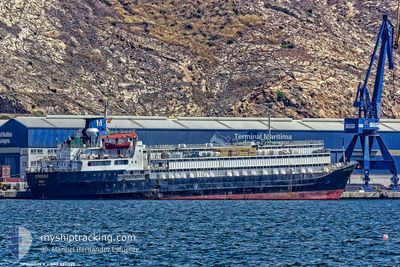
SPIRIDON II
General Cargo
Current Trip
| Time Travelled | 17 days |
|---|---|
| Remaining Time | --- |
| Distance Travelled | 4166.72 nm |
| Remaining Distance | --- |
| AVG Speed | 9.3 Knots |
| MAX Speed | 13.9 Knots |
| AVG Wind | 16.4 knots |
| MAX Wind | 32 knots |
| MIN Temp | 15.5°C / 59.9°F |
| MAX Temp | 28.4°C / 83.12°F |
| Draught | 7.2 m |
| Position Received | 1 d ago |
Current Position
| Longitude | 0.35192° |
|---|---|
| Latitude | 36.65667° |
| Status | Under way using engine |
| Speed | 10.4 Knots |
| Course | 82.2° |
| Area | Mediterranean Sea - Western Basin |
| Station | T-AIS |
| Position Received | 1 d ago |
Info
Information
The current position of SPIRIDON II is in Mediterranean Sea - Western Basin with coordinates 36.65667° / 0.35192° as reported on 2024-04-14 12:40 by AIS to our vessel tracker app. The vessel's current speed is 10.4 Knots and is heading at the port of TASUCU. The estimated time of arrival as calculated by MyShipTracking vessel tracking app is 2024-04-21 15:00 LT
The vessel SPIRIDON II (IMO: 7311329, MMSI: 671114100) is a General Cargo that was built in 1973 ( 51 years old ). It's sailing under the flag of [TG] Togo.
In this page you can find informations about the vessels current position, last detected port calls, and current voyage information. If the vessels is not in coverage by AIS you will find the latest position.
The current position of SPIRIDON II is detected by our AIS receivers and we are not responsible for the reliability of the data. The last position was recorded while the vessel was in Coverage by the Ais receivers of our vessel tracking app.
The current draught of SPIRIDON II as reported by AIS is 7.2 meters
Weather
| Temperature | 16.7°C / 62.06°F |
|---|---|
| Wind Speed | 8 knots |
| Direction | 1° N |
| Pressure | 1009.8 hPa |
| Humidity | 87.6 % |
| Cloud Coverage | 79 % |
Featured Company
Last Port Calls
| Port | Arrival | Departure | Time In Port |
|---|---|---|---|
| 2024-03-26 14:35 | 2024-03-29 13:38 | 2 d | |
| 2024-02-17 08:13 | 2024-02-22 16:20 | 5 d | |
| 2024-02-16 19:24 | |||
| 2024-02-13 17:25 |
Most Visited Ports (Last year)
| Port | Arrivals | |
|---|---|---|
| 5 | ||
| 4 | ||
| 2 | ||
| 2 | ||
| 2 | ||
| 2 |
Last Trips
| Origin | Departure | Destination | Arrival | Distance | |
|---|---|---|---|---|---|
| 2024-02-22 18:20 | 2024-03-26 11:35 | 5703.28 nm | |||
| 2024-02-16 21:24 | 2024-02-17 10:13 | 109.92 nm |
Events
| Time | Event | Details | Position / Dest | Info |
|---|---|---|---|---|
| 2024-04-14 12:58 | Status Changed | Default Under way using engine |
36.66604 / .44030
TRTAS
|
Speed: 10.4 kn Course: 82.2° |
| 2024-04-14 12:40 | Status Changed | Under way using engine Default |
36.65667 / .35192
TRTAS
|
Speed: 10.3 kn Course: 82° |
| 2024-04-14 12:40 | OUT of Coverage |
36.65667 / .35192
Mediterranean Sea - Western Basin
TRTAS
|
Speed: 10.4 kn Course: 82.2° |
|
| 2024-04-14 12:33 | Status Changed | Default Under way using engine |
36.65660 / .35126
TRTAS
|
Speed: 10.4 kn Course: 84.3° |
| 2024-04-14 06:39 | Detected in Sea | Algerian part of the Mediterranean Sea - Western Basin |
36.51577 / -.98621
Mediterranean Sea - Western Basin
TRTAS
|
Speed: 10.3 kn Course: 82.5° |
| 2024-04-14 06:39 | Status Changed | Under way using engine Default |
36.51577 / -.98621
TRTAS
|
Speed: 10.3 kn Course: 86° |
| 2024-04-14 06:15 | Status Changed | Default Under way using engine |
36.51000 / -1.06057
TRTAS
|
Speed: 10.9 kn Course: 81.3° |
| 2024-04-14 04:29 | Status Changed | Under way using engine Default |
36.46050 / -1.46821
TRTAS
|
Speed: 12.1 kn Course: 80° |
| 2024-04-14 04:17 | Status Changed | Default Under way using engine |
36.45611 / -1.50234
TRTAS
|
Speed: 12.3 kn Course: 81.5° |
| 2024-04-14 04:00 | Status Changed | Under way using engine Default |
36.44273 / -1.60717
TRTAS
|
Speed: 12.3 kn Course: 80° |