
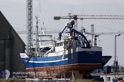
SPARKLING S
Fishing Vessel
Current Trip
| Trip Time | --- |
|---|---|
| Trip Distance | --- |
| AVG Speed | --- |
| MAX Speed | --- |
| Draught | --- |
| AVG Wind | --- |
| MAX Wind | --- |
| MIN Temp | --- |
| MAX Temp | --- |
| Position Received | 10 m ago |
Current Position
| Longitude | -9.90937° |
|---|---|
| Latitude | 51.65043° |
| Status | Under way using engine |
| Speed | |
| Course | 72° |
| Area | North Atlantic Ocean |
| Station | T-AIS |
| Position Received | 10 m ago |
Info
Information
The current position of SPARKLING S is in North Atlantic Ocean with coordinates 51.65043° / -9.90937° as reported on 2024-04-18 03:21 by AIS to our vessel tracker app. The vessel's current speed is 0 Knots and is currently inside the port of CASTLETOWN BEARHAVEN.
The vessel SPARKLING S (IMO: 7392945, MMSI: 250440000) is a Fishing Vessel that was built in 1975 ( 49 years old ). It's sailing under the flag of [IE] Ireland.
In this page you can find informations about the vessels current position, last detected port calls, and current voyage information. If the vessels is not in coverage by AIS you will find the latest position.
The current position of SPARKLING S is detected by our AIS receivers and we are not responsible for the reliability of the data. The last position was recorded while the vessel was in Coverage by the Ais receivers of our vessel tracking app.
Weather
| Temperature | 6.5°C / 43.7°F |
|---|---|
| Wind Speed | 5 knots |
| Direction | 358° N |
| Pressure | 1025.8 hPa |
| Humidity | 92.3 % |
| Cloud Coverage | 11 % |
Featured Company
Last Port Calls
Most Visited Ports (Last year)
| Port | Arrivals |
|---|
Last Trips
| Origin | Departure | Destination | Arrival | Distance |
|---|
Events
| Time | Event | Details | Position / Dest | Info |
|---|---|---|---|---|
| 2024-04-18 03:20 | IN Coverage |
51.65043 / -9.90937
North Atlantic Ocean
[IE] CASTLETOWN BEARHAVEN
|
Speed: Course: 328.9° |
|
| 2024-04-18 02:11 | OUT of Coverage |
51.65042 / -9.90932
North Atlantic Ocean
[IE] CASTLETOWN BEARHAVEN
|
Speed: Course: 312.6° |
|
| 2024-04-18 02:07 | IN Coverage |
51.65040 / -9.90937
North Atlantic Ocean
[IE] CASTLETOWN BEARHAVEN
|
Speed: Course: 313.5° |
|
| 2024-04-17 23:03 | OUT of Coverage |
51.65042 / -9.90933
North Atlantic Ocean
[IE] CASTLETOWN BEARHAVEN
|
Speed: Course: 198.2° |
|
| 2024-04-17 19:20 | IN Coverage |
51.65042 / -9.90937
North Atlantic Ocean
[IE] CASTLETOWN BEARHAVEN
|
Speed: Course: 224.2° |
|
| 2024-04-17 09:15 | OUT of Coverage |
51.65038 / -9.90935
North Atlantic Ocean
[IE] CASTLETOWN BEARHAVEN
|
Speed: Course: 287.6° |
|
| 2024-04-17 01:40 | IN Coverage |
51.65050 / -9.90927
North Atlantic Ocean
[IE] CASTLETOWN BEARHAVEN
|
Speed: Course: 233.2° |
|
| 2024-04-16 21:43 | OUT of Coverage |
51.65043 / -9.90930
North Atlantic Ocean
[IE] CASTLETOWN BEARHAVEN
|
Speed: Course: 303.7° |
|
| 2024-04-16 16:19 | IN Coverage |
51.65040 / -9.90935
North Atlantic Ocean
[IE] CASTLETOWN BEARHAVEN
|
Speed: Course: 262.5° |
|
| 2024-04-16 14:58 | OUT of Coverage |
51.65042 / -9.90933
North Atlantic Ocean
[IE] CASTLETOWN BEARHAVEN
|
Speed: Course: 311.2° |