
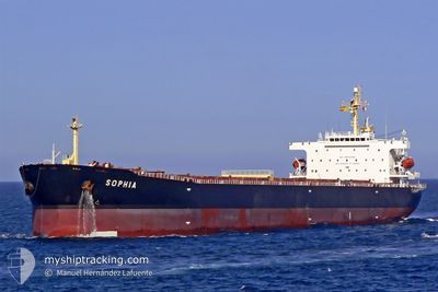
SOPHIA
Bulk Carrier
Current Trip
CAMPHA
| Time Travelled | 5 days |
|---|---|
| Remaining Time | --- |
| Distance Travelled | 1658.69 nm |
| Remaining Distance | --- |
| AVG Speed | 11.8 Knots |
| MAX Speed | 14.3 Knots |
| AVG Wind | 10.8 knots |
| MAX Wind | 27.5 knots |
| MIN Temp | 6°C / 42.8°F |
| MAX Temp | 27.7°C / 81.86°F |
| Draught | 11.3 m |
| Position Received | 4 d ago |
Current Position
| Longitude | 124.53182° |
|---|---|
| Latitude | 35.00814° |
| Status | Under way using engine |
| Speed | 12.5 Knots |
| Course | 150.7° |
| Area | Yellow Sea |
| Station | T-AIS |
| Position Received | 4 d ago |
Info
Information
The current position of SOPHIA is in Yellow Sea with coordinates 35.00814° / 124.53182° as reported on 2024-04-16 01:39 by AIS to our vessel tracker app. The vessel's current speed is 12.5 Knots
The vessel SOPHIA (IMO: 9323912, MMSI: 210970000) is a Bulk Carrier that was built in 2007 ( 17 years old ). It's sailing under the flag of [CY] Cyprus.
In this page you can find informations about the vessels current position, last detected port calls, and current voyage information. If the vessels is not in coverage by AIS you will find the latest position.
The current position of SOPHIA is detected by our AIS receivers and we are not responsible for the reliability of the data. The last position was recorded while the vessel was in Coverage by the Ais receivers of our vessel tracking app.
The current draught of SOPHIA as reported by AIS is 11.3 meters
Weather
| Temperature | 27.5°C / 81.5°F |
|---|---|
| Wind Speed | 5 knots |
| Direction | 96° E |
| Pressure | 1011.7 hPa |
| Humidity | 75.7 % |
| Cloud Coverage | 27 % |
Featured Company
Last Port Calls
| Port | Arrival | Departure | Time In Port |
|---|---|---|---|
| 2024-04-12 11:01 | 2024-04-14 07:41 | 1 d | |
| 2024-03-27 06:25 | 2024-03-29 05:23 | 1 d | |
| 2024-02-08 05:33 | 2024-02-09 13:01 | 1 d |
Most Visited Ports (Last year)
| Port | Arrivals | |
|---|---|---|
| 2 | ||
| 2 | ||
| 1 | ||
| 1 | ||
| 1 | ||
| 1 |
Last Trips
| Origin | Departure | Destination | Arrival | Distance | |
|---|---|---|---|---|---|
| 2024-03-29 14:53 | 2024-04-12 19:01 | 3480.06 nm | |||
| 2024-02-09 15:01 | 2024-03-27 15:55 | 8945.42 nm | |||
| 2024-01-13 10:11 | 2024-02-08 07:33 | 7120.52 nm |
Events
| Time | Event | Details | Position / Dest | Info |
|---|---|---|---|---|
| 2024-04-16 01:43 | Status Changed | Default Under way using engine |
34.99705 / 124.53937
CAMPHA
|
Speed: 12.5 kn Course: 150.7° |
| 2024-04-16 01:39 | OUT of Coverage |
35.00814 / 124.53182
Yellow Sea
|
Speed: 12.5 kn Course: 150.7° |
|
| 2024-04-16 01:29 | Status Changed | Under way using engine Default |
35.04026 / 124.51020
CAMPHA
|
Speed: 12.7 kn Course: 154° |
| 2024-04-16 01:13 | Status Changed | Default Under way using engine |
35.09020 / 124.47939
CAMPHA
|
Speed: 12.7 kn Course: 153.1° |
| 2024-04-16 01:08 | Status Changed | Under way using engine Default |
35.10537 / 124.47008
CAMPHA
|
Speed: 12.5 kn Course: 154° |
| 2024-04-16 00:32 | Status Changed | Default Under way using engine |
35.19734 / 124.41400
CAMPHA
|
Speed: 12.4 kn Course: 151.6° |
| 2024-04-16 00:21 | Status Changed | Under way using engine Default |
35.23084 / 124.39173
CAMPHA
|
Speed: 12.4 kn Course: 151° |
| 2024-04-16 00:09 | Status Changed | Default Under way using engine |
35.26635 / 124.36778
CAMPHA
|
Speed: 12.5 kn Course: 150.8° |
| 2024-04-16 00:05 | Change Sea Area | South Korean part of the Yellow Sea Chinese part of the Yellow Sea |
35.27845 / 124.35956
Yellow Sea
|
Speed: 12.6 kn Course: 151° |
| 2024-04-16 00:04 | Status Changed | Under way using engine Default |
35.28154 / 124.35749
CAMPHA
|
Speed: 12.6 kn Course: 151° |