
ALE
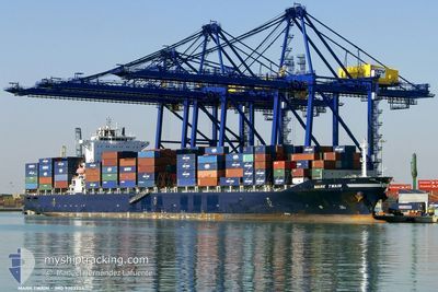
Container Ship
Current Trip
| Trip Time | 11 h, 14 mins |
|---|---|
| Trip Distance | 72.25 nm |
| AVG Speed | 9.6 Knots |
| MAX Speed | 11.1 Knots |
| Draught | 7 m |
| AVG Wind | 8.7 knots |
| MAX Wind | 15.2 knots |
| MIN Temp | 26.1°C / 78.98°F |
| MAX Temp | 31.6°C / 88.88°F |
| Position Received | 23 h, 32 m ago |
Current Position
| Longitude | 56.62421° |
|---|---|
| Latitude | 24.78843° |
| Status | Under way using engine |
| Speed | 10.7 Knots |
| Course | 181.4° |
| Area | Gulf of Oman |
| Station | T-AIS |
| Position Received | 23 h, 32 m ago |
Info
Information
The current position of ALE is in Gulf of Oman with coordinates 24.78843° / 56.62421° as reported on 2024-04-24 10:27 by AIS to our vessel tracker app. The vessel's current speed is 10.7 Knots and is currently inside the port of SOHAR.
The vessel ALE (IMO: 9303754, MMSI: 636016895) is a Container Ship that was built in 2006 ( 18 years old ). It's sailing under the flag of [LR] Liberia.
In this page you can find informations about the vessels current position, last detected port calls, and current voyage information. If the vessels is not in coverage by AIS you will find the latest position.
The current position of ALE is detected by our AIS receivers and we are not responsible for the reliability of the data. The last position was recorded while the vessel was in Coverage by the Ais receivers of our vessel tracking app.
The current draught of ALE as reported by AIS is 7 meters
Weather
| Temperature | 31.9°C / 89.42°F |
|---|---|
| Wind Speed | 10 knots |
| Direction | 36° NE |
| Pressure | 1006.3 hPa |
| Humidity | 23.6 % |
| Cloud Coverage | --- |
Featured Company
Last Port Calls
| Port | Arrival | Departure | Time In Port |
|---|---|---|---|
| 2024-04-24 16:51 | |||
| 2024-04-23 15:02 | 2024-04-24 05:37 | 14 h | |
| 2024-04-21 21:11 | |||
| 2024-04-12 22:41 | 2024-04-14 18:58 | 1 d | |
| 2024-04-11 01:59 | 2024-04-11 15:06 | 13 h | |
| 2024-04-02 02:54 | 2024-04-02 11:46 | 8 h | |
| 2024-03-31 18:27 | 2024-04-01 03:59 | 9 h | |
| 2024-03-24 04:22 | 2024-03-25 15:07 | 1 d | |
| 2024-03-11 09:01 | 2024-03-12 23:04 | 1 d | |
| 2024-02-23 12:55 | 2024-02-24 01:57 | 13 h |
Most Visited Ports (Last year)
| Port | Arrivals | |
|---|---|---|
| 8 | ||
| 7 | ||
| 4 | ||
| 3 | ||
| 2 | ||
| 2 |
Last Trips
| Origin | Departure | Destination | Arrival | Distance | |
|---|---|---|---|---|---|
| 2024-04-24 09:37 | 2024-04-24 20:51 | 72.25 nm | |||
| 2024-04-22 02:11 | 2024-04-23 19:02 | 356.76 nm | |||
| 2024-04-11 19:06 | 2024-04-13 02:41 | 64.26 nm | |||
| 2024-04-01 05:59 | 2024-04-11 05:59 | 2881.12 nm | |||
| 2024-04-01 05:59 | 2024-04-02 04:54 | 71.44 nm | |||
| 2024-03-25 15:07 | 2024-03-31 20:27 | 2094.24 nm | |||
| 2024-03-13 02:04 | 2024-03-24 04:22 | 2854.57 nm | |||
| 2024-02-24 03:57 | 2024-03-11 12:01 | 4657.39 nm | |||
| 2024-02-21 10:17 | 2024-02-23 14:55 | 582.86 nm | |||
| 2024-01-26 07:23 | 2024-02-18 21:05 | 4821.40 nm |
Events
| Time | Event | Details | Position / Dest | Info |
|---|---|---|---|---|
| 2024-04-24 17:25 | STOP Moving |
24.51357 / 56.61157
[OM] SOHAR
|
Speed: Course: 142° |
|
| 2024-04-24 16:51 | PORT ARRIVAL |
|
24.51913 / 56.62885
[OM] SOHAR
|
Speed: 9.5 kn Course: 196° |
| 2024-04-24 15:26 | START Moving | 7.36 nm, North of SOHAR |
24.62671 / 56.65632
OMSOH
|
Speed: 6.3 kn Course: 191° |
| 2024-04-24 15:08 | STOP Moving | 7.83 nm, North of SOHAR |
24.63475 / 56.65571
OMSOH
|
Speed: 0.1 kn Course: 102° |
| 2024-04-24 10:32 | Status Changed | Default Under way using engine |
24.77266 / 56.62561
OMSOH
|
Speed: 10.7 kn Course: 181.4° |
| 2024-04-24 10:27 | OUT of Coverage |
24.78843 / 56.62421
Gulf of Oman
OMSOH
|
Speed: 10.7 kn Course: 181.4° |
|
| 2024-04-24 09:11 | Change Sea Area | Omani part of the Gulf of Oman United Arab Emirates part of the Gulf of Oman |
25.01752 / 56.63334
Gulf of Oman
OMSOH
|
Speed: 10.9 kn Course: 184.7° |
| 2024-04-24 07:57 | ETA Changed | 2024/04/24 12:00 2024/04/24 16:00 |
25.23905 / 56.63110
OMSOH
|
Speed: 10.7 kn Course: 177.6° |
| 2024-04-24 05:40 | ETA Changed | 2024/04/24 16:00 2024/04/24 10:00 |
25.36742 / 56.37134
OMSOH
|
Speed: 5.9 kn Course: 57.5° |
| 2024-04-24 05:37 | PORT DEPARTURE |
|
25.36381 / 56.36787
OMSOH
|
Speed: 4.9 kn Course: 357.3° |