
SOLA TS
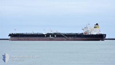
Tanker
Current Trip
| Time Travelled | 26 days |
|---|---|
| Remaining Time | 1 day |
| Distance Travelled | 6254.57 nm |
| Remaining Distance | 326.14 nm |
| AVG Speed | 11.4 Knots |
| MAX Speed | 17.6 Knots |
| AVG Wind | 18.1 knots |
| MAX Wind | 41 knots |
| MIN Temp | 3.2°C / 37.76°F |
| MAX Temp | 23.7°C / 74.66°F |
| Draught | 14.8 m |
| Position Received | 2 d ago |
Current Position
| Longitude | 14.03559° |
|---|---|
| Latitude | 36.44053° |
| Status | Under way using engine |
| Speed | 9.3 Knots |
| Course | 289.8° |
| Area | Mediterranean Sea - Eastern Basin |
| Station | T-AIS |
| Position Received | 2 d ago |
Info
Information
The current position of SOLA TS is in Mediterranean Sea - Eastern Basin with coordinates 36.44053° / 14.03559° as reported on 2024-04-17 16:40 by AIS to our vessel tracker app. The vessel's current speed is 9.3 Knots and is heading at the port of GIBRALTAR. The estimated time of arrival as calculated by MyShipTracking vessel tracking app is 2024-04-21 00:41 LT
The vessel SOLA TS (IMO: 9724350, MMSI: 248020000) is a Tanker It's sailing under the flag of [MT] Malta.
In this page you can find informations about the vessels current position, last detected port calls, and current voyage information. If the vessels is not in coverage by AIS you will find the latest position.
The current position of SOLA TS is detected by our AIS receivers and we are not responsible for the reliability of the data. The last position was recorded while the vessel was in Coverage by the Ais receivers of our vessel tracking app.
The current draught of SOLA TS as reported by AIS is 14.8 meters
Weather
| Temperature | 15.4°C / 59.72°F |
|---|---|
| Wind Speed | 20 knots |
| Direction | 76° ENE |
| Pressure | 1016.4 hPa |
| Humidity | 68.3 % |
| Cloud Coverage | 69 % |
Featured Company
Events
| Time | Event | Details | Position / Dest | Info |
|---|---|---|---|---|
| 2024-04-17 16:50 | Status Changed | Default Under way using engine |
36.44916 / 14.00511
EGSKT>GIGIB
|
Speed: 9.3 kn Course: 289.8° |
| 2024-04-17 16:40 | OUT of Coverage |
36.44053 / 14.03559
Mediterranean Sea - Eastern Basin
EGSKT>GIGIB
|
Speed: 9.3 kn Course: 289.8° |
|
| 2024-04-17 14:59 | Status Changed | Under way using engine Default |
36.34963 / 14.33969
EGSKT>GIGIB
|
Speed: 9.3 kn Course: 291° |
| 2024-04-17 14:48 | Status Changed | Default Under way using engine |
36.33927 / 14.37250
EGSKT>GIGIB
|
Speed: 9 kn Course: 292.9° |
| 2024-04-17 13:18 | Status Changed | Under way using engine Default |
36.25661 / 14.63847
EGSKT>GIGIB
|
Speed: 8.9 kn Course: 291° |
| 2024-04-17 13:10 | Status Changed | Default Under way using engine |
36.24888 / 14.66306
EGSKT>GIGIB
|
Speed: 9 kn Course: 290.9° |
| 2024-04-17 13:09 | Status Changed | Under way using engine Default |
36.24836 / 14.66477
EGSKT>GIGIB
|
Speed: 9.2 kn Course: 290° |
| 2024-04-17 13:09 | IN Coverage |
36.24836 / 14.66477
Mediterranean Sea - Eastern Basin
EGSKT>GIGIB
|
Speed: 9 kn Course: 290.9° |
|
| 2024-04-17 13:09 | Detected in Sea | Maltese part of the Mediterranean Sea - Eastern Basin |
36.24836 / 14.66477
Mediterranean Sea - Eastern Basin
EGSKT>GIGIB
|
Speed: 9 kn Course: 290.9° |
| 2024-04-16 11:57 | OUT of Coverage |
34.41045 / 20.15336
Mediterranean Sea - Eastern Basin
EGSKT>GIGIB
|
Speed: 12.4 kn Course: 290.9° |