
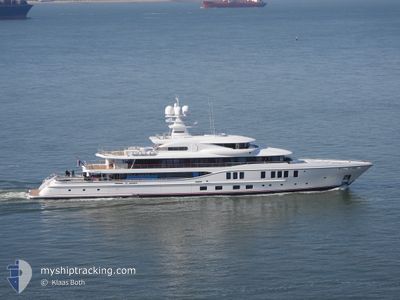
SIXTH SENSE
Pleasure Craft
Current Trip
Current Position
| Longitude | 2.18615° |
|---|---|
| Latitude | 41.36965° |
| Status | Moored |
| Speed | |
| Course | 187° |
| Area | Balearic Sea |
| Station | T-AIS |
| Position Received | 3 m ago |
Info
Information
The current position of SIXTH SENSE is in Balearic Sea with coordinates 41.36965° / 2.18615° as reported on 2024-04-24 12:02 by AIS to our vessel tracker app. The vessel's current speed is 0 Knots and is currently inside the port of BARCELONA.
The vessel SIXTH SENSE (IMO: 9799824, MMSI: 319155500) is a Pleasure Craft It's sailing under the flag of [KY] Cayman Is.
In this page you can find informations about the vessels current position, last detected port calls, and current voyage information. If the vessels is not in coverage by AIS you will find the latest position.
The current position of SIXTH SENSE is detected by our AIS receivers and we are not responsible for the reliability of the data. The last position was recorded while the vessel was in Coverage by the Ais receivers of our vessel tracking app.
The current draught of SIXTH SENSE as reported by AIS is 3.9 meters
Weather
| Temperature | 12.4°C / 54.32°F |
|---|---|
| Wind Speed | 6 knots |
| Direction | 188° S |
| Pressure | 1015.6 hPa |
| Humidity | 46.3 % |
| Cloud Coverage | 1 % |
Featured Company
Most Visited Ports (Last year)
| Port | Arrivals | |
|---|---|---|
| 3 | ||
| 2 | ||
| 1 | ||
| 1 | ||
| 1 |
Events
| Time | Event | Details | Position / Dest | Info |
|---|---|---|---|---|
| 2024-04-22 18:08 | IN Coverage |
41.36971 / 2.18625
Balearic Sea
[ES] BARCELONA
|
Speed: 0.1 kn Course: 0° |
|
| 2024-04-22 15:08 | OUT of Coverage |
41.36971 / 2.18619
Balearic Sea
[ES] BARCELONA
|
Speed: Course: 0° |
|
| 2024-04-17 08:05 | Status Changed | Moored Under way using engine |
41.36982 / 2.18616
[ES] BARCELONA
|
Speed: Course: 190° |
| 2024-04-17 07:38 | PORT ARRIVAL |
|
41.35252 / 2.18468
[ES] BARCELONA
|
Speed: Course: 331° |
| 2024-04-17 06:36 | Status Changed | Under way using engine Under way sailing |
41.35083 / 2.25465
ESBCN
|
Speed: Course: 36° |
| 2024-04-17 06:36 | Status Changed | Under way sailing Moored |
41.35082 / 2.25461
ESBCN
|
Speed: Course: 35° |
| 2024-04-17 05:54 | PORT DEPARTURE |
|
41.34685 / 2.18840
ESBCN
|
Speed: Course: 147° |
| 2024-04-16 13:35 | IN Coverage |
41.37123 / 2.18525
Balearic Sea
[ES] BARCELONA
|
Speed: Course: 0° |
|
| 2024-04-16 04:57 | OUT of Coverage |
41.37170 / 2.18536
Balearic Sea
[ES] BARCELONA
|
Speed: Course: 0° |