
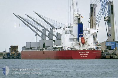
SIRIUS SKY
Cargo
Current Trip
ST.JOHN S
| Time Travelled | 2 days |
|---|---|
| Remaining Time | --- |
| Distance Travelled | 698.30 nm |
| Remaining Distance | --- |
| AVG Speed | 10.7 Knots |
| MAX Speed | 12.1 Knots |
| AVG Wind | 13.3 knots |
| MAX Wind | 18 knots |
| MIN Temp | 20.4°C / 68.72°F |
| MAX Temp | 25.6°C / 78.08°F |
| Draught | 13.1 m |
| Position Received | 2 d ago |
Current Position
| Longitude | -87.14190° |
|---|---|
| Latitude | 29.04545° |
| Status | Under way using engine |
| Speed | 10.3 Knots |
| Course | 143.8° |
| Area | Gulf of Mexico |
| Station | T-AIS |
| Position Received | 2 d ago |
Info
Information
The current position of SIRIUS SKY is in Gulf of Mexico with coordinates 29.04545° / -87.14190° as reported on 2024-04-16 16:25 by AIS to our vessel tracker app. The vessel's current speed is 10.3 Knots
The vessel SIRIUS SKY (IMO: 9817559, MMSI: 563033500) is a Cargo It's sailing under the flag of [SG] Singapore.
In this page you can find informations about the vessels current position, last detected port calls, and current voyage information. If the vessels is not in coverage by AIS you will find the latest position.
The current position of SIRIUS SKY is detected by our AIS receivers and we are not responsible for the reliability of the data. The last position was recorded while the vessel was in Coverage by the Ais receivers of our vessel tracking app.
The current draught of SIRIUS SKY as reported by AIS is 13.1 meters
Weather
| Temperature | 25.3°C / 77.54°F |
|---|---|
| Wind Speed | 14 knots |
| Direction | 79° E |
| Pressure | 1016.5 hPa |
| Humidity | 75.7 % |
| Cloud Coverage | 32 % |
Featured Company
Last Port Calls
| Port | Arrival | Departure | Time In Port |
|---|---|---|---|
| 2024-04-13 13:08 | 2024-04-16 05:41 | 2 d | |
| 2024-04-06 19:47 | 2024-04-07 15:35 | 19 h | |
| 2024-03-29 23:25 | 2024-03-30 20:37 | 21 h | |
| 2024-03-20 08:24 | 2024-03-25 15:21 | 5 d | |
| 2024-02-11 13:34 | 2024-02-13 20:32 | 2 d | |
| 2024-02-01 17:05 | 2024-02-06 09:55 | 4 d |
Most Visited Ports (Last year)
| Port | Arrivals | |
|---|---|---|
| 2 | ||
| 2 | ||
| 1 | ||
| 1 | ||
| 1 | ||
| 1 |
Last Trips
| Origin | Departure | Destination | Arrival | Distance | |
|---|---|---|---|---|---|
| 2024-04-07 11:35 | 2024-04-13 08:08 | 1511.71 nm | |||
| 2024-03-30 16:37 | 2024-04-06 15:47 | 82.93 nm | |||
| 2024-03-25 11:21 | 2024-03-29 19:25 | 341.67 nm | |||
| 2024-02-13 17:32 | 2024-03-20 04:24 | 9144.58 nm | |||
| 2024-02-06 04:55 | 2024-02-11 10:34 | 1397.64 nm | |||
| 2024-01-26 09:40 | 2024-02-01 12:05 | 668.89 nm |
Events
| Time | Event | Details | Position / Dest | Info |
|---|---|---|---|---|
| 2024-04-16 16:33 | Status Changed | Default Under way using engine |
29.02712 / -87.12670
ST.JOHN S
|
Speed: 10.3 kn Course: 143.8° |
| 2024-04-16 16:25 | OUT of Coverage |
29.04545 / -87.14190
Gulf of Mexico
ST.JOHN S
|
Speed: 10.3 kn Course: 143.8° |
|
| 2024-04-16 16:22 | Draught Changed | 13.1 10.6 |
29.05362 / -87.14865
ST.JOHN S
|
Speed: 10.4 kn Course: 143.9° |
| 2024-04-16 16:22 | Destination Changed | ST.JOHN S USMOB |
29.05362 / -87.14865
ST.JOHN S
|
Speed: 10.4 kn Course: 143.9° |
| 2024-04-16 16:22 | ETA Changed | 2024/04/23 05:00 2024/04/13 09:00 |
29.05362 / -87.14865
ST.JOHN S
|
Speed: 10.4 kn Course: 143.9° |
| 2024-04-16 16:15 | Status Changed | Under way using engine Default |
29.06949 / -87.16199
USMOB
|
Speed: 11.1 kn Course: 143° |
| 2024-04-16 16:15 | IN Coverage |
29.06748 / -87.16027
Gulf of Mexico
|
Speed: 10.6 kn Course: 143.2° |
|
| 2024-04-16 14:33 | Status Changed | Default Under way using engine |
29.32449 / -87.37292
USMOB
|
Speed: 11.3 kn Course: 143.6° |
| 2024-04-16 14:26 | OUT of Coverage |
29.34359 / -87.38866
Gulf of Mexico
|
Speed: 11.3 kn Course: 143.6° |
|
| 2024-04-16 14:23 | Status Changed | Under way using engine Default |
29.35026 / -87.39434
USMOB
|
Speed: 11.3 kn Course: 142° |