
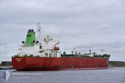
SILVER ZOE
Tanker
Current Trip
| Time Travelled | 1 day |
|---|---|
| Remaining Time | 5 h, 58 mins |
| Distance Travelled | 343.56 nm |
| Remaining Distance | 73.23 nm |
| AVG Speed | 11.4 Knots |
| MAX Speed | 13.2 Knots |
| AVG Wind | 9.5 knots |
| MAX Wind | 23.8 knots |
| MIN Temp | 24.9°C / 76.82°F |
| MAX Temp | 29.5°C / 85.1°F |
| Draught | 11.9 m |
| Position Received | 1 m ago |
Current Position
| Longitude | 56.73459° |
|---|---|
| Latitude | 25.68175° |
| Status | Under way using engine |
| Speed | 12 Knots |
| Course | 181.8° |
| Area | Gulf of Oman |
| Station | T-AIS |
| Position Received | 1 m ago |
Info
Information
The current position of SILVER ZOE is in Gulf of Oman with coordinates 25.68175° / 56.73459° as reported on 2024-04-23 23:09 by AIS to our vessel tracker app. The vessel's current speed is 12 Knots and is heading at the port of SOHAR. The estimated time of arrival as calculated by MyShipTracking vessel tracking app is 2024-04-24 05:08 LT
The vessel SILVER ZOE (IMO: 9692325, MMSI: 538006366) is a Tanker It's sailing under the flag of [MH] Marshall Is.
In this page you can find informations about the vessels current position, last detected port calls, and current voyage information. If the vessels is not in coverage by AIS you will find the latest position.
The current position of SILVER ZOE is detected by our AIS receivers and we are not responsible for the reliability of the data. The last position was recorded while the vessel was in Coverage by the Ais receivers of our vessel tracking app.
The current draught of SILVER ZOE as reported by AIS is 11.9 meters
Weather
| Temperature | 26.2°C / 79.16°F |
|---|---|
| Wind Speed | 8 knots |
| Direction | 161° SSE |
| Pressure | 1003.6 hPa |
| Humidity | 75.3 % |
| Cloud Coverage | --- |
Featured Company
Last Port Calls
| Port | Arrival | Departure | Time In Port |
|---|---|---|---|
| 2024-04-19 18:55 | 2024-04-22 17:06 | 2 d | |
| 2024-03-31 13:54 | 2024-04-02 00:50 | 1 d | |
| 2024-03-27 00:09 | 2024-03-27 17:40 | 17 h | |
| 2024-03-23 16:28 | 2024-03-25 13:52 | 1 d | |
| 2024-03-01 15:04 | 2024-03-04 14:00 | 2 d | |
| 2024-02-28 15:37 | 2024-02-29 15:53 | 1 d | |
| 2024-02-15 07:47 | 2024-02-17 07:11 | 1 d |
Most Visited Ports (Last year)
| Port | Arrivals | |
|---|---|---|
| 3 | ||
| 2 | ||
| 1 | ||
| 1 | ||
| 1 | ||
| 1 |
Last Trips
| Origin | Departure | Destination | Arrival | Distance | |
|---|---|---|---|---|---|
| 2024-04-02 06:20 | 2024-04-19 21:55 | 2233.53 nm | |||
| 2024-03-27 21:40 | 2024-03-31 19:24 | 756.56 nm | |||
| 2024-03-25 16:52 | 2024-03-27 04:09 | 389.96 nm | |||
| 2024-03-04 22:00 | 2024-03-23 19:28 | 4116.79 nm | |||
| 2024-02-29 23:53 | 2024-03-01 23:04 | 12.38 nm | |||
| 2024-02-17 16:11 | 2024-02-28 23:37 | 2659.54 nm | |||
| 2024-01-07 11:36 | 2024-02-15 16:47 | 8246.86 nm |
Events
| Time | Event | Details | Position / Dest | Info |
|---|---|---|---|---|
| 2024-04-23 22:01 | Change Sea Area | Omani part of the Gulf of Oman Omani part of the Persian Gulf |
25.90898 / 56.73300
Gulf of Oman
SOHAR OMAN
|
Speed: 12.1 kn Course: 179.2° |
| 2024-04-23 21:59 | Status Changed | Under way using engine Default |
25.91819 / 56.73289
SOHAR OMAN
|
Speed: 12.2 kn Course: 180° |
| 2024-04-23 21:44 | IN Coverage |
25.90898 / 56.73300
Gulf of Oman
SOHAR OMAN
|
Speed: 12.1 kn Course: 179.2° |
|
| 2024-04-23 14:52 | Status Changed | Default Under way using engine |
26.21259 / 55.96870
SOHAR OMAN
|
Speed: 12 kn Course: 50.2° |
| 2024-04-23 14:47 | OUT of Coverage |
26.20166 / 55.95424
Persian Gulf
SOHAR OMAN
|
Speed: 12 kn Course: 50.2° |
|
| 2024-04-23 14:34 | Change Sea Area | Omani part of the Persian Gulf United Arab Emirates part of the Persian Gulf |
26.17468 / 55.91745
Persian Gulf
SOHAR OMAN
|
Speed: 12 kn Course: 51.2° |
| 2024-04-23 06:40 | Change Sea Area | United Arab Emirates part of the Persian Gulf Iranian part of the Persian Gulf |
25.67276 / 54.46886
Persian Gulf
SOHAR OMAN
|
Speed: 11.2 kn Course: 119° |
| 2024-04-23 04:17 | Status Changed | Under way using engine Default |
25.88403 / 53.99637
SOHAR OMAN
|
Speed: 12 kn Course: 117° |
| 2024-04-23 03:57 | Status Changed | Default Under way using engine |
25.91511 / 53.93058
SOHAR OMAN
|
Speed: 12.1 kn Course: 117.6° |
| 2024-04-23 03:49 | Status Changed | Under way using engine Default |
25.92664 / 53.90568
SOHAR OMAN
|
Speed: 12.1 kn Course: 117° |