
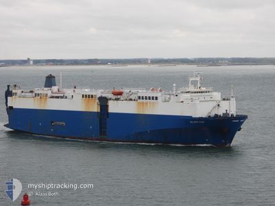
SILVER SUN
Vehicles Carrier
Current Trip
| Time Travelled | 2 days |
|---|---|
| Remaining Time | 1 day |
| Distance Travelled | 787.30 nm |
| Remaining Distance | 665.24 nm |
| AVG Speed | 13.2 Knots |
| MAX Speed | 14 Knots |
| AVG Wind | 6.6 knots |
| MAX Wind | 12.6 knots |
| MIN Temp | 27.9°C / 82.22°F |
| MAX Temp | 30°C / 86°F |
| Draught | 8.9 m |
| Position Received | 12 d ago |
Current Position
| Longitude | -17.38933° |
|---|---|
| Latitude | 23.24568° |
| Status | Under way using engine |
| Speed | 14.2 Knots |
| Course | 191° |
| Area | North Atlantic Ocean |
| Station | T-AIS |
| Position Received | 12 d ago |
Info
Information
The current position of SILVER SUN is in North Atlantic Ocean with coordinates 23.24568° / -17.38933° as reported on 2024-04-13 09:29 by AIS to our vessel tracker app. The vessel's current speed is 14.2 Knots and is heading at the port of LOME. The estimated time of arrival as calculated by MyShipTracking vessel tracking app is 2024-04-27 14:06 LT
The vessel SILVER SUN (IMO: 8519710, MMSI: 373207000) is a Vehicles Carrier that was built in 1988 ( 36 years old ). It's sailing under the flag of [PA] Panama.
In this page you can find informations about the vessels current position, last detected port calls, and current voyage information. If the vessels is not in coverage by AIS you will find the latest position.
The current position of SILVER SUN is detected by our AIS receivers and we are not responsible for the reliability of the data. The last position was recorded while the vessel was in Coverage by the Ais receivers of our vessel tracking app.
The current draught of SILVER SUN as reported by AIS is 8.9 meters
Weather
| Temperature | 28.6°C / 83.48°F |
|---|---|
| Wind Speed | 8 knots |
| Direction | 187° S |
| Pressure | 1009.9 hPa |
| Humidity | 83.4 % |
| Cloud Coverage | 100 % |
Featured Company
Last Port Calls
| Port | Arrival | Departure | Time In Port |
|---|---|---|---|
| 2024-04-22 07:07 | 2024-04-23 08:08 | 1 d | |
| 2024-04-21 03:44 | 2024-04-21 22:44 | 19 h | |
| 2024-04-20 19:36 | |||
| 2024-04-01 06:36 | 2024-04-05 22:34 | 4 d | |
| 2024-03-30 15:13 | 2024-03-31 05:30 | 14 h | |
| 2024-03-28 04:06 | 2024-03-29 01:26 | 21 h | |
| 2024-03-26 22:29 | 2024-03-27 15:17 | 16 h | |
| 2024-02-25 06:06 | 2024-02-26 19:54 | 1 d | |
| 2024-02-21 20:02 | 2024-02-23 07:10 | 1 d | |
| 2024-02-08 15:34 | 2024-02-09 13:34 | 22 h |
Most Visited Ports (Last year)
| Port | Arrivals | |
|---|---|---|
| 6 | ||
| 5 | ||
| 5 | ||
| 5 | ||
| 4 | ||
| 4 |
Last Trips
| Origin | Departure | Destination | Arrival | Distance | |
|---|---|---|---|---|---|
| 2024-04-21 23:44 | 2024-04-22 08:07 | 81.38 nm | |||
| 2024-04-20 19:36 | 2024-04-21 04:44 | 89.40 nm | |||
| 2024-03-31 06:30 | 2024-04-01 08:36 | 281.00 nm | |||
| 2024-03-29 02:26 | 2024-03-30 15:13 | 465.86 nm | |||
| 2024-03-27 16:17 | 2024-03-28 05:06 | 126.87 nm | |||
| 2024-02-26 21:54 | 2024-03-26 23:29 | 7384.53 nm | |||
| 2024-02-23 09:10 | 2024-02-25 08:06 | 418.15 nm | |||
| 2024-02-09 14:34 | 2024-02-21 22:02 | 3037.22 nm | |||
| 2024-02-07 22:46 | 2024-02-08 16:34 | 93.90 nm | |||
| 2024-01-25 03:14 | 2024-02-07 09:46 | 4152.07 nm |
Events
| Time | Event | Details | Position / Dest | Info |
|---|---|---|---|---|
| 2024-04-23 08:08 | PORT DEPARTURE |
|
6.38790 / 3.40374
BE ANR>TG LFW
|
Speed: 10.6 kn Course: 168° |
| 2024-04-23 07:25 | START Moving |
6.42833 / 3.34369
[NG] LAGOS
|
Speed: 6 kn Course: 74° |
|
| 2024-04-22 07:08 | STOP Moving |
6.42958 / 3.33866
[NG] LAGOS
|
Speed: 0.2 kn Course: 271° |
|
| 2024-04-22 07:07 | PORT ARRIVAL |
|
6.42958 / 3.33866
[NG] LAGOS
|
Speed: 5.4 kn Course: 250° |
| 2024-04-22 05:20 | START Moving | 5.74 nm, South East of LAGOS |
6.34355 / 3.40248
BE ANR>TG LFW
|
Speed: 4.4 kn Course: 352° |
| 2024-04-22 04:48 | STOP Moving | 5.74 nm, South East of LAGOS |
6.34537 / 3.40640
BE ANR>TG LFW
|
Speed: 0.3 kn Course: 295° |
| 2024-04-21 22:44 | PORT DEPARTURE |
|
6.34183 / 2.43698
BE ANR>TG LFW
|
Speed: 4 kn Course: 112° |
| 2024-04-21 22:41 | START Moving |
6.34373 / 2.43255
[BJ] COTONOU
|
Speed: 4 kn Course: 112° |
|
| 2024-04-21 04:05 | STOP Moving |
6.34807 / 2.42444
[BJ] COTONOU
|
Speed: 0.2 kn Course: 261° |
|
| 2024-04-21 03:44 | PORT ARRIVAL |
|
6.34376 / 2.43442
[BJ] COTONOU
|
Speed: 4.5 kn Course: 283° |