
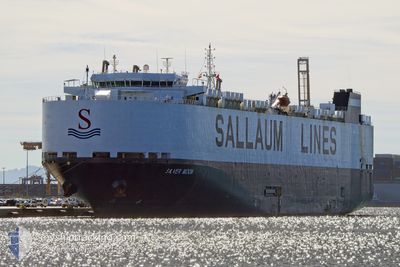
SILVER MOON
Vehicles Carrier
Current Trip
| Time Travelled | 8 days |
|---|---|
| Remaining Time | --- |
| Distance Travelled | 3183.93 nm |
| Remaining Distance | --- |
| AVG Speed | 15.4 Knots |
| MAX Speed | 17.3 Knots |
| AVG Wind | 9.5 knots |
| MAX Wind | 23.6 knots |
| MIN Temp | 11.9°C / 53.42°F |
| MAX Temp | 24.6°C / 76.28°F |
| Draught | 9 m |
| Position Received | 7 d ago |
Current Position
| Longitude | -72.36182° |
|---|---|
| Latitude | 35.88715° |
| Status | Under way using engine |
| Speed | 15.6 Knots |
| Course | 116° |
| Area | North Atlantic Ocean |
| Station | T-AIS |
| Position Received | 7 d ago |
Info
Information
The current position of SILVER MOON is in North Atlantic Ocean with coordinates 35.88715° / -72.36182° as reported on 2024-04-18 05:48 by AIS to our vessel tracker app. The vessel's current speed is 15.6 Knots and is heading at the port of COTONOU. The estimated time of arrival as calculated by MyShipTracking vessel tracking app is 2024-04-30 06:00 LT
The vessel SILVER MOON (IMO: 9448138, MMSI: 353033000) is a Vehicles Carrier that was built in 2010 ( 14 years old ). It's sailing under the flag of [PA] Panama.
In this page you can find informations about the vessels current position, last detected port calls, and current voyage information. If the vessels is not in coverage by AIS you will find the latest position.
The current position of SILVER MOON is detected by our AIS receivers and we are not responsible for the reliability of the data. The last position was recorded while the vessel was in Coverage by the Ais receivers of our vessel tracking app.
The current draught of SILVER MOON as reported by AIS is 9 meters
Weather
| Temperature | 23.6°C / 74.48°F |
|---|---|
| Wind Speed | 10 knots |
| Direction | 25° NNE |
| Pressure | 1011.7 hPa |
| Humidity | 78.2 % |
| Cloud Coverage | 55 % |
Featured Company
Last Port Calls
| Port | Arrival | Departure | Time In Port |
|---|---|---|---|
| 2024-04-15 22:29 | 2024-04-17 06:43 | 1 d | |
| 2024-04-06 12:17 | 2024-04-08 03:23 | 1 d | |
| 2024-04-04 20:48 | 2024-04-05 20:16 | 23 h | |
| 2024-04-02 04:21 | 2024-04-03 00:36 | 20 h | |
| 2024-03-18 10:56 | 2024-03-20 09:29 | 1 d | |
| 2024-03-17 12:26 | 2024-03-18 05:31 | 17 h | |
| 2024-03-14 10:30 | 2024-03-16 15:55 | 2 d | |
| 2024-03-11 04:52 | 2024-03-13 02:09 | 1 d | |
| 2024-03-07 07:52 | 2024-03-08 01:46 | 17 h | |
| 2024-03-06 03:49 | 2024-03-06 19:45 | 15 h |
Most Visited Ports (Last year)
| Port | Arrivals | |
|---|---|---|
| 6 | ||
| 4 | ||
| 4 | ||
| 4 | ||
| 3 | ||
| 3 |
Last Trips
| Origin | Departure | Destination | Arrival | Distance | |
|---|---|---|---|---|---|
| 2024-04-07 23:23 | 2024-04-15 18:29 | 1566.38 nm | |||
| 2024-04-05 16:16 | 2024-04-06 08:17 | 164.99 nm | |||
| 2024-04-02 20:36 | 2024-04-04 16:48 | 529.52 nm | |||
| 2024-03-20 10:29 | 2024-04-02 00:21 | 4045.25 nm | |||
| 2024-03-18 06:31 | 2024-03-18 11:56 | 52.59 nm | |||
| 2024-03-16 15:55 | 2024-03-17 13:26 | 241.88 nm | |||
| 2024-03-13 03:09 | 2024-03-14 10:30 | 470.72 nm | |||
| 2024-03-08 02:46 | 2024-03-11 05:52 | 152.96 nm | |||
| 2024-03-06 20:45 | 2024-03-07 08:52 | 125.03 nm | |||
| 2024-02-13 03:02 | 2024-03-06 04:49 | 7267.71 nm |
Events
| Time | Event | Details | Position / Dest | Info |
|---|---|---|---|---|
| 2024-04-18 06:01 | Status Changed | Default Under way using engine |
35.86322 / -72.30210
US BAL >> BJ COO
|
Speed: 15.6 kn Course: 116° |
| 2024-04-18 05:48 | OUT of Coverage |
35.88715 / -72.36182
North Atlantic Ocean
US BAL >> BJ COO
|
Speed: 15.6 kn Course: 116° |
|
| 2024-04-18 05:21 | Status Changed | Under way using engine Default |
35.93978 / -72.49202
US BAL >> BJ COO
|
Speed: 15.1 kn Course: 114° |
| 2024-04-18 05:12 | Status Changed | Default Under way using engine |
35.95457 / -72.53197
US BAL >> BJ COO
|
Speed: 15.1 kn Course: 114° |
| 2024-04-18 05:03 | Status Changed | Under way using engine Default |
35.97095 / -72.57720
US BAL >> BJ COO
|
Speed: 15.4 kn Course: 116° |
| 2024-04-18 05:03 | IN Coverage |
35.96798 / -72.56873
North Atlantic Ocean
US BAL >> BJ COO
|
Speed: 15.1 kn Course: 114° |
|
| 2024-04-17 19:58 | Status Changed | Default Under way using engine |
36.67475 / -75.25310
US BAL >> BJ COO
|
Speed: 14.9 kn Course: 88° |
| 2024-04-17 19:54 | OUT of Coverage |
36.67415 / -75.27206
North Atlantic Ocean
US BAL >> BJ COO
|
Speed: 14.9 kn Course: 88° |
|
| 2024-04-17 17:26 | Status Changed | Under way using engine Default |
36.85143 / -75.85059
US BAL >> BJ COO
|
Speed: 9.8 kn Course: 124° |
| 2024-04-17 17:22 | Status Changed | Default Under way using engine |
36.85679 / -75.86037
US BAL >> BJ COO
|
Speed: 9 kn Course: 132° |