
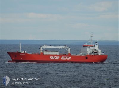
SILVER CRYSTAL
General Cargo
Current Trip
| Trip Time | 2 days |
|---|---|
| Trip Distance | 536.42 nm |
| AVG Speed | 12.1 Knots |
| MAX Speed | 13.6 Knots |
| Draught | 4.2 m |
| AVG Wind | 7.9 knots |
| MAX Wind | 17 knots |
| MIN Temp | 2.8°C / 37.04°F |
| MAX Temp | 8.9°C / 48.02°F |
| Position Received | 4 h, 39 m ago |
Current Position
| Longitude | -6.71655° |
|---|---|
| Latitude | 62.00723° |
| Status | Under way using engine |
| Speed | 13.4 Knots |
| Course | 354.8° |
| Area | North Atlantic Ocean |
| Station | T-AIS |
| Position Received | 4 h, 39 m ago |
Info
Information
The current position of SILVER CRYSTAL is in North Atlantic Ocean with coordinates 62.00723° / -6.71655° as reported on 2024-04-25 06:45 by AIS to our vessel tracker app. The vessel's current speed is 13.4 Knots and is currently inside the port of KOLLAFJORDUR.
The vessel SILVER CRYSTAL (IMO: 8915536, MMSI: 257308000) is a General Cargo that was built in 1991 ( 33 years old ). It's sailing under the flag of [NO] Norway.
In this page you can find informations about the vessels current position, last detected port calls, and current voyage information. If the vessels is not in coverage by AIS you will find the latest position.
The current position of SILVER CRYSTAL is detected by our AIS receivers and we are not responsible for the reliability of the data. The last position was recorded while the vessel was in Coverage by the Ais receivers of our vessel tracking app.
The current draught of SILVER CRYSTAL as reported by AIS is 4.2 meters
Weather
| Temperature | 4.2°C / 39.56°F |
|---|---|
| Wind Speed | 10 knots |
| Direction | 14° NNE |
| Pressure | 1011.7 hPa |
| Humidity | 73.8 % |
| Cloud Coverage | 96 % |
Featured Company
Last Port Calls
| Port | Arrival | Departure | Time In Port |
|---|---|---|---|
| 2024-04-25 08:02 | |||
| 2024-04-22 19:31 | 2024-04-23 03:50 | 8 h | |
| 2024-04-20 17:24 | 2024-04-21 16:05 | 22 h | |
| 2024-04-07 18:29 | 2024-04-09 13:37 | 1 d | |
| 2024-04-03 12:14 | 2024-04-03 15:56 | 3 h | |
| 2024-03-30 13:06 | 2024-04-02 17:28 | 3 d | |
| 2024-03-23 06:26 | 2024-03-23 14:47 | 8 h | |
| 2024-03-21 23:44 | 2024-03-22 17:20 | 17 h | |
| 2024-03-15 14:18 | |||
| 2024-03-14 07:02 |
Most Visited Ports (Last year)
| Port | Arrivals | |
|---|---|---|
| 7 | ||
| 7 | ||
| 5 | ||
| 4 | ||
| 4 | ||
| 3 |
Last Trips
| Origin | Departure | Destination | Arrival | Distance | |
|---|---|---|---|---|---|
| 2024-04-23 03:50 | 2024-04-25 09:02 | 536.42 nm | |||
| 2024-04-21 16:05 | 2024-04-22 19:31 | 295.49 nm | |||
| 2024-04-09 15:37 | 2024-04-20 17:24 | 2200.01 nm | |||
| 2024-04-03 17:56 | 2024-04-07 20:29 | 1025.03 nm | |||
| 2024-04-02 19:28 | 2024-04-03 14:14 | 201.77 nm | |||
| 2024-03-23 15:47 | 2024-03-30 14:06 | 1537.42 nm | |||
| 2024-03-22 19:20 | 2024-03-23 07:26 | 129.69 nm | |||
| 2024-03-15 14:18 | 2024-03-22 01:44 | 1375.28 nm | |||
| 2024-03-06 19:07 | 2024-03-10 22:11 | 1180.45 nm | |||
| 2024-03-01 11:10 | 2024-03-04 19:58 | 229.50 nm |
Events
| Time | Event | Details | Position / Dest | Info |
|---|---|---|---|---|
| 2024-04-25 08:02 | PORT ARRIVAL |
|
62.10220 / -6.92683
[FO] KOLLAFJORDUR
|
Speed: 6.2 kn Course: 263° |
| 2024-04-25 07:01 | Status Changed | Default Under way using engine |
62.05512 / -6.73556
FOKOL
|
Speed: 13.4 kn Course: 354.8° |
| 2024-04-25 06:45 | OUT of Coverage |
62.00723 / -6.71655
North Atlantic Ocean
FOKOL
|
Speed: 13.4 kn Course: 354.8° |
|
| 2024-04-25 05:59 | Draught Changed | 4.2 5.3 |
61.92173 / -6.90133
FOKOL
|
Speed: 11.7 kn Course: 111.5° |
| 2024-04-25 05:59 | Destination Changed | FOKOL ISSIG |
61.92173 / -6.90133
FOKOL
|
Speed: 11.7 kn Course: 111.5° |
| 2024-04-25 05:59 | ETA Changed | 2024/04/25 06:00 2024/04/20 06:00 |
61.92173 / -6.90133
FOKOL
|
Speed: 11.7 kn Course: 111.5° |
| 2024-04-25 05:42 | Status Changed | Under way using engine Default |
61.93260 / -7.01861
ISSIG
|
Speed: 12 kn Course: 77° |
| 2024-04-25 05:25 | IN Coverage |
61.93287 / -7.00453
North Atlantic Ocean
|
Speed: 11.8 kn Course: 90.2° |
|
| 2024-04-25 02:29 | Status Changed | Default Not under command |
61.93200 / -7.15357
ISSIG
|
Speed: 0.8 kn Course: 251° |
| 2024-04-25 02:16 | OUT of Coverage |
61.93524 / -7.15018
North Atlantic Ocean
|
Speed: 0.8 kn Course: 204.4° |