
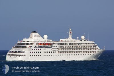
SILVER CLOUD
Passengers Ship
Current Trip
| Time Travelled | 3 days |
|---|---|
| Remaining Time | --- |
| Distance Travelled | 1039.03 nm |
| Remaining Distance | 622.84 nm |
| AVG Speed | 12.4 Knots |
| MAX Speed | 14.4 Knots |
| AVG Wind | 12.9 knots |
| MAX Wind | 19.9 knots |
| MIN Temp | 21.2°C / 70.16°F |
| MAX Temp | 28°C / 82.4°F |
| Draught | 5.7 m |
| Position Received | 6 d ago |
Current Position
| Longitude | 31.29172° |
|---|---|
| Latitude | -29.80845° |
| Status | Under way using engine |
| Speed | 12.7 Knots |
| Course | 72.7° |
| Area | Indian Ocean |
| Station | T-AIS |
| Position Received | 6 d ago |
Info
Information
The current position of SILVER CLOUD is in Indian Ocean with coordinates -29.80845° / 31.29172° as reported on 2024-04-13 22:13 by AIS to our vessel tracker app. The vessel's current speed is 12.7 Knots and is heading at the port of DURBAN. The estimated time of arrival as calculated by MyShipTracking vessel tracking app is 2024-04-13 09:00 LT
The vessel SILVER CLOUD (IMO: 8903923, MMSI: 309027000) is a Passengers Ship that was built in 1994 ( 30 years old ). It's sailing under the flag of [BS] Bahamas.
In this page you can find informations about the vessels current position, last detected port calls, and current voyage information. If the vessels is not in coverage by AIS you will find the latest position.
The current position of SILVER CLOUD is detected by our AIS receivers and we are not responsible for the reliability of the data. The last position was recorded while the vessel was in Coverage by the Ais receivers of our vessel tracking app.
The current draught of SILVER CLOUD as reported by AIS is 5.7 meters
Weather
| Temperature | 25.4°C / 77.72°F |
|---|---|
| Wind Speed | 10 knots |
| Direction | 192° SSW |
| Pressure | 1016.1 hPa |
| Humidity | 71.8 % |
| Cloud Coverage | 3 % |
Featured Company
Last Port Calls
| Port | Arrival | Departure | Time In Port |
|---|---|---|---|
| 2024-04-16 05:55 | 2024-04-16 15:58 | 10 h | |
| 2024-04-14 05:22 | 2024-04-15 12:37 | 1 d | |
| 2024-04-13 09:45 | 2024-04-13 21:12 | 11 h | |
| 2024-04-12 05:06 | 2024-04-12 13:28 | 8 h | |
| 2024-04-08 10:20 | 2024-04-10 16:41 | 2 d | |
| 2024-04-03 02:48 | 2024-04-05 18:40 | 2 d | |
| 2024-04-02 04:52 | 2024-04-02 17:15 | 12 h | |
| 2024-03-28 03:51 | 2024-03-30 00:25 | 1 d | |
| 2024-03-26 03:25 | 2024-03-27 17:03 | 1 d | |
| 2024-03-24 10:39 | 2024-03-24 17:50 | 7 h |
Most Visited Ports (Last year)
| Port | Arrivals | |
|---|---|---|
| 9 | ||
| 4 | ||
| 3 | ||
| 2 | ||
| 2 | ||
| 2 |
Last Trips
| Origin | Departure | Destination | Arrival | Distance | |
|---|---|---|---|---|---|
| 2024-04-15 14:37 | 2024-04-16 07:55 | 245.91 nm | |||
| 2024-04-13 23:12 | 2024-04-14 07:22 | 90.30 nm | |||
| 2024-04-12 15:28 | 2024-04-13 11:45 | 265.36 nm | |||
| 2024-04-10 18:41 | 2024-04-12 07:06 | 556.96 nm | |||
| 2024-04-05 20:40 | 2024-04-08 12:20 | 696.35 nm | |||
| 2024-04-02 19:15 | 2024-04-03 04:48 | 136.81 nm | |||
| 2024-03-30 02:25 | 2024-04-02 06:52 | 626.73 nm | |||
| 2024-03-27 19:03 | 2024-03-28 05:51 | 94.40 nm | |||
| 2024-03-24 19:50 | 2024-03-26 05:25 | 437.33 nm | |||
| 2024-03-23 18:55 | 2024-03-24 12:39 | 257.28 nm |
Events
| Time | Event | Details | Position / Dest | Info |
|---|---|---|---|---|
| 2024-04-16 15:59 | START Moving | 0.28 nm, South East of MAPUTO |
-25.98068 / 32.56913
DURBAN
|
Speed: 10.1 kn Course: 132° |
| 2024-04-16 15:58 | PORT DEPARTURE |
|
-25.98068 / 32.56913
DURBAN
|
Speed: 2.7 kn Course: 134° |
| 2024-04-16 06:29 | STOP Moving |
-25.97265 / 32.56240
[MZ] MAPUTO
|
Speed: Course: 304° |
|
| 2024-04-16 05:55 | PORT ARRIVAL |
|
-25.97265 / 32.56240
[MZ] MAPUTO
|
Speed: 6.1 kn Course: 310° |
| 2024-04-15 12:37 | PORT DEPARTURE |
|
-28.81652 / 32.11250
DURBAN
|
Speed: 12.2 kn Course: 107° |
| 2024-04-15 12:21 | START Moving |
-28.79952 / 32.07588
[ZA] RICHARDS BAY
|
Speed: 4 kn Course: 214° |
|
| 2024-04-14 05:57 | STOP Moving |
-28.79687 / 32.07780
[ZA] RICHARDS BAY
|
Speed: Course: 118° |
|
| 2024-04-14 05:22 | PORT ARRIVAL |
|
-28.81120 / 32.09660
[ZA] RICHARDS BAY
|
Speed: 13 kn Course: 295° |
| 2024-04-13 22:17 | Status Changed | Default Under way using engine |
-29.80287 / 31.30825
DURBAN
|
Speed: 12.7 kn Course: 72.7° |
| 2024-04-13 22:13 | OUT of Coverage |
-29.80845 / 31.29172
Indian Ocean
|
Speed: 12.7 kn Course: 72.7° |